Go confidently in the direction of your dreams. Live the life you have imagined.

Henry David Thoreau

Rodman Campground, When to Visit and Why

Wednesday March 22, 2017                                                           Most Recent Posts:
Rodman Campground                                                                       Spring Equinox on the Florida Trail
Palatka, Florida                                                                              The Santa Fe River and Two Tries at River Rise


Let me say straight up that in all the years we’ve been wintering in Florida in Winnona I have never chosen Rodman as a campground because of the dam.  Those who know me realize that I am opposed to daming rivers period.  That rivers shuld have the right to run free is my strong feeling.  I realize that daming rivers provides water to allow people to live in many places but it is also my feeling that they clearly have no business living there if the land, unaltered, can’t support them. 

That said, we have come to Rodman becasue of Marjorie Harris Carr.  I wanted to see the Greenway named in her honor and to kayak the river she tried to save.  After reading her biography, Marjorie Harris Carr: Defender of Florida’s Environment by Peggy Macdonald, I am a fierce admirer of hers.  More about MHC in another post.


IMG_0945

Now about the campground.   It is located 15 miles South of Palatka Florida on US 19.  There are a total of 68 campsites split between what they call “Phase one” and “phase two”.
In Phase I, Sites 1-13 have electricity only and 6 pull through sites and several sites up to 40’.  Sites 14-39 are “primitive” and listed as tents only.  At the far end of the campground is the picnic area and a boat ramp into the “Lake Oklawaha” more rightly known as the Rodman Dam Reservoir.  We are staying in the Phase II campground which has sites 40-68 in a loop around a long mound made from the fill taken out to dig the canal.  We call it the fill hill.  It is fairly steep and treed.  Sites 41-58 are on both sides of the campground road.  One side backs up to the fill hill and the other to woods. Sites 59-68  back up to the fill hill and face the canal, across the road,  for a water view.   One other note is that the only restroom is on the sites 41-58 side of the fill hill so if you want to use it you must hike up and over the hill, or go around it.


David surveys a piece of the Cross Florida Canal with its perfectly straight edges.  Mother Nature seldom if ever makes straight lines.  Wonder why?

IMG_1148


The sites are varying distances apart.  Our neighbors to the left are a nice distance away, our neighbors to the right are pretty close.  Too bad the ones to the right are the stay up at night and party types with many noisy children and late night guests.  There does not appear to be any enforcement of the 10pm to 6am quiet hours.   That is probably due to the fact that mainly people come here to fish in the reservoir.  Reservations can be made on Reserve America though this does not seem to actually be a Florida State Park..    It’s listed there as Florida “Department of Recreation and Parks”.  It is not listed in the Florida Parks Passport book.  My guess is that this was an Army Corps of Engineers site since they are the villains in this pork barrel project.  When the project was finally decommisioned I guess they withdrew from it all.  This was not confirmed by the person at the entrance booth who so far has not known the answers to any question we have asked.  There do not appear to be any rangers and she works from 7am to 3pm taking money from mostly fishermen I think.  It is called Rodman Campground, not Rodman State Park


IMG_1167

If you are interested in Rodman for any reason like hiking the Florida Trail or kayaking the Oklawaha, I strongly suggest you book for mid February so you can catch what is billed as and looks like it must have been a spectacular Azalea Bloom at nearby Ravine Gardens State Park in Palatka.   The information says the bloom is January-April but my experience with Azaleas tells me that by mid March they are usually history.  

David really wanted to see the Azaleas so he called the park to check on the status of the blooms and was told they were pretty much finished.  “Nevertheless, he persisted”.  We went.  It’s an easy 15 mile drive and we needed groceries anyway and there is a Publix there.  there are no services closer to Rodman than Palatka.


IMG_1170

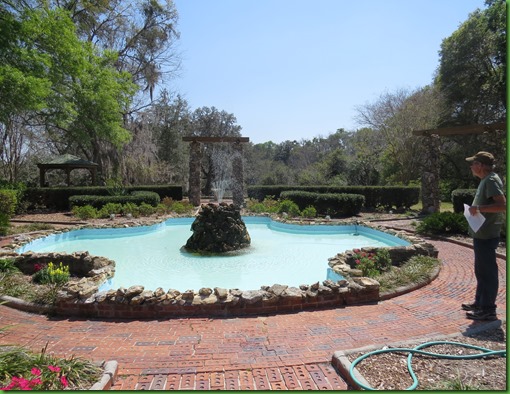
In an effort to spur the economic recovery of the city of Palatka, a ravine created by water flowing from the sandy ridges on the shore of the St. Johns River was turned into what they describe as “dramatic gardens” during the Great Depression from 1933-39 by the Federal Works Proggress Administration (WPA).  Of course that means the infastructure was done by the CCC from local stone.  They  put in the walls, walkways, fountains, and other infastructure as well as the trails and the drive.  By 1934 over 95,000 Azaleas had been planted by Federal Emergencfy Relief Administration Workers.   No wonder he wanted to see it.  These plantings are over 80 years old.


IMG_1173


The surviving structures include the main entrance, two suspension bridges, an amphitheater, stone terraces and the Court of States with its obelisk dedicated to President FDR.  It is on the National Register of Historic Places.


IMG_1261


The 146 acre park is a combination of formal and “natural” gardens though the trails through it are 2.5 and .8 miles long so a lot of those acres are inaccessible.  There is also a 1.8 mile paved loop road which winds around the ravine, l offering walkers, motorists and bicyclists a view of the gardens if they do not or cannot hike in among the trees and plants.  The drive closes to motor vehicles one hour before sunset.

It must be spectacular to hike these trails and be literally surrounded by azalea blooms, large live oaks and huge magnolia trees.


One point to be noted, Ravine Gardens has very little signage so it can be difficult to find the trail heads if you don’t know to walk through the “formal gardens” down the brick path next to the very large Roy E Campbell Civic Center which you will think is the visitor center but isn’t.  There isn’t a visitor center but the map below can be obtained from the wall inside.

After hiking all the trails I am convinced that they spent all their money on this great big thing to the detriment of upkeep on the park, its many steps and on the deteriorating trails.
The CCC works really need some attention.  The condition of them is a shame in many cases.

Sorry about the spots on the infamous building, I was taking into the sun for the picture.

IMG_1260


Here’s the map provided.  The very dark line is the drive which we do after we hike the Azalea Trail which is the longer hike with the smaller dashes.  The 8/10 mile spring hike is the one with the larger dashes.  After doing the 2.5 mile Azalea Trail with very few azaleas in bloom, we opted out of the spring trail although if it were Mid February with everything in bloom we surely would have done it as well.


Once you go down the formal walk and get to the bottom of the steps everything turns to sand and you go left for Spring or right for Azalea.

IMG_1174


Fairly soon we come to the first of the two suspension bridges.  I wonder out loud if these cement columns are really what the CCC did originally or if they are a replacement idea.


The bridge itself is made of wood.

IMG_1182


The paths are all sand and easily walkable when the ground is level but here in the Ravine, it is up and down.  On slopes the paths are falling away and that is perhaps why both trails are  labeled on the map as difficult with this one called the most difficult.  Maybe that’s true for Florida but I certainly wouldn’t call it difficult though you must be careful on the washouts which make the trail very narrow.  David wants me to point out that there are a lot of tree roots to watch out for which have been exposed by erosion, and often occur as loops that could prove very hazzrdous to anyone, young or old who happens to get a foot snagged by one


IMG_1180


Lots of stairs both newer wooden ones and CCC era cement which have not been kept up and are tricky since they are covered with sand and no longer level.


David finds the first Azalea bloom.  He thinks it’s coming, I think it is going.

IMG_1184


We come to the second suspension bridge which is identical to the first.  Both of these bridges could be used to cut the hike into smaller sections since the bridges run over the ravine.  


IMG_1186


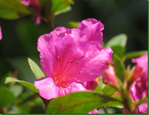
We finally find a few blooms that aren’t completely gone.  Even faded, their color is wonderful and this would definitely be a spectacular hike if all 95,000 were in bloom or even a fraction of that number.


Azaleas are on both sides of the trail and in most cases taller than we are.

IMG_1193


IMG_1195


No trail would be complete without some BIG trees.

IMG_1227


IMG_1205


IMG_1206


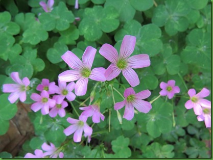
There are a few wildflowers along the trail as well.


IMG_1245

IMG_1213


On the back side, we come again to the suspension bridges.

IMG_1229


The trail and step edges are stone at this point and either still in good shape from the 30’s or nicely maintained.  These steps lead us down into the bottom where the picnic area and amphitheater are.

IMG_1233


From here is a nice view of the bridge.

IMG_1238


The amphitheater, grass terraces edged with large stones, is across the drive from the picnic area.  Although the Azalea trail goes along side the drive in several places, this is the only time it crosses the drive.


IMG_1242


amphitheater


Some of the steep inclines and descents do not have steps.  Who says Florida doesn’t have “hills”.


We’re back at the formal gardens where you can see the Civic Center just beyond.

IMG_1250


IMG_1253


It is here next to the parking lot that we finally see two bushes, one purple and one white, with more than two or three flowers on them.

IMG_1255

IMG_1259


At this point it is 89 degrees out and I think more than ever that this was a crazy thing to do but we hop back in the car, turn on the air conditioning and drive around the drive where David, ever mindful of food, sees not azaleas out his window but wild tangerines and oranges.  Thankfully, they are too high up for him to stop the car, jump out and grab some.


IMG_1262


IMG_1263


Next stop is the Publix grocery store in Palatka after which we drive through the little town which ends as the bridge goes across the St. John’s River.  Palatka is making a bid to be a mural town documenting its history with murals on many of the sides of buildings on the main street.  There is a guide to the murals and they are definitely worth a visit. To close this post, here are some of our favorites. 


. HarlemNights-2014-


by gone days mural


Spring Equinox on the Florida National Trail

Monday March 20, 2017                                                                          Most Recent Posts:
Rodman Campground                                                           The Santa Fe River and Two Tries at River Rise
Palatka, Florida
                                                            March at O’Leno – So Far Raining and Cold


HAPPY SPRING EQUINOX

Spring Equinox this year Bring on the longer days and sunshine but not toooo hot.
Spring Equinox is the time of  balance between the light and the dark. 

It has felt very dark to me since November 8 and I am very ready for a journey out of that dark. 

To mark the day I put on my special shirt which I hope you can read and hike a section of the Florida Trail.  I’ve been finding little bits and pieces of it at some of the state parks we stay in and always try to hike them.  The Florida National Scenic Trail is a 1300 mile hiking trail that stretches the length of Florida from the Southern trailhead at Big Cypress National Preserve where we have hiked to the Northern Terminus at the Gulf Islands National Seashore near Pensacola where we have also hiked.  It is one of only 11 congresionally designated scenic Trails in the United States.   The Florida Trail Association began the trail near here in the Ocala National Forest in 1966 and continues to work closing the still existing gaps in this long trail through a very populous state.  I’m amazed at their continuing effort.

In my resarch on this section I read that the trail head is across the damn dam and that I should park in the parking lot and walk up and over to it..  In my research on this I find that to walk from the campground would add 2.5 miles to this hike and to walk from the parking lot adds over a mile..  The hike is 8 miles so instead I drive over the dam, look around and park on the far side with the fishermen.   I’m not sure where the trailhead is but I follow the orange blazes on the utility poles.

Here’s Ruby looking back at the main part of the dam.  By the time I get to the trailhead and look back, I can’t even see Ruby.   It was another half mile from my parking place.

IMG_0961

IMG_0974


Here’s the trail head and there is a truck parked where I should have parked and where you should if you ever come to Rodman Campground to see what Marjorie Harris Carr tried to save and walk the Florida Trail.


IMG_0975


IMG_0976


So by now I have 3/4 of a mile on my pedometer and I finally enter the woods beside the reservoir created by the damn dam.

IMG_0980


IMG_0982

Not sure what “recreational use” this reservoir is since nearly 60 years after it was put in the drowned trees are sticking up all over it making it dangerous for any motorized boats.  Trees line the dam wall and the shores of the reservoir from where they have been uprooted.

It isn’t a very pretty sight.

IMG_0983


But as nature will do, she takes my mind off of all this man created mess with an osprey yelling over my head.   We call back and forth a couple of times and then s/he flies out to a nest platform in the lake and calls from there

IMG_0987


IMG_0997

IMG_0993


S/he doesn’t look all that happy.  After the fly off, I quit calling so I hope it isn’t me that’s the target of this.

IMG_0994


The Ocala National Forest which I am now walking through has many Grimms Fairy Tale looking spots with Spanish Moss hanging down creating dark tunnels.


IMG_1000


As I move away from the lake and into the Scrub Pine Forest habitat,  I come upon the first of MANY forest roads that cross the Florida Trail here in the National Forest.  The first of these is one of the ATV trails that is part of what is known as the Rodman Trail system.  Thank goodness it is a Monday and not a weekend or the noise level from those would seriously impact the wonderful serenity all around me.

IMG_1007


IMG_1010


I’m not very far into my hike when I pass what turns out to be the only bench on this section of the trail.  Great idea for the use of a downed tree.  I try it out and proclaim it very fine.

IMG_1013

IMG_1014

The sand pines are getting taller with an understory of scrub oaks.


Oh dear, now what do I do, I’m over two miles into the hike when I come to what looks not like and ATV road or a regular Forest Service road but a fire break. My first clue is that across it the soil is all black and there is a red plastic piece of hazzard tape on the ground as though it had once been blocking the path.

IMG_1021


I go across to investigate.  Having spent over two weeks at Rainbow Springs beginning the day after they burned the entire park around the campground, my nose can tell this fire is days old. 

IMG_1022


I see these guys are back to business as usual on the trail so it’s clear the ground is no longer hot.  I make the executive decision to continue on.

IMG_1042


I do pass one smoking hole and walk up a little closer to see what’s going on.

IMG_1024


It’s a root still flaming but with no probability of escaping its confines which is clearly why the forest service left it as the park service at Rainbow did with similar things we saw on hikes there.


IMG_1027


Further on, there is hazard tape at the Forest Road on both sides but I continue.

IMG_1036


I’ve walked under a mile through the burned area when I cross another fire break and it’s all past.   This is a lovely section of the trail and the last of the scrub area before I move into the fantastic Long Leaf Pine area.


IMG_1053


The understory is wide open.  These are the forests that once covered nearly all the southeast before they were clearcut for “wise use”.

IMG_1055


There are small long leaf all around.  I am so happy to see them. Soft light filters through the pines and dapples the forest floor.


Just look at the length of those needles.  I shake this one’s hand and wish him a long life and perfect health.


IMG_1069


Another source of joy on this Equinox Day is the sight of these white bands around some of the Long Leaf pine trees.  There are 4 in this picture. They represent trees which have been marked as having evidence of the Red-Cockaded Woodpecker, now an endangered species from lack of habitat due to the devastation of its only dwelling place.  He’s going to be in big trouble if the Endangered List is eliminated as I have heard is on the list for the scraping of the EPA

The pines are immense, raising like columns to the sky.   Such a huge cathedral.  My camera cannot capture the ground and the tree tops in one picture.

IMG_1075


Sadly for me, I didn’t see or hear the Red-cockaded but here is a picture from Bird of North America.   He sure is handsome but that seems like a silly name for a woodpecker with a fine black cap since the red cockade for which the bird is named is a small patch of feathers behind the eye of the male, that is very hard to see in the field if you can even find the bird.
Who decides these things and keeps changing the names?.

Red-cockaded woodpecker


Tall Long Leaf Pines as far as I can see with an understory of wire grass.  This is ideal habitat for the woodpecker which needs mature pine woods (trees 80-100 or more years old), with very open understory maintained by frequent fires (the pines are fire-resistant).


IMG_1082


More white strips, this time 6 in one area.

IMG_1087


I spy several cactus in the grasses.  That really surprised me when I first came to Florida.


From the pines I pass into an area of very large Live Oaks and palmetto.

IMG_1090


This oak is so large that I cannot get a picture of its enormous canopy no matter how far away I get.  Majestic is the only word for such a venerable being.

IMG_1092


I’m hoping a Florida native can tell me what kind of fruit this is that I find on the ground underneath a medium size tree covered with them. 


IMG_1109


IMG_1110


I was hoping on this section to see or at least hear not only the Red-cockaded woodpecker but the Florida Black Bear which is known to live is this area.  The best I could do is see clear evidence that both are here even if unfortunately out of sight.   Convenient of the bear to leave evidence right ON the trail.


IMG_1115


IMG_1117


I’m actually shocked when I see the little trailer through the trees.  It’s the white spot on the left.  Clearer in person than in this picture.  I’ve obviously reached my destination, the Lake Delancy West Campground.  I’m earlier than I predicted by nearly an hour.


IMG_1121


So I wait for David to come pick me up and chat with these inadvertent camp hosts.
They were in Florida from Michigan and bent the axel of their popup and were stranded here when they were offered this host spot which is very hard to fill becasue of the noise of the ATVers who us this campground for the trails nearby.


While I’m waiting I hear several sandhill cranes calling and follow the sound until I locate this campground visitor.  When he stands up tall to look around, he’s significantly taller than the picnic table.   This is a big bird.

IMG_1139


Even his back is taller than the seats.


David eventually comes after some self induced difficulty but I add another 2 miles and 2 hours to my trip exploring the campground and enjoying the crane. 

My total for the day was 23,944 steps and 9.44 miles.


Imwithher 25

As I walked these steps, I thought about the beauty I was seeing and the significance of this day.

Spring Equinox always brings to my mind nature’s resilience after the harshness of winter, in most places. Carrie lives in Severn Maryland.  She wrote today to say that this has seemed like a very long winter.  Although I haven’t had to experience the cold and literal dark, these days have seemed dark and harsh.  Even though I don’t watch the news, you can’t live and know nothing about the jaw dropping events that seem to occur every day now.

We need Nature’s resilience amidst the struggle.  Hopefully beauty will emerge and the threats to our values and safety will decrease as the light increasingly shines on these fear mongers with no moral values.  My greatest hope today is that a very new life for all beings will be born from this struggle.  I hope we are coming out of  the dark before the rebirth into a time of loving and caring for each other and the Earth from which all life springs.

HAPPY SPRING EQUINOX