Saturday September 7, 2013
Moosehead Lake Family Campground
Greenville, Maine
I really want to see this huge lake from above.
Moosehead Lake is the largest lake in all of New England and it really is huge with coves and fingers going all over the place. It has 200 miles of shoreline and an area of 117 square miles. It’s mind boggling.
There is actually a nice view of the south end of the lake as you come over the hill toward Greenville from the campground but the utility wires strung across the road ruin any picture you might want to take.
SO….with no tall buildings to go up to say the 20th floor for an aerial view and no seaplane to take me up, it seems the only way is to hike up Mount Kineo and take a look.
I learn that in July of 1857, Henry David Thoreau, a friend and Penobscot Indian guide Joe Polis paddled to the Kineo Peninsula and hiked the mountain. If it’s good enough for Henry, it’s good enough for me.
We don’t have Joe so we take a ferry across the lake to hike the mountain.
We drive the 20 miles to Rockwood where a pontoon ferry will take you over to the Peninsula for $10.
A 10 minute ride at a $1 a minute. Pretty good for the captain but the other choice is about a 2.5 mile walk to the trail head. Very sketchy directions for this dissuaded me.
The ferry leaves every hour during the season from the boat dock in Rockland and returns on the 45. We arrive in plenty of time for the first ferry at 9:00. We pay our cash money to the driver and hop in.
It is wonderful to watch the mountain come closer and closer as we near the shore line.
It’s another glacier gift.
Mount Kineo, like all of Maine, was really created by the several thousand foot thick glacier that flowed south across the landscape of Maine toward the Atlantic Ocean. As it rode the upstream, northern, side of the mountains it left a gentle slope, while on the downstream, southern, side it chipped and tore the rock away leaving ledges and cliffs. The 1789 foot mountain dominates Moosehead Lake.
The southern side of the mountain bears the greatest scar of the ice age's passage, a fantastic 900-foot cliff of rhyolite, one of tallest cliffs in the country.
The mountain was highly prized by Native Americans for its rhyolite, a volcanic rock used in making tools. Archeologists have found evidence of native tools of rhyolite from 11000 years ago to the 1700s
OK now which trails do we want to take?
There are 3 trails on Mount Kineo. We plan to hike one up and one down. The question is which one.
Most folks apparently take the Indian trail which is sort of a cliff walk up and then take the Bridle Trail down for a total hike of about 3 miles including the .8 mile lakeside base trail from which they all begin. We’re thinking we might like to go up one of those two and come down the much longer North/Carriage Trail combination for a hike of about 6 miles or so all combined. Doing that, we would nearly circumnavigate the mountain.
The lakeside trail begins at the dock which is off the bottom of this map toward the middle. As you walk along the trail you are at the base of this amazing cliff. You can see the rhyolite which has broken off and fallen along the trail.
Walking along the base of this cliff was one of my favorite parts of this day. They are simply beautiful.
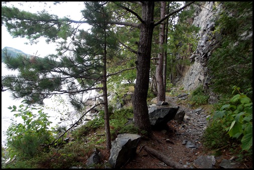
The trail along the shore is quite narrow at times
After a pleasant .8 mile walk along the shore, we come to the first of the three trails, the Indian Trail. It is the shortest at .8 mile and the steepest. It is described as going right along the cliff edges and not for those with a fear of heights. Sounds like a cool trail but it is very windy today and threatening rain so we decide to skip cliff walking and save it for a better day.
We go on to the second trail, the Bridal Trail described as “longer but the easier of these two winding up the gentle grade of the Western Face of the mountain through maple and yellow birch”. After a mile it enters a forest of spruce and fir where it connects to the Indian trail and they go to the summit together.
The first part of the trail is a very rocky path.
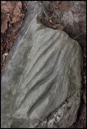
We see a great many examples of the gouging of the glacier here.
The higher we go the more difficult the trail becomes. It has been a long time since there has been any maintenance done here. I’m not sure that I would describe this as a gentle grade. But perhaps that’s compared to the Indian Trail.
In a half mile or so we reach the connection with the Indian Trail and our first views which are fantastic.
Then it’s on up to the summit.
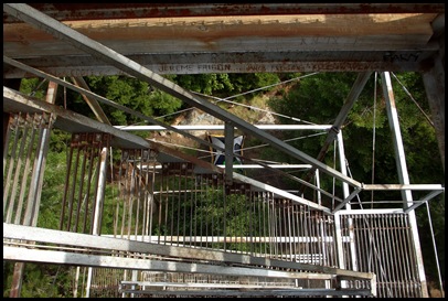
Another 4/10ths of a mile up and we reach the summit which has a restored fire tower to give us views that the trees would otherwise no longer allow.
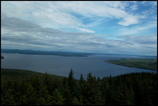
We climb the 80 steps up and the views are 360 degrees. But boy is it windy and unfortunately cloudy. Still what a sight.
This is one HUGE lake. And there are no man made structures in sight other than the tower on which we stand.
The mountains are visible. I know which ones are out there, Little Kineo, Big and Little Spencer Mountains, the Lily Bay Mountains, Big Moose, Bald Mountain and if the day were clear, we could see Mount Katahdin. But not today…..maybe “NEXT TIME”.
I take a panorama shot from every direction.
It’s getting chilly up here in the wind, time to head back.
We head back down the 80 steps to the North Trail. This is the longest of the trails and turns out to be more beautiful than the Bridal Trail we think. It is not nearly as washed out and difficult although it is very steep after a short gentle beginning. I would not call either the Bridal or the North “gentle”. If you do any of these trails, wear good hiking BOOTS and bring poles.
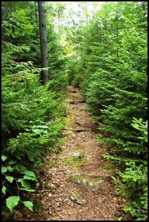
The North Trail is much greener and more lush than the Bridal Trail which I found to be very heavily worn and not maintained. Both added to its difficulty.
This Trail is clearly not used as much and that’s too bad for those who miss it. But it is longer for those who are in a hurry or care about those things.
There are sections of walking through knee, thigh, waist high little spruce trees. They are so cute.
The trail starts out at a very moderate descent but gets steeper and steeper as we go.
Even so, I notice that we have much more time to take pictures on the trail down than we took on the more difficult route up.
Even time for a birch tree hug! I do love my trees and am SO thankful for all they do for me.
We begin to get lake views as we descend.
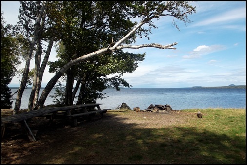
When we make it back down to the water, we know it’s time for some lunch.
All the hard climbing up and down is over and now we only have about 2.5 miles to walk around the lake. Piece of cake.
Because we are sitting on rocks at the edge of the water, we aren’t close enough together to do the self lunch photo so I take one and David takes one. They turn out to be pretty funny. But they do prove that we were both here having our lunch on the shores of Mount Kineo at Moosehead Lake in Maine on this very day. LUCKY US!!
This guy joined us for lunch. Actually he is here when we arrive and when David tries to sit on him as a bench, he throws his rear up and David slides off. Guess that shows who is boss here.
Back on the trail, just up from our lunch spot we discover a sweet rock cove. From the look of the stones I can tell they are not cobblestones but rhyolite as many have sharp edges. It wouldn’t take much to make this flint like material into tools.
This lake side trail is called the Carriage trail and is flat and a pleasure to walk.
Sauntering along there are many special things that catch my eye.
A large group of mushrooms under a birch tree. The light makes designs on their tops. Such art work in the forest.
The peeling birch bark never ceases to attract me.
On around the shore we reach Hard Scrabble Point where there are three great back pack in campsites.
I know Henry David Thoreau climbed Kineo and camped along the shore during his 1857 trip to Maine. I wonder if he camped here, on the point.
We round the point into the last stretch of trail for today.
The beavers have been very busy pretty recently along this route.
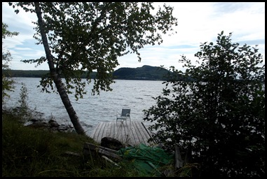
We pass an abandoned lake side cabin with a sketchy looking dock and a great view. David decides to risk it for a rest in an equally sketchy looking lawn chair.
We make it back to the dock where we find our shuttle waiting for the 2:45 sailing. We have about one minute to spare. Tired and happy is the result of an excellent hike on Mount Kineo.
And now that we’ve done it and I’m writing about it, what do I think?
I think we had a great time. That said, I don’t think these trails are well enough maintained to keep them from rapidly deteriorating badly. I also think the difficulty of the 2 we did is underestimated but we didn’t really have any trouble with them We were just expecting “moderate”. Whoever is writing the guides needs to come back out and hike the trails again for a more recent assessment.
I would highly recommend taking the ferry over and at least walking the Carriage Trail as far as it goes and coming back. I think pretty much anyone can do that although there are some muddy sections and sections with planks to cross.
If you don’t mind a tricky steep trail then go for any of them. The view from the fire tower is fantastic. We really enjoyed what we did.
















I think I prefer the boat ride:)
ReplyDeleteIf you go to the summit for the views, think steep ascent whichever way you go and you will be better prepared, at least mentally.
ReplyDeleteWell, I'm certainly thankful that y'all didn't take the Indian Trail. What must that be like?!? It might have involved rappelling! I'm sure with my bad judgement, I would have gone for that one immediately.
ReplyDeleteIt's easy for me to say, but I think the pictures from the fire tower were worth the hike. How absolutely lovely. I am sorry that it was so windy though. Of course, you might have overstayed in better weather and missed your ride home. :-) Looks like another lovely day. Thank you for all of the work that goes into this, Sherry. I love it!
Always love your tree hugging pictures and sentiments ... the panoramas were beautiful!
ReplyDeleteWow! You guys are real hikers!
ReplyDeleteThanks for taking pic's and describing the adventure, That is the only way I will see it.
I also want to thank you for the wonderful comments on my posts. After reading this, I feel silly even showing our stroll down the hall way of the Savage River old folks home. To think, I felt great going beyond the parking lot.
Thanks for sharing those beautiful views!!
ReplyDeleteAmazing view from the top of that fire tower, pure nature with no manmade damage anywhere! Loved the pictures of the glacier scoured rocks, that is something you don't see every day.
ReplyDeleteDon't know if I could have climbed that tower, those see through steps looked really scary! :cO
How cool to see the rocks that glaciers have carved patterns on. Birch trees always remind me of onions. Great hike!
ReplyDeleteYou are walking in Thoreau's footsteps. Cool! I love the views. Well worth a slightly difficult hike. Interesting differences between Bridal and North Trail. North is so green!!! Lovely. Hilarious lunch shots. That log did show dad ;) Birch trees are so unique-great pictures!
ReplyDeleteYou too have certainly left footprints all over Maine. Good for you!
ReplyDeleteWe have come to the realization that trail guides are almost useless. Better to do a Google search for blogs about a trail you're interested in. Most people will give a much more accurate description, as you did.
ReplyDeleteThat looks like a great hike. And I really want to go to Maine after seeing all your wonderful photos!
"not a man-made structure in sight" says it all for me.
ReplyDeleteI really enjoyed your hike. The rhyolite is really beautiful. I don't think those trails were exactly as described. The part of the trail with the little spruce trees was incredible.
ReplyDeleteWe put on our pedometers the other day, and I asked Al, I wonder how many miles/steps David and Sherry have hiked this summer? Have you kept track? You really have had a wonderful summer and I've enjoyed following along.
I love it all! The climb was certainly worth those fantastic fire tower views, almost as good as flying over.
ReplyDeleteI wish I had gone here. Why do the beavers eat the trees? It's so pretty, I would never get Dave to climb up that high!!!!
ReplyDelete