Friday June 27, 2014
Fort Wilkins State Park Campground
Copper Harbor, Michigan
Today we are going to take the scenic shore drive down M-26
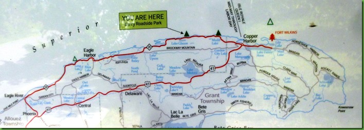
We’re headed to Eagle Harbor and then Eagle River. The route on this map is close to the circle we are making. Ignore the you are here. We are starting out at the red pine tree in the upper section on the right and going left through Eagle Harbor and then to Eagle River before starting back. The route back is going to be a different than this map shows. We came in up Route 41 so we’ve seen that. So going back we are going to take those little roads you can see like Garden City Road out of Eagle River. We are just going to enjoy this scenic drive. Our only planned stops are in the two towns. Anything else we see along the way will be happenstance.
But FIRST……
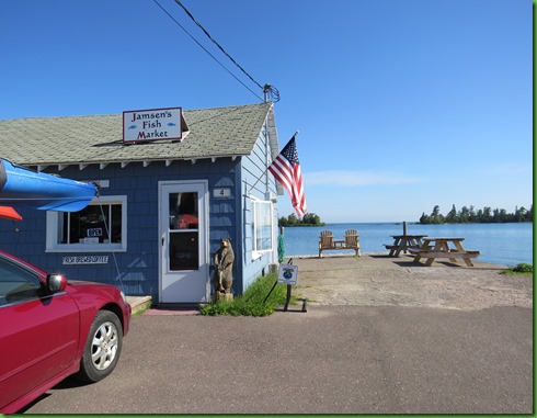
Of course on the way we have to drive almost by the bakery. Ruby seems to gravitate toward bakeries when David is driving. She’s actually my car and she’s never done that to me.
Don’t you love that double chair on the lake. Picture a raspberry danish and the hot beverage of your choice.
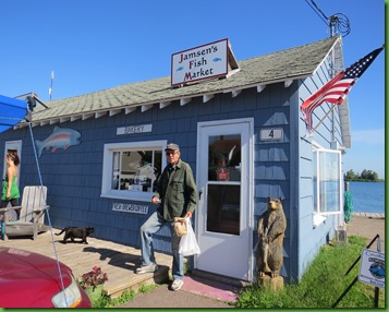
David buys not only danish but also some white fish and 2 fish sausages. I’ve never even heard of fish sausages. But these have to be taken back to the Winnona to be refrigerated.
So it’s a little later when we actually start along the shore toward Eagle River.
We stop at one of the many pull offs to enjoy the rocky shore line of Lake Superior here at its Northern most point in Michigan. It really is a beautiful coastline.
We’ve seen many alligators in the far south but I had no idea they had Lake Superior alligators up here.
We see a Michigan Nature Association Sign and stop to check it out.
They are the ones who provided the wonderful hike through Estivant Pines. This is called the Keweenaw Shore Nature Sanctuary. We’re always ready for an impromptu hike.
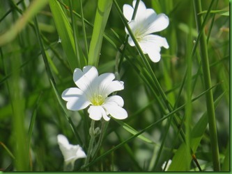
The trail leads from the small parking area back into a nice stand of woods. Lovely flowers.
The trail gets more faint and then a red tree tag seems to indicate that we should walk over these logs but we don’t see anything after that. Remember those red tree tags at the “couldn’t find it falls hike” in Munising?
Well David goes to check this out and sure enough. He can’t find the trail. It looks like it is all under water. Back he comes.
I definitely brake for falls.
When we see the Silver River Falls sign by this lovely bridge, we pull over and park in the small space provided. Then we go down the little path from the parking lot looking for the falls. Like déjà vu the trail gets less and less traveled and when it seems to slide down an incline I say we’re in the wrong place. David goes on a bit to see and I go back to the parking lot. I know these falls are here and sure enough, across the road from the parking lot is a set of stairs that go down to the real trail to the falls.
We follow the trail away from the bridge and continue to get different looks at the water cascading down.
The foot of the trail is in a really lovely grove of cedars by the river. What a great place to spend some time and the mosquitoes seem to be absent. Wow!
We haven’t even reached Eagle Harbor yet so we can’t stay as long as I’d like. Hiking back up is as great as hiking down. This is a terrific little find.
Next we pull over for a Lake Bailey.
Maybe we could paddle here. Local residents note our arrival but don’t pay much attention.
Strike two.
On down the road we see a Nature Conservancy sign. I was on the Speaker’s Bureau for the Nature Conservancy in Charlottesville and have always felt they were a wonderful organization which stepped up in many cases to save places that would otherwise be lost. They are much like the Michigan Nature Association except they are Nationwide with state chapters who do similar work. Often TNC will buy a piece of property when developers are interested and hold it until local resources can raise the money to buy it from them. They don’t own very many properties themselves.
I’m interested to see what they felt was important to save here.
Ruby starts down the dirt road in search of the parking area.
And then we come to another one of those water hazards. We’re not sure about taking low to the ground Ruby through here so it’s either park her and walk or skip it. We have a lot of possibilities today so we pass this one by.
We have reached Eagle Harbor.
We turn down one arm of the harbor and find the Life Saving Station. It is on the tip of course and has a great view. We think we’ll have our lunch here.
But when I see the lighthouse through the trees on the other tip, I want to go on over there for lunch.
And a great lunch spot it is.
At lighthouses, we usually investigate the grounds before going inside.
Here there is a viewing platform just off of the parking area and when we go up we see the great rocky outcroppings just below us. That’s where we’ll have our lunch.
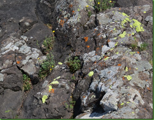
So off we go to find a spot. These rocks have great lichens and beautiful flowers on them. We have to be careful where we step. I always hesitate to do things like this because it seems whenever I do, being oh so careful, about 10 people show up out of no where, see me do it and follow me paying no attention to what they are doing.
Luckily this doesn’t happen today. We have the place to ourselves.
What a lunch spot huh?
Anchors aweigh and boy does this one and the buoy too.
After lunch we check out the grounds. How about this anchor? The information sign by it tells us that this is the common anchor of the great lakes. It was used from the time of the earliest lake navigation until 1890. Look at the size of this thing and imagine the size of the ship that used it.
I’m sure many of you have heard and seen a bell buoy near shore lines on both the ocean and the Great Lakes. But have you ever seen one outside of the water? I should have stood near this too in order to show how amazingly big it is. It is 8 feet wide, 13 feet tall and weighs 50, 000 lbs.
Of course we have to take pictures of the lighthouse.
The first lighthouse here was built in 1857 but the present one replaced it in 1871. It has a 44 foot high tower and its focal plane is 60 feet above lake level. In 1980, after a succession of light keepers the light was automated. The Coast Guard maintains the light and the Keweenaw Historical Society maintains the buildings, grounds and operates a museum on the property.
A fog signal was install in 1895. Since its removal in 1978, a bell buoy several hundred yards off shore marks the harbor entrance and warns of a nearby reef. The Coast Guard removes the buoy every fall and replaces it every spring. I wonder how many of those they have to do on Lake Superior.
The grounds have some lovely flowers I haven’t seen before in bloom. Wish I knew how to easily find their identities. Anyone with suggestions, please help!
Time to go inside.
We pay our $5 fee more as a donation to the maintenance of the lighthouse than anything else.
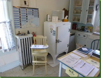
The Friends of the lighthouse have covered up too much of the kitchen with their papers and sale things in my opinion. Not sure where they should put all this, but not here. It really detracts from the great collection of period things they have on display. The room is too busy. And the kitchen table/desk set up makes it difficult to walk over to the counters and look closely in the cupboards.
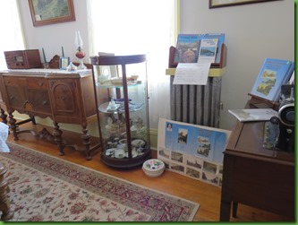
My favorite thing in the dining room where there are also things for sale, is the ladies spittoon. I have never seen a “ladies” spittoon. There was one lady lighthouse keeper. I wonder if she used it. I had an interesting observation about her.
Mary Ann Wheatley was a lightkeeper here. I think.
One of the downstairs rooms had a display of information on all the lighthouse keepers of the Eagle Harbor light. One was Mary Ann Wheatley who was keeper from 1898 to 1905. Or at least that’s what this information says including the letter at the bottom right with her official appointment. But over on another wall was a list of all the keepers and their dates and she is not listed there. There are two men listed with totally different dates. Others with pictures and information are listed and their dates are correct but she is not. What’s up with that? I know women keepers were rare. I meant to ask about this discrepancy on our way out and forgot.
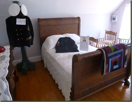
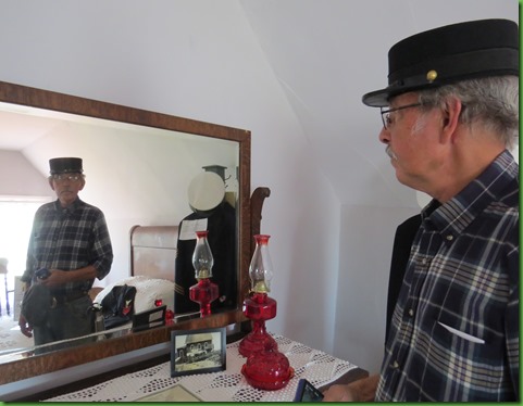
Upstairs was the keeper’s bedroom with his uniform and his hat on the dresser. The lightkeeper was in residence but in his casual clothing other than his hat.
Finally the perfect chair.
I love the sewing chair with the drawer on the side for needles and thread, scissors and seam rippers. It is exactly my size. Both my feet touch the floor AND I could sit all the way back at the same time.
Also on the dresser is a picture of the light house during winter. Good grief! Thank goodness the lake freezes and the light keepers could leave from sometime in December until April it appears. But what about the people who live in Eagle Harbor all year long. How DO they do it??
The gem of their collection (IMO)was here in a glass case.
On display in this room is a gorgeous 1907 wedding dress. The hand work on it is just exquisite. If you’ve ever wanted a Victorian dress Carrie, this may be the time. ;-)
The children’s room had the best view in the house other than the one at the top of the tower I assume.
But we can’t get to the top of these stairs.
Sadly, I suppose for insurance reasons, we could climb the beautiful red iron stairway to the door up to the light but we could not go all the way up and look out of the windows at the view. We could only see the view from the windows on the way up the stairs. But I put my camera lens up to the hand hole in the floor door and took this shot.
We look in all of the other buildings but spend most of our time in this one.
I’m pretty sure David found the most interesting thing here to be in one of the outbuildings.
It was the 1926 Chrysler which had been rescued from the City of Bangor cargo ship when she went down near Copper Harbor.
The ship City of Bangor was upbound from Detroit to Duluth when she went up on the rock reef, in an area of heavy forest between Keweenaw Point and Copper Harbor. You can see both of those points on the map at the beginning of this post. Her cargo consisted of 248 brand new 1926 Chryslers.
The wind was so fierce that 18 cars on the deck were blown into the lake and they still reside somewhere between and slightly below Horseshoe and Copper Harbors.
This exhibit is here because it was the Eagle Harbor Coast Guard Men from the life saving station who rescued the crew of 29.
The men were in bad shape. When the City of Bangor hit the rocks, the hull was ripped open, and water poured into the engine room, drowning her fires. The ship was dark and cold. The lake spray froze over the steel ship, creating an iceberg.
When the seas moderated the following day, the crew reached shore in the lifeboat. There they found a couple feet of wet snow and nothing else - no road, no people, no houses. They built a fire and spent a cold night in the woods. The men were without adequate clothing for the freezing temperatures. There was no food. The ship's officers forcibly kept the men moving to prevent them from succumbing to the cold. When sighted by the Coast Guard, they were exhausted and nearly all in. Many were suffering from frostbite and would require hospitalization. All of her crew were rescued by the Eagle Harbor Coast Guard, in spite of the blizzard and below zero temperatures.
Before Lake Superior turned hard for the winter she converted the entire ship into an ice palace. Eventually all of the cars, outside of those blown into the lake, were recovered. When the water surrounding the steamer froze solid enough, a ramp was built to the deck and the Chryslers were driven off. Teams cleared a road along the ice to Copper Harbor and the cars were driven over the ice to the town. There, they were kept until March when it took 2 weeks to clear the roads. It was the very first time the roads had been plowed between Copper Harbor and Phoenix. The caravan of vehicles drove to Calumet between snow banks eight to ten feet high where they were loaded on a Detroit train, shipped by rail back to Detroit and, after repairing, resold. The period pictures give testimony to the conditions and amazing effort made to save those cars.
The day is getting away from us here.
We head out on down M-13 in the direction of Eagle River. But on the way we stop at Great Sand Bay. More Great Lakes sand dunes. Michigan also has Sleeping Bear Dunes, Indiana has Indiana dunes and now the Keweenaw has the Great Sand Bay. This is pretty unusual up here since mostly the coast is rocky.
There are two sets of stairs going down to the beach. People are sunbathing along the shore today and in the water. I don’t blame them. The high is 85. We haven’t seen many of these days and find that 85 here seems hotter than other places we’ve been. Is the sun closer to us? Are we just out of shape for hot weather?
As we return to the parking lot it is 3:30 and a group of 8 teen girls pile out of cars in their short shorts headed for the beach.
Time to turn around and head back.
We arrive at our final point, Eagle River, where we see Jacob’s Falls. Couldn’t find out who Jacob was but we liked his falls.
We leave Eagle River down Garden City Road. It is not at all what we’d expected with a name like that. It went to the edge of town and then turned to dirt. A nicely maintained dirt road but still dirt, tree lined, no houses.
Actually many of the “not main” roads in the upper Keweenaw are dirt. I guess with so much snow why pave everything. People want to cross country ski and snowmobile and in the summer use ATVs.
Along this road we stumble on Copper Falls Park.
We think there might be a falls here but no luck. What is here is several picnic tables and this rather short tower, as towers we have climbed go. The sign is no help in figuring out what it is about.
The view wasn’t high enough to see much of Lake Superior but it was pretty with the puffy clouds.
The thing that made it fun was that the “cabin” on top had 4 windows which I realized I could use to frame a picture.
One real advantage to this dirt road was that we were of course traveling more slowly. So when this hawk flew from one side of the road to another, David could stop and I could get this quick shot before he gave me his back and flew away. Wish we had been pulled up JUST a little bit further. He was a beauty.
Only 1990 miles to Miami; it’s a straight shot.
Back in Copper Harbor we took the time to stop and get a picture of this sign. Today we went to Eagle Harbor, when we leave, we will have to go back through Houghton since there is only one road into and out of the upper Keweenaw and that’s Route 41 which if you keep going on it will take you all the way to Miami.
David was anxious to try out the fish sausages.
He put them on the grille for dinner and pronounced that he liked them very much especially with a local Brickside Brewery Beer and the great Ray’s mustard we bought in Eastport Maine last summer. Yes we bought a lot of Ray’s in many different kinds. David has it on nearly every sandwich he makes. I think there is actually one jar left. Don’t know what he’ll do between then and when we return to Maine. My treat is a Cherry Soda from The Cherry Republic.
It’s one happy camper!
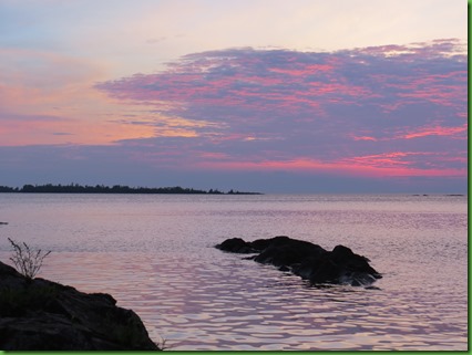
To end our day, we keep our date with the sunset.
It is spectacular! None of these photographs has been altered. They almost look unreal to me. What a fun day!! It didn’t seem so long until I started posting about it.












I brake for lighthouses like you brake for falls :) Never heard of a lady lighthouse keeper! That must have been rough back in the day.
ReplyDeleteYes indeed you do cram a lot into a day.... must help to sleep well at night!! I too brake at all sign for falls, scenic highways, viewpoints and then again there are historic markers. Lol.... its a wonder I ever make it to a destination... oh wait.... those are the destinations.
ReplyDeleteAnother gorgeous day! THIS is what retirement is all about!
ReplyDeleteSounds like you'll be in shape to do all of the fifteen miles of the North Country Trail when you visit Tamarac. ;)
ReplyDeleteFish sausage sounds good- especially with a good beer!
ReplyDeleteI love the shot of the stairs in the lighthouse - a great view. The last time I could have cinched my waist in to fit into a victorian dress was when I was about 8 yrs old! It's a toss-up for me as to whether I like Lake Huron or Lake Superior the most. I think it has to be Superior by just a tiny bit.
ReplyDeleteI love these free exploring days. You run into the neatest things. You had quite a fantastic day! I love your Michigan alligator! Neat story about the ship. Sure did make an impressive sculpture in ice. That seemed to be a lighthouse full of valuable info and items. I really would have enjoyed that tour. Love that chair! It fits you perfectly!
ReplyDeleteIf you get a chance take the Brockway Drive. It shows on your map and is noted by Brockway Mountain.
ReplyDeleteGlad you didn't get too close to that gator, he might have splintered you to death... :cD
ReplyDeleteInteresting story on the car rescue. Nice that they had one on display.
My kind of day for sure. Loved following along as it unfolded.
ReplyDeleteJust one special day after another!!! The rocky coastline sure reminded me of our time in Maine:o)) Fish Sausage...interesting concept!?!?!!!
ReplyDeleteWhat neat history! Love the lighthouse and the unaltered sunset pictures - amazing! Neat that you came a upon a few things by happenstance - bakery, falls. All great :)
ReplyDeleteAnother day in the life of Sherry and David! Terrific, as always.
ReplyDeleteFish sausage? Hmmmm -- I like fish, and I like sausage. Just not sure I'd like the two combined.
ReplyDeleteThe story of the 18 cars blown into the lake -- unbelievable!
Sherry, I have to ask, do you and David agree on all the stops? If you do, then lucky for you as you get to explore all the neat natural things to see in a day and take lots of picture too.
ReplyDeleteI like that framed picture, that was so cool that you thought about it.
Beautiful sunsets, usually by the lake. Great pictures.
What an amazing day! The hike was beautiful, and the lighthouse tour so interesting. Haha, I know exactly what you mean about being delighted to find a chair where your feet can touch the floor, because I have the same challenge! Your sunset photos are lovely—and you got your pinks to come through perfectly. :-)
ReplyDeleteSuch a delightful scenic drive. Love all those waterfalls and the rugged coast. Oh, and the lighthouses too. Fish sausage is a new one on me. And that colorful sunset sure was a great ending to a wonderful day.
ReplyDelete