Thursday February 12, 2015
Koreshan State Historic Site
Estero Florida
We head out about as early as I can get David on the road which turns out to be 9:15. Not early enough in my book but with the temperatures in the 40’s in the morning his oil isn’t warmed up.
To get to the Refuge you have to first get onto Sanibel Island which requires a $6 bridge toll. At least they only charge you coming in and not going out. Not sure if the fee is to help pay for the bridge or to discourage cars. If the latter, it isn’t working very well but more on that later. It’s great to see a fly by pelican rather than an airplane as we head over the bridge.
The Refuge itself has no entrance fee unless you want to drive rather than walk or bike the “wildlife drive”. Then it’s $5 a car. $1 for walkers or bikers. The Federal Senior pass is honored here for a free pass. Also note that the wildlife drive is closed on Fridays to give the wildlife free reign of the park.
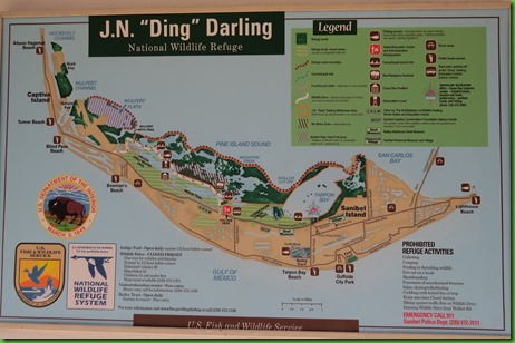
As you can see from the map, the Refuge takes up a lot of the land on the island. You can hike here on the drive or the Indigo Trail. You can bike the drive or the Indigo Trail and you can kayak from several launching sites. Just check the weather and the tides.
They have a lot of very interesting looking programs at the refuge which you might want to know about before you come. This is the list of this year’s winter programs which is also available from their website. Here’s the link for this year’s.
If you bike the drive or hike it for that matter there are two routes. You can do the first half and then cut over and go back on the Indigo trail for a 4 mile trip or you can do the entire drive and go back on the bike path along the outside road that runs along the refuge. This is a very bikeable island. There are bike paths everywhere. And no wonder people don’t want to go by car as we found out when we left the refuge. More on that later. The longer route is 8 miles and that’s the one we did.
We see many birds taking advantage of the sanctuary. Most are the regular birds we are used to seeing in southern Florida. The sun is bright, my camera is not dealing well with it. Or actually the operator wasn’t dealing well with it.
All a long the canals are white ibis clustered in the mangroves and fishing in the waters
There are human fisherman along the banks and a sign about crabbing but I don’t see any crabbers. Since you have to use only dip nets and no chicken necks perhaps it’s not very successful. Also today the water would be probably too chilly.
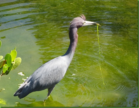
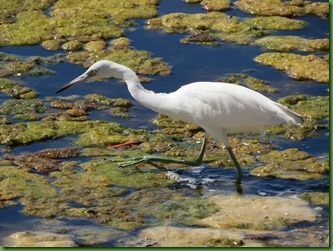
We spend some time watching this little blue heron fishing and see him pull up some plant. That was a surprise to me.
Pied Billed grebes are here.
We find a group of white pelicans and one cormorant resting on a sand bar. On the far bank is an eagle nest with two eagles but too far away for my camera to get a clear shot. But it is wonderful seeing them here. A lone roseate spoonbill is on the far bank below the eagles.
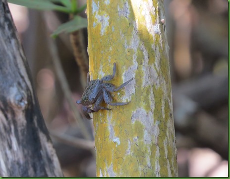
Along the drive there are 2 or 3 short hikes. On one of them we see our first mangrove tree crabs. I’m not sure whether we would have noticed them at all if a man hadn’t been pointing them out. You have to have sharp eyes to see them on the tree trunks and branches.
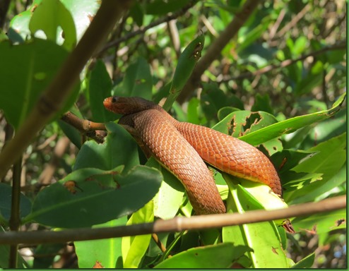
Not so hard to see what I think is a Pine Woods Snake also on this boardwalk just curled around some leaves on a tree just over my head. It is hard to tell how long he is since he is wrapped around. He looks longer than what I later learn is the average 1-12” size. The record size is 15.75”. Maybe we saw the new record holder. Any knowledgeable snake experts out there? He sure was nice about everyone taking his picture and being so close to the boardwalk.
With the challenges of my eyesight, I’m not sure exactly what that dark spot in the middle of the water is but my camera shows me it is a perfect example of a new mangrove island beginning. The mangrove shoots float in the water and when possible take root and begin to grow. I wonder how many years it will take this one to block this inlet and turn it into something that looks like a lake. Nature is amazing in her intense quest for life.
The sunlight on the water makes for an interesting background for this Pied Billed Grebe and the Double Crested Cormorant.
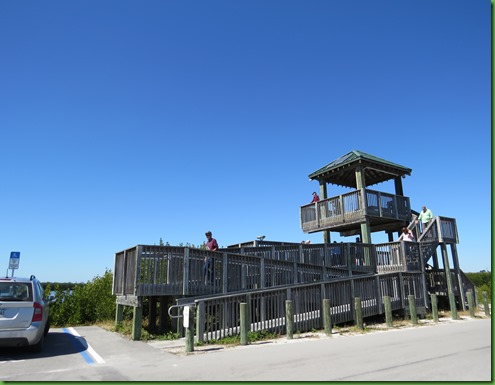
About 2/3rds of the way down the drive is a viewing tower. From there we get a better view of the flock of White Pelicans and just to their left an even bigger flock of Willets with maybe some Dunlins and one lone Royal Tern mixed in.
In this shot from the tower you can see the “tram”. It is an open air bus actually. I think it would be an excellent introduction to the refuge mostly to hear what the interpreter has to say as you move along. They do not stop so if you want to be able to stay a while or to walk any of the short trails you have to drive, hike or bike the road.
The Pelicans and others are out on that sand island.
The pelicans fly in and out of the group. They are beautiful and graceful in the air despite always reminding me of a pterodactyl..
Once down, we bike closer to the sand island where on the other end closer to the road we see the bird of the day. It’s a reddish egret. We’ve only seen one other one and that was in the Everglades. That one was actually dancing. What fun to watch. This one seems like he’s trying to warm up. I’m not sure if he’s molting or moving into breeding plumage or just elderly. His face looks somewhat mottled. We watch him for quite a while. He stands the entire time on that one foot which made me think perhaps he was warming it up.
There are several kayak put ins along the drive. This one was currently being used as a fishing spot. A volunteer told me that their fishermen are the nicest people and very tidy unlike the photographers who destroy the habitat by breaking off branches and getting right in the birds’ faces to get their pictures. They actually had to block off a yellow crowned night heron rookery from the public because of the photographers.
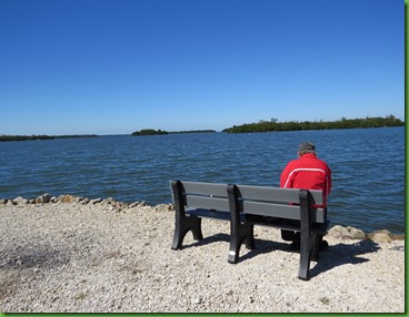
Further along, we stop for a walk out to Colin’s point which looks like a perfect fishing or sitting spot to me especially in this weather with no mosquitoes in the mangroves.
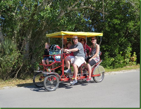
Shortly after we are back on the drive we stop again to watch a first year little blue heron working on his fishing skills. He is right by the road and paying no attention to anyone until one of the kids in the surrey rings its bell which unfortunately frightens it away. I sure hope that was a teaching moment for the parents.
We think it’s about time for lunch when we see the Wulfert Keys Trail so we grab the lunch bag and set of on the 1/4 mile hike. Turns out it’s down the power line to the shore of a very large body of water when the wind is way too strong for a lunch spot. But David is amazed at the size of the bolts on the power pole and we wonder what the other equipment at the top here is with its solar panels.
I see this Great Blue Heron through the mangrove roots. I like the way he is just peeking out and take several pictures of him. I don’t notice until I’m looking over the picture the Green Heron right next to him with the same intense stare. I wonder who got the first bite?
There aren’t too many cars on the drive today luckily and they really thin out towards the end. We find that we are constantly getting off and on the bikes to see things so the first 4 miles in the refuge isn’t as much biking exercise as the last 4 miles back to the refuge are.
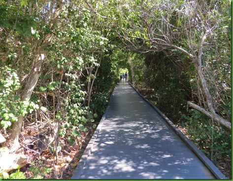
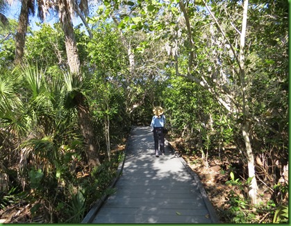
Just beyond the end of the drive is the Calusa Shell Mound Trail. This is a trail which encircles the eastern part of a Calusa Indian Village built centuries ago on man made hills. It’s a really lovely tunnel trail but unfortunately in 2004 Hurricane Charley destroyed the shady canopy of tall trees allowing the sunlight to reach the mound top creating a tangled low growth of native and invasive plants. The mound itself is no longer visible.
Along the walk, there are a number of informative boards about the lives of the Calusa here and the tools they used and foods they ate. All the information was discovered by archeologists at this site. Invasion by non-native peoples had a fateful impact on the Calusa. The arrival of Europeans introduced diseases and cultural disruption that brought about the demise of 12,000 years of Calusa culture.
We are happy to see some large gumbo limbo trees on the trail but sad that they had to be wrapped to keep stupid people from carving their initials into them. What is it with the megalomania that requires people to carve their names into trees and boardwalks and pretty much any thing they can?
The gumbo limbo is native to tropical regions of the Americas from southern Florida through Mexico and the Caribbean to Brazil and Venezuela. The tree is jokingly referred to as the tourist tree because its bark is red and peeling.
After the Shell Mound Trail we ride the bikes the 4 miles back to the Refuge and have our lunch on a scenic table in the parking lot next to the tram ticket sales booth. It’s the only picnic table I’ve seen anywhere on the Refuge.
We spend our last hour in the excellent visitor center where among other things we learn bout the work of Ding Darling who was a famous political and environmental cartoonist from 1919 to his death in 1961. He won two Pulitzer Prizes and was a very important figure in the conservation movement his entire life.
In the VC Store I of course find several books I’d love to read but the high prices for hardbacks has me just taking pictures of their covers. As I mentioned before, the drive is closed on Fridays to give the animals at least a day of recovery from so many people. But on Friday there is a Lecture Series which often has authors presenting their books. If I were here for the season I would never miss one of those. Here are some of the books I’d love to read whose authors either have been here already or are coming.
We had a very full day at the refuge as you can see. It was a mistake not to have come during our first week at Koreshan so that we would have had time to return at least once. If you come, one day may not be enough.
But, as promised earlier, let me make this already too long post just a little longer with tales of the traffic. Here’s the story of leaving the island at 5:00 when the center closes. We drive out of the refuge and up to the cross island road that leads to the bridge. Well we don’t quite get to it because the traffic is backed up for about 4 or5 cars at the left hand turn. Everyone is either going straight or turning left from our side. There is no road going right. Problem is there is no where to turn to because the traffic is backed all the way up to the light in the direction we want to turn. We sit for about 20 minutes during which time the line of cars behind us gets longer and longer while no one turns left and many people from the other direction turn right making the line we are trying to turn into always have no room for any left hand turn. David is doing some heavy duty ranting but we don’t know any other route.
We finally get around the corner and are stopped dead again. The line behind us is running out of sight down toward the refuge. This isn’t even a Friday. Is it like this every day of the week in winter? Boy the poor local residents. But they must know something right?
At this rate it will take 3 or 4 hours just to get to the bridge. David is really losing his patience. So I get on google maps to see if there is any other way. Sure enough, I see that this road it took us so long to turn left onto is solid RED all the way to the turn to the bridge. This really will take hours since have barely moved in 30 minutes.
But if we get out of the turn lane and go straight down the road away from the refuge, we can wiggle around and go twice as far to get where we are going but in half or less the time I’m sure. So that’s what we do, turn around, go back to the intersection where everyone is waiting to get to the spot we just left. As soon as we get around the corner there is NO traffic and it remains pretty much that way until we get to the road to the bridge. Here perhaps we have found the source of the trouble. There is someone directing traffic.
By the time we are on the bridge to the mainland it is an hour since we left the Refuge and we’ve gone less than 3 miles. Who knows how long it would have been had we not been able to find out what the locals know about getting off the island. Thank you smart phone and google maps.





















What a great day with lots of interesting sights. I just love the crabs on the trees! And a snake in a tree...very cool! You don't see that too often (at least not out West).
ReplyDeleteI didn't see a mention of John and Carol Herr, but they are lovely people that we met last year. They are volunteers right there at Ding Darling and Carol taught us so much about the place when we visited last year. It is a lovely most wonderful refuge, glad to see you made it over the bridge to check it out!
ReplyDeleteI just love how your days are filled with beauty, hikes and biking, beautiful photos and words. Living every day to the fullest in the wake of ups and downs. You too are amazing! We actually made it to Ding Darling many years ago when we were staying near Fort Meyers, so this was a nice "ride" down memory lane.
ReplyDeleteNice that the drive is closed one day a week to give the wildlife a break. Great shot of the snake!
ReplyDeleteEnjoyed reading about Ding Darling..Never made it there....thanks for the share! Ugh on the snake, but great shot. :-)
ReplyDeleteIt looks like quite a peaceful place. The pelicans are such characters!
ReplyDeleteMaybe that blue heron is a vegetarian? I'd bet that David has a wrench in his toolbox to fit those nuts on the power pole! :cD
ReplyDeleteThose frogs look a bit like crabs...or no? Neat sighting. I like the snake picture - nice color. Also, the herons - what a great shot! Looks like a good day - so many birds and an educational visitor center. So much sun and lovely water - I liked that newly started mangrove.
ReplyDeleteOf course they are mangrove crabs not frogs what in the world were my fingers typing. I've changed it to reflect your astute notice. I need an editor PRE-publication. Would you like to apply for the job. LOL thank you sweetheart!
DeleteI'm thinking Ding Darling was the one who created the first 'blue goose' that adorns all of our Nat'l Wildlife Refuges, but I could be wrong.
ReplyDeleteYes he did Judy. He is considered the father of the National Wildlife Refuge Federation. You reminded me that I left out an entire paragraph about this amazing man. He was the first head under FDR of what became the US Fish and Wildlife Service. He also created the Duck Stamp and designed the first one. He was often called "the best friend a duck ever had". Thanks Judy, you keep me on my toes.
DeleteAbsolutely horrendous traffic going out there. Our one day was not enough either but the traffic going there is enough reason not to go back.
ReplyDeleteThe snakes and the crabs on the mangrove trees reminded me of what we also saw at our mangrove tree forest in the Philippines on our last visit.
I just came across this article, and thought of you, Sherry.
http://www.trueactivist.com/science-proves-hugging-trees-is-good-for-health/
That is a great place. You got a good photo of that pelican just getting the breeding bump on his beak.
ReplyDeleteI love that David's "oil" hasn't warmed up yet :-) The snake is beautiful, and the little crabs very strange looking. With the hurricane changing the landscape and the mangrove roots making new islands the grandkids would see a very different place years from now. How wonderful! Those ginormous bolts however, will likely look just like that. That traffic sounds like a nightmare (I'd want an audiobook about then) but it seems like the alternatives to accommodate the cars would be a worse impact on the area. Your resolution seems to be the smart one for sure :-))))
ReplyDeleteI'm with David in the mornings but getting better. I must be a diesel engine. ;) Never seen anything so wild as crabs climbing trees. Beautiful snake. Imagine, seeing the birth of an island. Interesting color on that heron and they look way to big to be standing on one leg. Seems photography tends to focus our attention yet the photograph reveals more than we could see. Our European ancestors were very good at wiping out existing people, seems like a "stupid gene" passed down to some that would continue to destroy life on the planet. Carve your name in a picnic table if you must but not the trees. I know I'm preaching to the choir here. Looks like a Huge VC. We could use more like D. Darling today.
ReplyDeleteGreat pics and information. Especially like the flying pelicans (they really are pterodactyls) and the tourist tree.
ReplyDeletehad I seen those "crabs" from a distance, I would have most likely thought they were spiders. . .UGH!
ReplyDeleteand yikes on the snake. . .am assuming this is not a native, but something some pet owner turned loose. . .that seems to be a problem in that area of the country. . .so sad. . .
enjoy your ride, and the pics, as always. . .
We love Ding Darling refuge, and agree that biking it is the best way to experience it. We've twice stayed for a week at Periwinkle Park on the island; although it's more expensive than the state parks it keeps us out of the traffic jams. Looks like you had a wonderful day -- I'm especially taken by your shot of the Great blue heron and Green heron hanging out together!
ReplyDeleteWe are headed down to Ding Darling next month to visit with John and Carol Herr, mentioned by a previous commenter. Thanks for the preview!
ReplyDeleteThose mangrove crabs are only slightly larger than a quarter, but so many they would feed a lot of birds, snakes and other predators looking for a crunchy snack to munch. I do love the reddish egret and wish we could have seen his dance again. Great pictures as always!
ReplyDeleteI"m just reading your post today and am so sad we missed seeing you. I had a knee replacement which limited my ability to blog or read posts. Your post is a fantastic overview of the refuge we call home each winter. I thought you captured it so well and gave some great advice to first time visitors who want to explore this amazing place.
ReplyDeleteAs to the traffic issue - yes it is horrible. Most folks who work here live off island due to the high real estate prices. Plus all the folks who come to the beach also are exiting at the same time. My best advice is to plan on having dinner here at one of the many great restaurants. Then you can leave the island quickly and avoid the aggravation of bumper to bumper traffic.
We will be returning again this fall. If you travels bring you nearby this area please let us know. We have read your blog for several years now and consider you "family".