August 6, 2015 Most Recent Post:
Big Meadows Campground An Evening Meadow Walk
Shenandoah National Park
Today’s AT section hike is going to take us from Jewell Hollow Overlook, the blue arrow at the bottom, to Panorama, the blue arrow at the top, at the Thornton Gap, Route 211 entrance to the park near Luray Virginia. The AT is in Yellow, the Skyline Drive in Red. There are 4 entrances onto the Skyline Drive in Shenandoah National Park and those entrances divide the park into 3 sections. Thornton is the Northern End of the Central Section where both Big Meadows Campground and Lewis Mountain Campground are located. It is also the Southern end of the Northern Section which begins in Front Royal and includes Mathews Arm Campground. Have I totally confused you?
At the overlook is a very informative sign about the building of the drive and the overlooks themselves. On May 15, 1933, the first Civilian Conservation Corps camps in the country were established in Shenandoah National Park at Skyland and Big Meadows. Under the leadership of National Park Service landscape architects, CCC enrollees and engineers helped build Skyline Drive’s stone walls and overlooks, including this one.
The stone walls in Shenandoah were built in two styles of masonry: dry-laid and ashlar. I want to quote the information sign here, “Dry laid walls like those at the Jewell Hollow Overlook, could be built by less experienced stone workers, like the young men of the CCC, since they require only moving and aligning heavy stone – more muscle than skill.” Perhaps so but if you’ve ever tried to build a rock wall, you know it takes patience and even some geometry to stack them up so they don’t fall over. For being as much as 82 years old, they look wonderful to me and the overlooks with them are much more attractive than those without. Rock walls also line the Skyline Drive along many of its 105 miles. Sure was nice of Mother Nature to provide so many flat rocks for the men to stack.
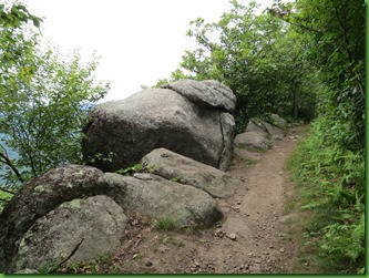
As usual, the Appalachian Trial is just a wonderful foot path through lovely woods, along beautiful overlooks, past massive rocks.
Along the way are pretty flowers, delicious berries and interesting mushrooms. Really, what more could you ask for?
I love the really beautiful flowers of the thimbleberry in the rear of this picture. I feel kind of bad not leaving them and the blackberries for the bears.
But I just can’t help myself.
It does appear that another snacker has proceeded us. Where’s the Midlife Cruiser now? She’d love this.
I’m hoping someone will know what this is. It looks like a giant okra. Usually these pods stick straight up in the air.
We pass a section of young chestnut trees trying their best. Some of them are nearly 20’ tall. They are tiny compared to their giant ancestors but I give them a hug and wish them well and a long life.
These mountains are for sure rocky. We wonder if the CCC men used the stones they removed from the trails for the walls throughout the park.
I’m not great at lichens and mosses but I do know that this interesting chocolate one is the Smooth Rock Trip Lichen.
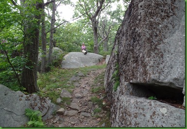
At one point I stop on a convenient comfy rock and wait for David to catch up. I’ve got my camera ready and so does he. That makes us both laugh.
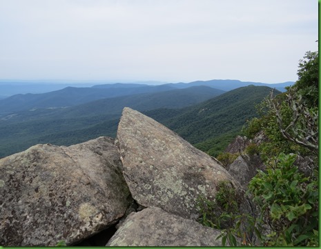
This section of the AT on the way to Panorama and Mary’s Rock has a number of lovely overlooks. We, of course, stop at them all.
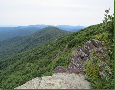
As you might expect, we usually find the same view from a slightly different angle.
Notice these really darker rocks just off the side of where we are now. You might recognize them later. Sure wish I knew my rocks. I know most things here in the park are greenstone but not those.
I just love the pink lichen on these rocks but try as I might, I can’t find an identity for it.
If you’ve been following along during our Shenandoah adventures, you already know that former Senator Harry Byrd was instrumental in the creation of the park and donated a number of shelters known as Byrd’s Nest. We’ve visited a couple previously since they are all near the AT. Today we come down the trail and overlook Byrd’s nest #4. A hiking trio is looking at their maps when we arrive.
The shelter’s water near by and a privy out back and a broad platform to sleep out of the rain if you like. Although you might be sleeping with mice running around looking for your food.
Each shelter has a “record” in which those who stop by can write whatever they like. Sometimes the entries are interesting.
It’s a picturesque setting that’s for sure.
Some of our hikes on the AT have had no views at all but this one goes up and over The Pinnacle (3730 feet) and thus has them all along the way as we climb up the west side of the ridge to the top. These rocks are right on the trail and when we climb up we see this flat outcropping beyond. Great viewing spot!
It’s funny how often we have the same pictures of each other doing the same thing.
Remember those dark rocks that aren’t greenstone? We’re looking back on them now and can see how large they are.
We have to go down this last stretch before we climb up to Mary’s rock. David looks happy about the down part.
And here’s the marker where we turn left and start UP again.
A rocky trail on the way to Mary’s Rock. Mary’s rock has a number of legends for how it was named. One story claims that Francis Thornton wed Mary Savage and brought her up the mountain to show her the lands they would own together. Another legend claims that Thornton had a daughter named Mary, who climbed up the mountain when she was young and came back with a bear cub under her arm. And of course there is the one about the young lover who was forbidden her man and threw herself off the rock.
Mary’s Rock is 3514 feet tall. The reason we had to climb down in order to climb back up is that we had just gone over The Pinnacle. The Thornton Gap entry station is the round about looking thing you can see. That’s Route 211 and the Northern end of the Central Section of the park. We’re on our way to the Panorama Parking area down there.
David enjoys the view while I look around for a secluded place for lunch.
I find it by crawling through this narrow passageway. Hope he’ll fit through there too. I call out to him so he can see where I am and he does figure out how to get here.
Sweet lunchtime view here on the edge. You should try this one Bill. I think you can do it.
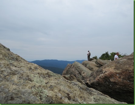
After lunch, before we head on, David, of course, has to climb to the very top.
Not sure I’d do these things if he weren’t here but I have to see what he sees. I don’t want to see just his pictures so up I go.
We can for sure see all the way to West Virginia from here. Definitely the best view of Mary’s Rock. Thanks David.
And to prove we were both up here, probably our worst selfie yet.
It begins to rain while we are up there and I have a thing about rain on rocks – too slick for me – so I’m out of there.
By the time David comes down he has his raincoat on. Thankfully, it’s not pouring and no lightning, just a nice gentle rain.
Later when he takes his pictures off of his camera David finds that the rain storm was moving our way while I was climbing up to meet him. No wonder we weren’t up there long before it rained. Look at it off there to the left (west). Wonder how he didn’t see it when he took this? Or maybe he did and just didn’t say anything. That’s more likely. He knew I’d turn right around and go back down.
This is the last picture before things totally fogged in. What had been a beautiful view 10 minutes before became a no view at all by the time we leave.
Down we go to Panorama. Just a few pictures of the last drop down. I’ve got my camera under my raincoat. Luckily only most of the sections of the trail are rocky. We do get some flat and dirt sections.
This tree is the largest one we’ve seen today. It’s fabulous and I had to get its picture and hug it even in the rain. David’s coming up behind me and snaps the moment.
Can you believe the size of that trunk? I have my arms stretched completely out. It would take 3 or 4 of me to go around it.
We wish it long life and perfect health.
It’s a foggy end to a very nice hike. Even with a gentle rain at the end our total was 7 miles and 16, 573 steps.










Lovely hike. I like the selfie..made me smile :) I also liked the journal at the cabin-it's always interesting what people choose to write. Great views and then the clouds begin to fall. Neat that you caught that on the camera.
ReplyDeleteAnother great hike.
ReplyDeletehave no idea how these photos affect me, and make me think about backpacking through the Shenandoah. I've done a lot of weekend and week-long trips through the Park, some on the AT and many on other trails. But I want to start at one end and hike through to the other. I have been thinking if my granddaughter attempts a thru hike in 2017 I might drive through the Shennies and resupply her, maybe hiking a couple of days at a time. It's a grand thought but I'm not sure I could do it.
ReplyDeleteThe shelters are handy when it is either snowing or raining, but then they are usually crowded beyond belief (the shelter is full when everyone is in!) The mice are relentless, although they never bothered the shelter when my dog was by my side.
What a great hike! We have done a few sections of the AT ourselves and I would love to do the whole thing someday but somehow I don't think that will be happening. The scenery is absolutely amazing all long the Skyline Drive so I can just imagine how much more beautiful it would be from the trail itself. Hope you didn't get too wet coming down.
ReplyDeletewww.travelwithkevinandruth.com
The "Byrd's Nest was lovely and the journal made me smile. Bill said if he managed to join you two for lunch at that precarious location, he probably wouldn't be eating much;o)) I wish we could have been there and at the top of the view...sooooo beautiful!! Raining here since the day we got back...but at least we had great hiking weather this summer!!
ReplyDeleteThat was another memorable hike on the AT. Your picture of David was the winner in my opinion where you both took the same picture of the other. Sorry David.
ReplyDeleteYou're both very brave hiking up on top of those massive rocks. I'm too afraid of heights.
Have you guys ever thought about a longer hike, say a few days and nights? I can see you doing something like that.
That final tree is quite a beauty! Looks like another lovely day on the trail, even with the rain!
ReplyDeleteNow this was a fantastic eastern hike! Rocks and views:) Sure glad you got to see the views before the rain and fog blocked it. Just beautiful:) Interesting "chocolate" fungi and pink lichen! Now that is one huge tree! I like that arch the branch is creating. Sounds like another wonderful day:)
ReplyDeleteHopefully those young Chestnut trees will survive to be as big and healthy as that giant tree you hugged. Hope nature finds a way.
ReplyDeleteI thought your "worst" selfie was cute, you two make a great couple, but I think you knew that already! :c)
I'm envious! What a beautiful landscape.
ReplyDeleteyour giant okra is typical of the milkweed family fruits, so you have some type of milkweed there...
ReplyDeleteWhat a huge tree! It would be fun to see how many people it would take to reach around the trunk.
ReplyDeleteIts quite a contrast, a small tree and a huge tree but equally given Sherry's love. I love the playfullness of your hike, it made me smile as well as your tender moments.
ReplyDeleteThe CCC, another good reason for you two to love Shenandoah. Those stone walls must have required a lot of time and man power and they sure did a great job, plus learned a skill. So nice to graze along the trail. Blackberries over thimbleberries for me any day. So is the 'chocolate' lichen edible? ;) Nice to have shelters along the AT. Looks like some very interesting geology. Love that huggable tree with it's arch branch. You two are so cute, and funny. In a good way.
ReplyDeleteI'm enjoying getting caught up after once again a few days without internet access. I love this hike, although seeing the two of you up on those rocks at what looks to be the edge of the world makes me want to pull you back :-) I bet that little Chestnut tree will be the tallest in the forest. The thru hikers heading to the B&B in a previous post were so cute, great they are being flexible in meeting their goal.
ReplyDeleteBeautiful view from Mary's Rock! But best thing of the day (she said with great authority, not even having been there) is that amazing tree with the arched branch! Were you able to identify it? I wonder what happened to make the branch grow like that, and how many decades ago??
ReplyDelete