Go confidently in the direction of your dreams. Live the life you have imagined.

Henry David Thoreau

Currituck Beach Lighthouse in Corolla

Wednesday May 9,, 2018                                                   Most Recent Posts
Cape Hatteras National Seashore                                      Kayaking in Alligator River Natioinal Wildlife Refuge
Oregon Inlet Campground                                                  Frisco Native American Museum
Nags Head, North Carolina


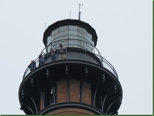
There are 220 steps up the Curritcuck Beach Lighthouse for a  view of Currituck Sound on one side and the Atlantic Ocean  on the other.   On Wednesday we drive 44 miles north to Corolla.  That’s as far north as you can go on the North Carolina Outer Banks.

The light is about half way down the coast between the Cape Henry Lighthouse in Virginia Beach, Virginia and  Bodie Island Light.  It is still in use and has a first order Fresnel lens that can be seen for 18 nautical miles.  It flashes for 3 seconds, is off for 17 seconds and repeats that cycle.

It’s a beautiful unpainted brick lighhouse.  One million bricks they say.  I doubt if it’s that exact.  Maybe one million two hundred and forty three?


IMG_2767


Also on the grounds are several other builidings including a gorgeous double Keepers House and a smaller Head Keepers House.  To see them now you would have no idea what disrepair they were in not so very long ago. 

No one was willing to step in and restore the national landmark so local citizens formed the Outerbanks Conservationists (OBC) to save the structures.  They’ve spent more than three decades and nearly $1.5 million from private funding restoring, maintaining and operating the lighthouse. OBC receives no government funds. OBC opened the lighthouse to the public on July 1, 1990.   I was more than willing to pay my $10 climbing fee to support this effort and the really fine exhibits inside.


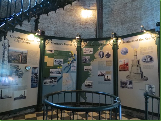
In the Lighthouse  base and on first two landings are fantastic exhibits on history of  this lighthouse as well as lighthouses in the U.S., particularly along the Southeast coast, and from around the world.  There is also information on the fresnel lens.   I climbed the lighthouse first and did the exhibits on my way back down.  While I was there people either just walked by with a glance or spent a moment or two at the exhibits which is a shame since they were extremely well done.

In the exhibits were these pictures of the buildings which showed clearly how hard this group had worked.


The Lighthouse and Double Keepers residence in 1893.


Here’s what had happened to it by the time the group stepped in to save it in the 1970’s.


Here it is today, still directly across from the Lighthouse with two separate paths from each residence leading to the oil house entry and a cistern for water on either end.  The work done is beyond outstanding.

IMG_2773


IMG_2774


The Head Keepers House was in deplorable condition and required considerable structural repairs before it could be used as it is today as the gift shop.  What a loss this would have been without the OBC.


Hard to believe it’s the same building.

IMG_2772


Tickets for climbing are sold just inside the door.  On December 1st of this year it will be 145 years old since the lighthouse was constructed and they are offering free climbs to celebrate.  Wonder if there will be a cake for the party??


IMG_2778


IMG_2781


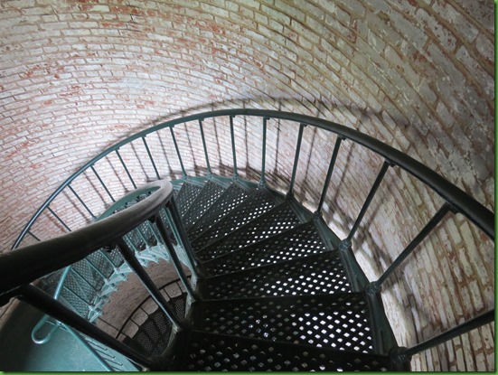
At the ground floor exhibit I look up before beginning my climb up the spiral staircase.


It’s hard not to want to spend time at the attractive exhibit but there will be time for it later.

IMG_2785


At each level’s window there is information to tell you how far you are above the ground and a few facts about the lighthouse or the keepers..  This one is 20 feet from the ground and faces East.


IMG_2787


IMG_2788


I’m 42’ up and facing west.  The first two levels also have smaller exhibits.  Might be nicer to have those further up when folks really need an excuse to rest a bit.


Up, Up.  Around and around.


At 82’ up and facing west I stop to look down both inside and outside..  I can see the Double Keepers house and the ground floor.


IMG_2821


The next window is 102’ from the ground and faces east.  I can see the Atlantic.
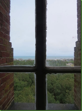

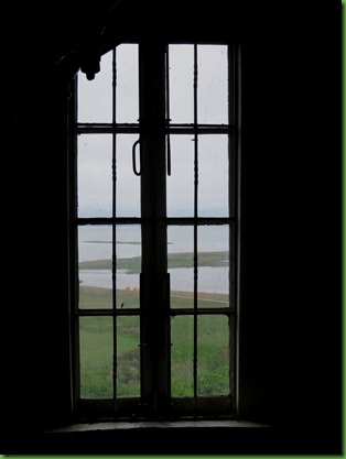
One last set of stairs to the final landing.  As I go up, there are 4 windows.  One facing each direction.

IMG_2823


The developments in the distance are primarily huge summer rental homes.


Development on the East and South and North but the wetlands and the sound have protected the west.


And then I’m in the doorway to the balcony.
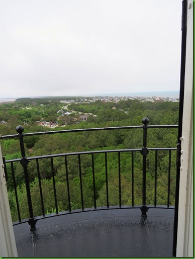

A 360 degree view.  All I have to do is walk around the circle.


Hmmm, those look suspiciously like man made “ponds”.  Why with natural wetlands?

IMG_2834


I see the Double Keepers House. The sound looks closer than I thought.


Just around from it, nearly hidden by the trees, is the Main Keeper’s house Gift Shop


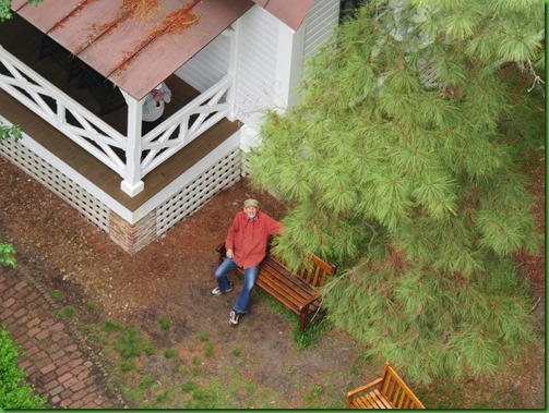
David is waiting for me on the bench beside the house.  Becasue of his heart surgery he isn’t able to climb today.   Can you see him.  He has on an orange jacket.
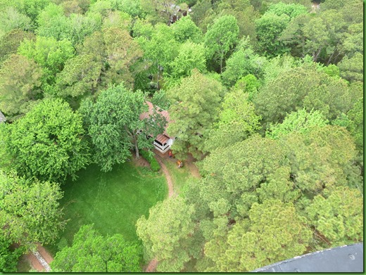

Does the yellow arrow help?


How about now?
IMG_2847


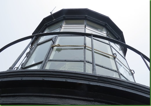
While I’m up here I try for a better shot of the Fresnel Lens without much success but you can see what appears to be a door perhaps?
IMG_2849


Time to head down those 220 steps.

IMG_2850


One last look down as others are climbing up.

IMG_2890


At the lowest two levels I stop to look at the exhibits there.  When I get down to the base I ask the woman at the ticket window if David may come just that far to see the exhibits since they are so excellent and becasue of his health he is unable to climb.  She is happy that he’d like to.

IMG_2785


We both really enjoyed the exhibits.   Here are some of the things that were most interesting.  Take a look at the number of ship wrecks along the coast here at the Graveyard of the Atlantic in North Carolina.  The type is so small you can hardly read them even in the very large graphic.


A drawing of  the lighthouse in Alexandria Egypt from 300 BC.  A 450’ tower with a fire blazing at its top.  The building was listed as one of the Seven Wonders of the Ancient World and survived until it was toppled by earthquakes.  And one of the Genoa Italy Lighthouse considered to the the tallest lighthouse that’s still active.  Built in 1544 it replaced an earlier one dating from the dark ages.  Very different surrounings today.  Take a look.

There  is a map showing all the lighthouses from Maine to Key West on the East Coast.  This is the Southern Virginia to South Carolina Section.  The lighthouses are much closer together (approximately 30 miles apart) here than anywhere else on the east coast.

Looks like we’ll have to return to see Ocracoke and Cape Lookout.  We have less than a week left here on the Outer Banks.


After visiting the Lighthouse we walk back toward the see Ocracoke Village, drive out to Curritucks Bank Reserve for some short hikes and end our day visiting with Carrie’s in-laws Bob and Joan Iwanowski who have a beach home here.   But this post is about the lighthouse.  The rest of our day will be in the next post.

Kayaking in the Alligator River National Wildlife Refuge

Thursday May 3- Sunday May 6, 2018                                              Most Recent Posts:
Cape Hatteras National Seashore                                       Frisco Native American Museum
Oregon Inlet Campground                                     Outer Banks Light House Number Two:  Cape Hatteras Light
Nags Head, North Carolina


From the sparce comments on my previous post it appears not so many folks are interested in Native American Museums.  Guess we’ll see about kayaking and windy beach days.


IMG_2584My friends for many years, Keith and Pam VanDerbeek, have a home on the Outer Banks in Duck, North Carolina.  Keith (Beek) knows all the places to kayak around here.  I asked him what was his favorite and he said the National Wildlife Refuge trails.

Unfortunately, it has been SO windy that kayaking hasn’t been possible at least in my mind.  But when Pam got back to Duck from Charlottesville yesterday we decided we’d give today a try thinking that perhaps off the ocean front it would be better.

Beek got us to the put in to Milltail Creek at the end of Buffalo City Road and under the bridge we went out into a larger body of water where the wind was not insignificant.


No pictures there becasue I was too busy paddling to keep up with their slick 16’ Necky kayaks that glided through the water with much less effort than my 13.5’ more flat bottomed Wilderness Systems 135.  Before today I always said I loved my kayak and would never trade it but today I have serious kayak envy.  Not sure I’d want 16’ since I like to go into narrow little places where I have enough trouble turning around as it is.  But a Necky would be my choice if I ever had money I didn’t know what to do with.  Although perhaps it is the length that makes it sail right along.

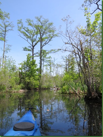
We were headed down to a quieter area of marked trail on our way to Sawyer Lake  Once we were out of the wind it was wonderful. 


IMG_2586


Quiet narrow waters are my absolute favorite be they wetlands, rivers, streams. 


IMG_2591


Pam was hoping for an alligaor sighting.  This is Alligator River National Wildlife Refuge.  Having spent a lot of time in Florida kayaking with alligators so I’m fairly used to them.

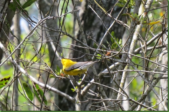
But I was seriously excited when a pair of  Prothonotary Warblers flitted through the trees along the way.  Most of my pictures were mere blurs or branches with no birds.  They are speedy.  But some came out well enough.  Warblers are so beautiful!!


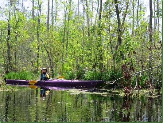
She hasn’t seen an alligator yet but the banks have been lined with wild blue iris and this clump made Pam do a happy wave.   Planted iris are always lovely but there is something about seeing them out in the wild that’s even better.


IMG_2610


IMG_2607


IMG_2611


IMG_2589


We have circled around to where we put in but we still haven’t seen a gator.  So we continue back out into the wind and head to the right toward the Alligator River.  They should be there right.


IMG_2615


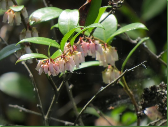
Pretty bells along the water’s edge, anyone know what they are called?

IMG_2616


We finally reach the other end of Milltail Creek headed for the river when Beek, who is behind us, says he’s spotted a gator.  Pam does a quick turn around, I follow her and we see this gator going back and forth from one bank to the other of the creek over and over again.  I’ve never seen this before and can’t imagine what’s going on.

Here s/he goes left to right.

IMG_2626


And back, right to left.


IMG_2630


We move a little bit closer but with 3 of us, I don’t want to make the gator feel penned in.  S/he just sinks under the water and we have no idea where he goes from here.

This is the northernmost point of the American Alligators range and Pam is happy to have seen one.  I admit, me too.

IMG_2631


Back we go to the put in.  What a great day it’s been.

IMG_2634


Once we’re back in the wider and windier section, they leave me in the dust, so to speak.  But I paddle on and on and on behind the two dots WAY ahead.  “Hey you guys, wait for me!”

IMG_2635


I’m so glad for these last two days.  The weather before this has been cold and windy and that returns for the next FIVE days.   Tonight the wind was so strong I had to bring the slides in and the rig was still rockin’ and rollin’.  

On Friday, I walk down to the beach and along the shore but into the wind is rough. Coming back the sand is blowing and stinging my legs.   All the pictures from today were taken going north.  Too much sand to have the camera out going south.

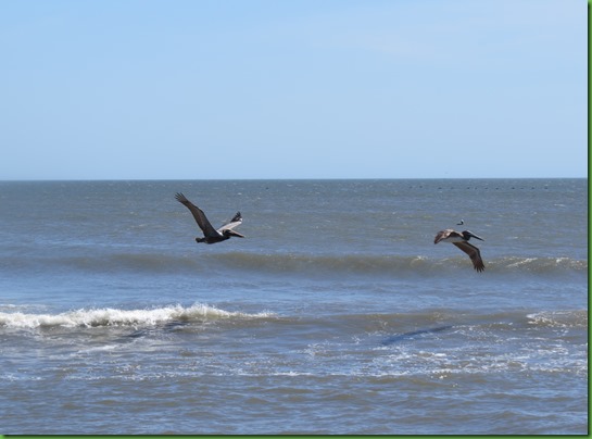
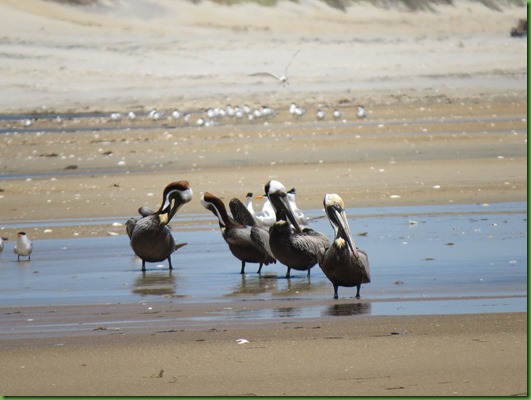
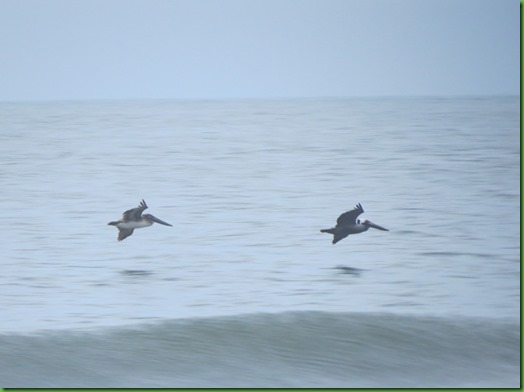
Smart pelicans flying south with the wind.  Skimming the water for possible treats.

IMG_2643


IMG_2644


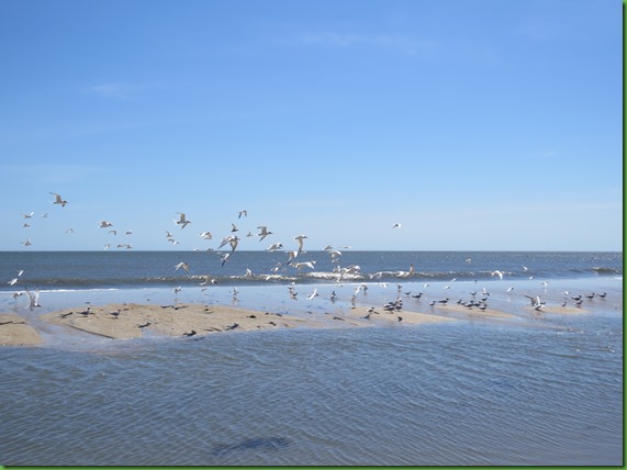
Birds line the shore and there are only two trucks out.  It’s Friday so you know the wind is keeping them away.   Makes it nice for walking through.

IMG_2646


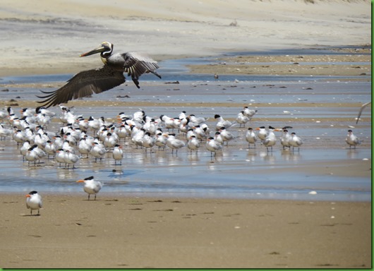
Looks like a gathering spot as more and more fly in.

IMG_2647


IMG_2648


Terns, sandpipers, sanderlings and others.  Can’t say that I blame them in this wind.

IMG_2650


IMG_2652


It appears I am the first person to walk along the shore today which is also not surprising given the weather.  I’m taking a bit of a risk going so far down the beach since another storm is in the forecast for today.

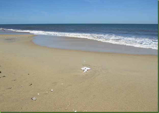
I’m not very good at my fish identification.  Is this a skate or a ray that has washed up on shore?

IMG_2656


IMG_2657


IMG_2667


I’m fairlly far up the beach at this point and see a few more trucks in a line facing the water.

IMG_2670


IMG_2673


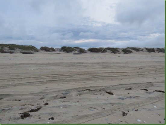
Most of the tire tracks have been washed away from near the shore by the high tide.  But not back by the dunes.

IMG_2677


I can’t even imagine what the wind would be like for Winnona without these beautiful protective dunes between her and the ocean.

IMG_2678


IMG_2681


After I return from my walk, the campground is starting to fill in for the week-end.I guess these folks are really optimistic given the forecast.   In all the rain and the high winds I feel very sorry for my neighbors in their very small rigs.

To my left is a small motorcycle trailer/tent and byond him is a little orange tab pulled by an orange jeep.


Taking advantage of a break in the rain to stay out of the wind.


On my right another little one and beyond them a tent.  I’m seriously happy I have Winnona to come home to in this weather.  


I don’t go down to the beach on Saturday.  Too many trucks.  Too much wind.  It rains off and on all day and steadily all night long and into Sunday.   Most of my neighbors aren’t interested in being stuck inside during more rain on Sunday so they pack up in the rain and are gone by 10am.  This includes a boy scout troop with 9 tents.  Not a fun camping trip for them.

Later, the rain takes a break and I walk down to the beach through the ruts left by yesterday’s trucks.   Looking at the skies I can see my hike will be short.  The rain is going to return.

IMG_2698


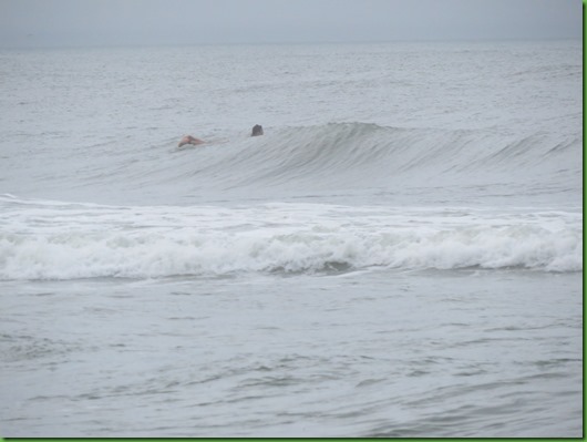
Surf’s up!  Looks cold to me.

IMG_2702


IMG_2703


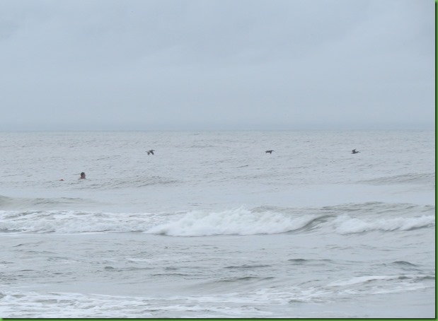
But one lone surfer heads out into the water.  Can’t tell if he has a wet suit on.  I watch him for quite a while but he never gets up on his board.  I’m surprised he’s out there, there have been small craft warnings and rip tide warnings for days. 

IMG_2704


I admit to being captivated by stormy skies.  I once lived a block from the ocean on the north end of Virginia Beach and loved to go down and watch the skies and water on the ocean front during storms with no lightning.

IMG_2706


The would be surfer is  still out there as the thunder rumbles and it starts to spit rain. I didn’t want to wear a rain coat so I head back to Winnona hopefully to beat the next storm. 

IMG_2708


I’d love to be that close to a pelican fly by but not on a rough surf day like this.

IMG_2709


IMG_2715


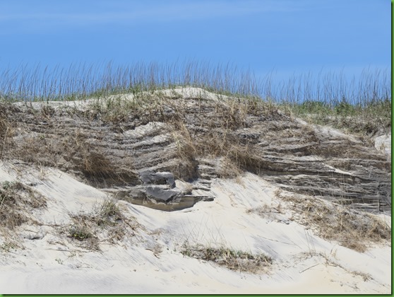
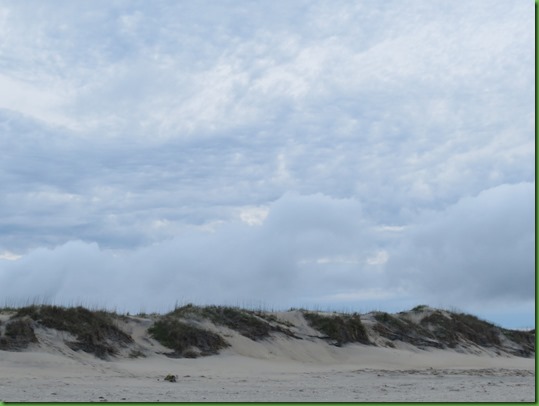
The undisturbed and vegetated dunes hold the sand in place against the winds and look striking beneath the huge clouds.

IMG_2717


IMG_2718


I’ve made it back to the dune path to the campground as the rain picks up.  I can see it moving toward me coming out of the low dark clouds in the distance.

IMG_2720


IMG_2724


One last look behind me.

IMG_2725


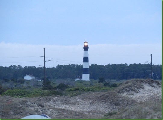
As I head across the dunes I can see from the top that it is dark enough for the Bodie Island Light to come on.

IMG_2733


Most of my neighbors left during the earlier rain this morning.  Winnona is alone under a turbulent sky as the thunder increases.  Surely it can’t keep this up for another week can it?  Should I leave or should I stay?  How many more days of rain and winds here at Cape Hatteras National Seashore on the Outer Banks of North Carolina.   No wonder it’s the Graveyard of the Atlantic.


IMG_2735