Bryce Canyon National Park
North Campground Site 45
Well I’ve run short on great running trails.
There really isn’t anything fabulous like
at Zion and North Rim so I ran the roads
today. Not bad but the altitude is 8000 feet
and my lungs are struggling. It was a tough run
and I’m really not looking forward to repeating it
day after tomorrow. If my chef would stop
making such good food and desserts perhaps it
wouldn’t be so necessary. LOL
We hung around doing this and that until
around 1:00 and then decided to do the
Rainbow Point drive and viewpoints.
After such a torturous run, I wasn’t much
into anything big as a hike.
around 1:00 and then decided to do the
Rainbow Point drive and viewpoints.
After such a torturous run, I wasn’t much
into anything big as a hike.
The drive goes from Bryce Point up to the end of the
park road at Rainbow Point, a distance of 18 miles.
We decided to start at the end and come back
toward the campground so that if we weren’t able
to do it all, it would be easy to pick up the
other view points later.
park road at Rainbow Point, a distance of 18 miles.
We decided to start at the end and come back
toward the campground so that if we weren’t able
to do it all, it would be easy to pick up the
other view points later.
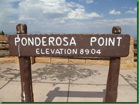
When we got to Rainbow Point,
(notice the elevation)
(notice the elevation)

the wind was gusting over 40 mph.
We’d packed a lunch rather than
just have lunch before we left
so that we wouldn’t be further delayed.
At this point we were both hungry and
so we took a look from the point.
I think the winds made the viewing distance
better actually. IF you could keep yourself from
being blown over.
better actually. IF you could keep yourself from
being blown over.
We found a picnic table for our
lunch of fruit, sandwiches and chips.
I warned David about the wind.
He opened up his container of chips,
I left the top on mine.
Within minutes a gust came along and
threw his container 40’ away,
the lid in as far in another direction
and the chips everywhere.
Boy do I wish I could have had a picture of the
look on his face.
Priceless!!
I hunted for chips in the bushes nearby since
they weighed more than their containers obviously,
and didn’t fly as far.
David went much further afield and found the
red lid pretty quickly. It did stand out after all
But the bottom of the container was clear.
After a more prolonged search he found that too
and we finished our lunches holding tightly on to everything
No lunch picture obviously but we
did take a shot of the spot in order to
remember “the great lunch caper”.
After lunch, although the winds had not died down,
we decided to do the 1 mile Bristle Cone Pine Trail.
we decided to do the 1 mile Bristle Cone Pine Trail.
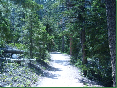
There was quite a bit of devastation on the
trail due to parasites, fungus and disease.
lots of dead trees and those that had come
down had in some cases brought healthy trees
down with them. It looked like the park service
had worked a lot on keeping the trail clear.
trail due to parasites, fungus and disease.
lots of dead trees and those that had come
down had in some cases brought healthy trees
down with them. It looked like the park service
had worked a lot on keeping the trail clear.
This debris makes this area ripe for a much hotter fire
than would occur if natural fires were more
frequent here.
than would occur if natural fires were more
frequent here.
David took this shot to make sure it
would be in the blog since I am not usually
the one to violate the “rules”.
But with editor’s license, I will explain
that I had walked out to look down into
the canyon before I came to the sign.
I did not see the sign and then deliberately ignore it
as SOME people “sometimes” do!
Or should that be as sometimes people sometimes do???
:-)))))))
At the far point on the loop trail we came out into
a windy clearing and got our first sight of
the Bristlecone.
a windy clearing and got our first sight of
the Bristlecone.
As “maybe” you can read on the information sign below,
Bristlecones like living in places few other plants can exist
such as bare rocky ground and extremely windy spots.
Just like where we were!
Bristlecones like living in places few other plants can exist
such as bare rocky ground and extremely windy spots.
Just like where we were!
They are thought to reach an age far greater than
any other known living organisms,
up to nearly 5000 years.
The Latin name is Pinus Longaeva
any other known living organisms,
up to nearly 5000 years.
The Latin name is Pinus Longaeva
They grow in isolated groves at and just below tree line.
Because of cold temperatures, dry soils, high winds,
and short growing seasons, the Bristlecone grows
very slowly. But the Rocky Mountain population is
severely threatened by blister rust infection and
pine beetles which have caused the destruction
we had just seen.
Because of cold temperatures, dry soils, high winds,
and short growing seasons, the Bristlecone grows
very slowly. But the Rocky Mountain population is
severely threatened by blister rust infection and
pine beetles which have caused the destruction
we had just seen.
The oldest known Bristlecone is living in an
undisclosed (to all of us, not to scientists) location
in California. Named, of course, Methuselah its age
was measured by core sample in 1957 to be 4,789 years.
WOW!
You can see why we wanted to be sure to see these trees.
undisclosed (to all of us, not to scientists) location
in California. Named, of course, Methuselah its age
was measured by core sample in 1957 to be 4,789 years.
WOW!
You can see why we wanted to be sure to see these trees.
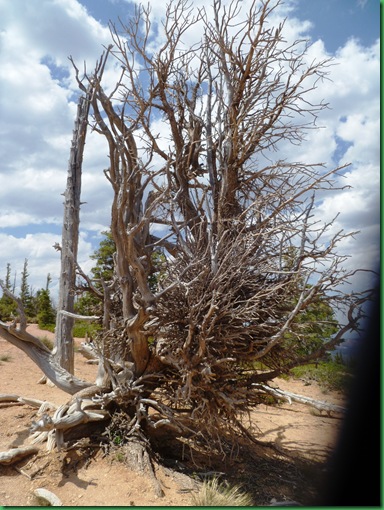
In this picture you can see the 1600 year old
Bristlecone whose trunk they say had been dead
a long time but a branch had continued and become a new tree.
Bristlecone whose trunk they say had been dead
a long time but a branch had continued and become a new tree.
But here is the tree now standing just
behind the sign.
behind the sign.
The branch apparently didn’t make it either
(rust? beetles??)
and the park service hasn’t altered their signage.
(rust? beetles??)
and the park service hasn’t altered their signage.
Just around the corner still in the worst conditions
on the trail we did find this young one
looking very fine.
Although Bristlecones are not usually stout
at the bottom but rather tall and slender.
We’re still pretty sure from looking at the
Bristles that this is one.
on the trail we did find this young one
looking very fine.
Although Bristlecones are not usually stout
at the bottom but rather tall and slender.
We’re still pretty sure from looking at the
Bristles that this is one.
And this unusual double
which has more the typical Bristlecone shape.
which has more the typical Bristlecone shape.
And this tall thin one clinging to a bare wind swept slope.
We are sure hoping these amazing trees will
make it to very ripe old ages.
We are sure hoping these amazing trees will
make it to very ripe old ages.
The other loop of the trail had much much
less destruction. I haven’t been over to the
Visitor Center to ask what the current situation
is there but I’m hoping the damage has been
halted somehow before it affects the rest of this
lovely high elevation forest.
less destruction. I haven’t been over to the
Visitor Center to ask what the current situation
is there but I’m hoping the damage has been
halted somehow before it affects the rest of this
lovely high elevation forest.
On the way back to the car we passed this
GREAT idea! Way to go NPS!!!!
Where can I get one about 1/10th this size
for my RV???
GREAT idea! Way to go NPS!!!!
Where can I get one about 1/10th this size
for my RV???
Next stop
Notice we are going down in elevation.
I told myself I was going to limit myself to one picture
per stop and I did try, but it was really hard.
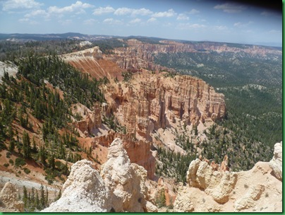
This place is just amazing!
per stop and I did try, but it was really hard.
This place is just amazing!
The Paiute Indians have occupied the area around Bryce Canyon
since 1200. Their legend about the Bryce
Canyon Hoodoos says that
since 1200. Their legend about the Bryce
Canyon Hoodoos says that
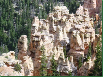
“Before there were any Indian People there were
the Legend People, the To-when-an-ung-wa
who lived in Bryce Canyon. There were many kinds,
birds, animals, lizards, but they all looked like people.
They were not people but they had power to make themselves
look that way. They were bad people, the tale is not
clear on exactly what they did to get that label but because
they were bad, Coyote turned them all into rocks.
Some standing in rows, some sitting down, some holding
on to each other. You can see their faces with the
paint still on them Just as they were before they became
rocks.”
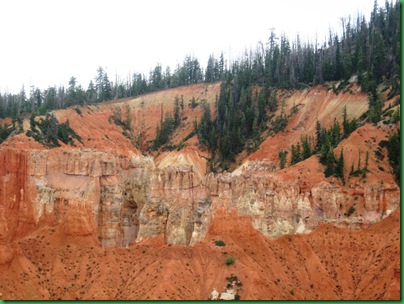
I’ve been trying to see these people
and think I finally did.
Do you?
and think I finally did.
Do you?
How about now?
Does this next picture look like a Castle or what??
All it needs is Knight on his white horse.
All it needs is Knight on his white horse.
Or is it made out of spun sugar?
Notice those are full size trees.
Boy do I wish there was a path down there.
Notice those are full size trees.
Boy do I wish there was a path down there.
Next stop and we’ve gone back up a bit
in elevation
in elevation
I don’t think this is where Bonanza was filmed. :-)
This must be a bad queen from the previous castle.
Guess she was away from home when Coyote
made his move.
Guess she was away from home when Coyote
made his move.
Maybe Coyote was insulted when she turned
her back on him.
her back on him.
Next
As you can see, we were there with
a dozen of our closest friends.
The drive is much more populated than
the trails. I wonder why??
a dozen of our closest friends.
The drive is much more populated than
the trails. I wonder why??
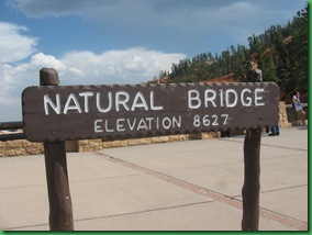
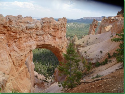
Off to
But, we were told, this really isn’t a natural “bridge”
but actually a natural “arch”. Bridges are carved
by rushing streams while arches are sculpted
by “more subtle” forms of weather.
Whatever you want to call it, it’s certainly beautiful.
but actually a natural “arch”. Bridges are carved
by rushing streams while arches are sculpted
by “more subtle” forms of weather.
Whatever you want to call it, it’s certainly beautiful.
Another face?
We went on to
When I saw this sign, I thought these had
all been more than FAIR views.
all been more than FAIR views.
See any thing? Anyone?
We walked down the trail to
Nice trail
but we didn’t see anything
from either direction that
looked like a Pirate or a Pirate Ship.
Here’s some of what we did see.
from either direction that
looked like a Pirate or a Pirate Ship.
Here’s some of what we did see.
Next stop on the drive was Bryce Point but we
plan to hike over there tomorrow so we skipped
that one and went on home.
plan to hike over there tomorrow so we skipped
that one and went on home.
It was nearly dinner time when we got back
so David put together a Red Bean Toss for dinner
and I took my laptop and phone over to
the General Store to recharge while I worked on
the blog.
so David put together a Red Bean Toss for dinner
and I took my laptop and phone over to
the General Store to recharge while I worked on
the blog.
Here’s my set up.
I was all alone on the porch.
I was all alone on the porch.
except for this fellow who was checking out the crumbs
After dinner we spent some time looking at
the other trails we’d like to do and
figuring out when might be best to do them
based on their length and the predicted weather.
the other trails we’d like to do and
figuring out when might be best to do them
based on their length and the predicted weather.
So we’ve got a plan for tomorrow…….















Loved that solar compactor! I'd be another one wanting a smaller size for my RV :) Never even knew such a thing existed.
ReplyDeleteThanks for the memories!! That was what we saw when we visited Bryce. We only did the drive trail. Remember we were moving rather quickly.
ReplyDeleteNow we can't wait to go with you out on the trails to see what we missed and what we have to look forward too.
I think I would be willing to do a little extra workout if I had someone cooking those fabulous meals and goodies ;o)) Just be careful at that altitude!
Stay safe and have fun...
I've never heard of a solar compactor before and had to look it up online to see what it was all about. Very cool!
ReplyDeleteCool rock formations!
Was that snow I saw on the far away mountains?! As for elevation, if you came back East now and ran - it would seem EASY!! Red Bean Toss - jealous :)
ReplyDelete