Wednesday June 29, 2011
Bryce Canyon National Park
North Campground Site 45
Bryce Canyon National Park
North Campground Site 45
David has graciously agreed to do the blog
on this hike. So here are his thoughts and pictures:
After breakfast, we reviewed
the choices for hikes we could fit in
during the rest of our stay and decided to hike
the Rim Trail starting from our campsite in the North Campground
and heading south to Bryce Point.
This would give us the full range of views
from above the rim into
the Bryce Amphitheater as it is called.
This is the heart of the park
so we wanted to see it before going deeper
– like below the rim.
This turned out to be a good choice,
but not perfectly planned.
More on that later.
We were not out as early as we had hoped
to be to beat the heat,
but we were on the Rim Trail
snapping photos by 8:45 AM.
We had our Camelbacks for water
and one carrot and a piece of fruit each .
We estimated the hike at 3.5 miles
and at our speed that means 3.5 hours
so we would be home for lunch
probably by 1 PM and out of the sun.
The first point we came to is Sunrise Point
and the second is Sunset point.
These two points are the most heavily trafficked
for many reasons.
They are close to parking lots,
They are within easy walking distance
from two corresponding shuttle bus stops,
They are in close proximity to the lodge,
North Campground and General Store,
and there is a paved, handicapped accessible
0.5 mile trail between them
that affords great views
and finally because many of the most popular trails
that go below the rim start or end here.
Here is a fine view from along the trail
before we reached Sunrise Point.
View from Sunrise Point looking south.
The main points along our hike
can all be seen in this picture.
Sunset Point is the green point sticking out
from the right near the top.
Inspiration and Bryce Points
are on the green covered high plateau
on the far side of the amphitheater.
We agreed with LBJ on this point
on one of the information displays at Sunrise.
Other views from Sunrise Point:
Views from Sunset Point:
After leaving Sunset Point (elevation 8000 ft.),
the Rim Trail starts to climb a bit
and heads up to Inspiration Point (elevation 8100 ft.),
a trip of 0.7 miles.
As we left Sunset Point
the crowds thinned out almost immediately.
Much of the time we were hiking alone
on the broad, well traveled trail.
We did notice that we were encountering
more people going in the opposite direction
than in the same direction.
Sherry was quick to surmise
that we must have missed something
that these other people did not miss
in planning their hike.
It turns out that we had failed to factor in
the elevation change from Sunset to Inspiration and Bryce Points
and therefore we were going primarily uphill
while most everyone else was going downhill.
These things can happen with information overload,
which was our condition at the point of decision
this morning, hence a good decision
but maybe not the best.
Sherry’s advise:
DO NOT HIKE THE RIM TRAIL GOING SOUTH.
RATHER TAKE THE SHUTTLE BUS TO BRYCE POINT
(THE SOUTHERN TERMINUS at elevation 8296 ft.)
AND HIKE DOWN TO SUNRISE POINT.
At this point, we are rounding the spectacular
Bryce Amphitheater and getting different perspectives
on the same landscape from each point.
Amazing how the views change as you go.
This picture looks back north from Inspiration Point.
Here we found a new type of marker.
Not exactly a benchmark.
But still…….
Sherry thinks it counts. :-)
Maybe even extra points??
Some of the views between
Inspiration Point and Bryce Point were:
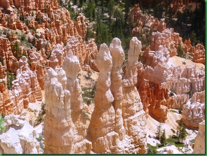
A closer view of the central formations.
Further along …
Do you recognize the Three sisters?
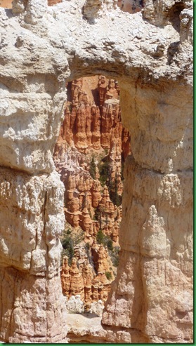
We do love the view through these windows.
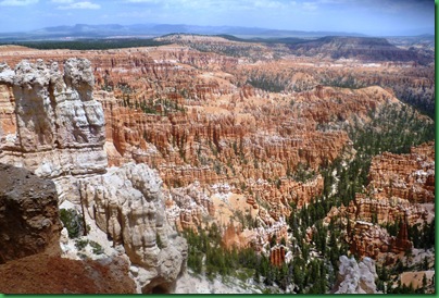
And finally a couple of views of the main amphitheater
from Bryce Point.
A lot of hoodoos out there!
Just to wrap this up,
a hoodoo is a word somebody made up
for these pinnacles and other odd-shaped rocks
left standing by the forces of erosion.
Knowing that, I wondered why
they didn’t just call this Hoodoo Land
or Hoodoo National Park?
I guess those naming things at the time
were giving priority to the name
of the first white man who had
anything to do with the place
as though it did not exist before them.
It certainly had a name before Bryce came.
Oh well, they got it right at Sequoia anyway.


Fabulous Photos!!! I don't see any spot???
ReplyDeleteJust think of all the exercise you added to your day going uphill. You also got to see the trail from a point of view most folks miss!! Thanks for taking us that direction;o)
First time I have seen LBJ's quote, but I may have to borrow it from time to time. May be one of my all time favorites!!
Your photos are spectacular. I can only imagine what the view is like in person.
ReplyDeleteFabulous pictures and great quote from LBJ. My guess is that you agree with him on more points than you know. :)
ReplyDeleteWell done, Pops! I'm glad I've been there in person so I know how amazing it is - just magical. You look bronze - what a tan! :) I'm in agreement with you and the other commenters regarding the LBJ quote. And, as always - great pictures! :) Wish I was there with you!!
ReplyDelete