Go confidently in the direction of your dreams. Live the life you have imagined.

Henry David Thoreau

Schoodic Peninsula Acadia National Park

Friday & Saturday, August 18 & 19, 2017                                                              Most Recent Posts:
Schoodic Woods Campground                                                         Bass Harbor Lighthouse and Friends of Acadia
Acadia National Park                                                                                Shut Out on Acadia Mountain
Winter Harbor, Maine
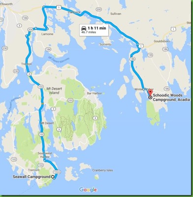


Seawall to Schoodic

Our move to Schoodic Woods Campground takes us off of Mount Desert Island and over to the mainland section of Acadia.  It’s a trip of about 47  miles and takes only an hour. If you want to see the peninsula but not drive over, you can take one of two ferries from Bar Harbor and then pick up the Island Explorer Bus from Winter Harbor to take you to the park.  The Island Explorer makes constant loops through the park and several nearby towns so you can do quite a bit of site seeing from the bus just by getting off and on.  Buses run at approximately 1/2 hour intervals.

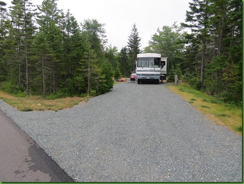
The campground, opened in 2015,  sits on the northern end of the Schoodic Section of the park.  It is entirely paved, has lovely new bathrooms but like at Seawall and at Blackwoods, there are no showers.  They are provided by private businesses outside the park.  In a brand new campground that seems odd.   There are 94 tent/RV sites and all have electricity.  Some have water and electric so be careful which site you choose if that matters.   The sites are nearly all pull throughs and very long.  There is nice separattion between sites.   But apparently they didn’t have leveling equipment because many of the sites are further from level than I expected in a new campground.   Still, it is a place we can easily stay 2 weeks, and we do. 
IMG_1872


IMG_1873


With some planning you can hike from the campground across the mountain to the beautiful Schoodic Point.  There are several interesting trails in the park and many more at National Wildlife Refuges and other preserves nearby

We’ve been lucky that it rains the first night we are here so we’re hoping the waves will be crashing at the point.  It’s definitely all about the weather.  Over our time here we hve seen the point totally placid so bear that in mind.  If you come over to see the point, it is gorgeous in any situation but much more dramatic during and after a storm.

In the morning, the fog is thick after the rain so we know we won’t be able to see much beyond the shoreline.  We also know we don’t want to hike down to the point.


IMG_1875


Instead we’ll take the bus.  After a leisurely breakfast, we walk over to the really lovely Ranger’s Station where the bus stop is located.

IMG_1880


IMG_1881


Inside it looks like a mountain lodge with wonderful comfy chairs in front of a stone fireplace.

IMG_1887


The large relief map gives a good sense of where you are and what is nearby both on the mainland and in terms of islands.
We pick up a nice laminated trail map for which we pay $1.00.   You can have a black and white copy for free but the color one is more than worth the price.

IMG_1888


The bus picks us up right in front of the Ranger’s Station and off we go.  Sadly I have no pictures of the gorgeous coastline along the loop road as we drive.  Fog, fog, fog.

IMG_1890


We arrive at the point and set out carefully across the wet giant rockface to get closer to the shore. 


IMG_1900


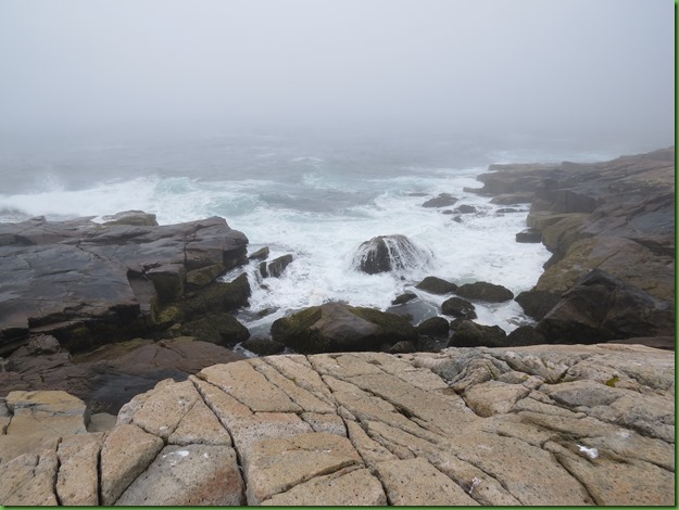
The sea is churning as you can just barely see in this foggy picture.

IMG_1903


The geology here is just fantastic. Schoodic Point is a peninsula of granite.  Although this looks similar to the Cadillac pink granite of Mount Desert, it actually has smaller mineral crystals and more fractures.   The granite is light gray with a pink tinge and cut through with dikes of dark basalt. The dikes formed as a result of the rapid cooling of molten rock.   Some of ther dikes are wider than others.  


IMG_1908


Here at Schoodic Point, the granite was formed first as one large mass. Fractures formed in the granite were later filled by molten rock. The magma cooled quickly to form the basalt dikes. The dikes are softer than the granite and erode more quickly leaving nooks and crannies where water and soil collect. Then of course plants begin to grow and we see some in bloom today.


IMG_0058


IMG_1944

IMG_1946


IMG_1915


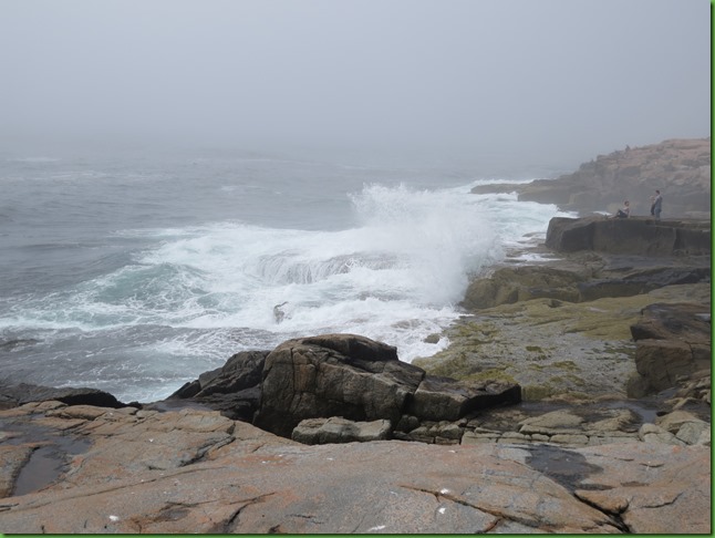
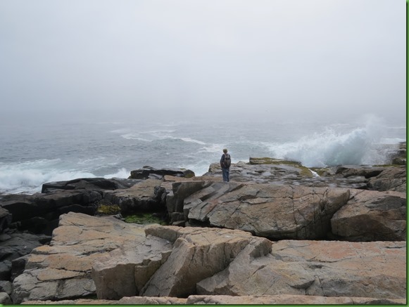
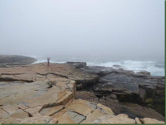
This is about as close as you want to get to the edge.  People have been swept off by unsuspected waves.
 

IMG_1927


IMG_1930


Giant sized glacial eratic egg has fallen into a low spot.  Wonder how far it was dragged to get dropped here?

IMG_1938


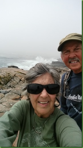
Seriously everybody is taking selfies these days and this group makes us decide to do one too.  Hope theirs turned out better than ours.

IMG_1943


20170819_125910


IMG_1958


IMG_1954


It’s easy to get mesmerized by watching the waves.  We spend about three hours at the point sitting in various spots.


IMG_0035


IMG_1969


IMG_1971


IMG_1982


IMG_1986


IMG_1994


We stay until 2:00 in the afternoon  but before we leave, we walk the loop road around along Schoodic Harbor before taking the bus back to the campground.  Even the normally tranquil harbor and buck cove are showing signs of the winds.


IMG_0100


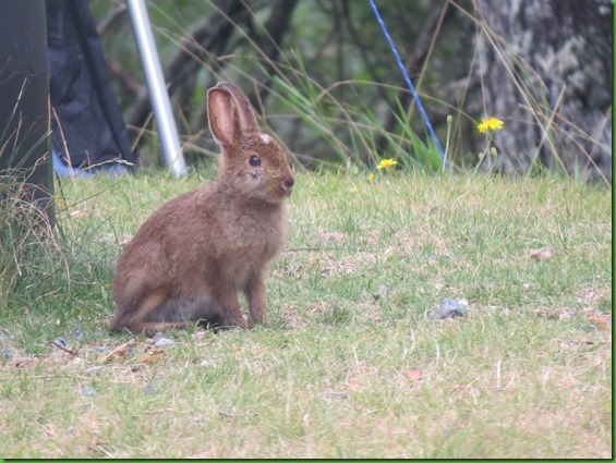
The bus drops is off at the ranger station and when we return to Winnona we see one of our neighbors.
IMG_2038


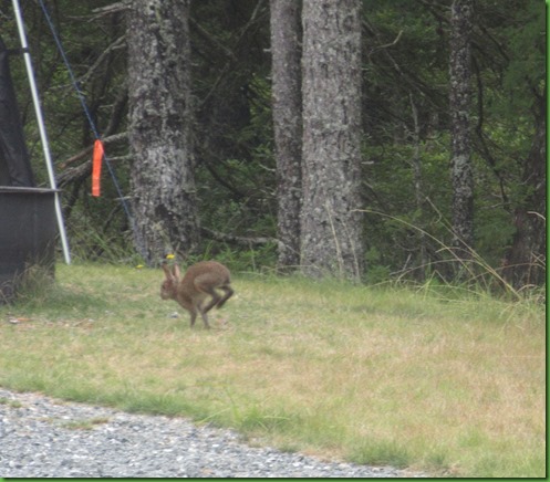
After sitting patiently for portraits, he decides he’s had enough of this.
 

Tomorrow we’ll be exploring The Schoodic Institute which has an interesting history also associated with John D Rockefeller to whom Acadia National Park owes a great deal.

Bass Harbor Lighthouse and Friends of Acadia

Thursday August 17, 2017                                                                   Most Recent Posts:
Seawall Campground                                                                     Shut Out on Acadia Mountain
Acadia National Park                                                                    Moving INTO Acadia National Park
Mount Desert Island, Maine


For our last day at Seawall David and I do two different things.

He leaves early to volunteer with the Friends of Acadia trail maintenance crew.  He’s been wanting to do it and today is his last chance.


A 8:00  the crew gathers in front of one of the administration buildings at Acadia National Park and assignments are chosen.


There’s a chart with the different projects for today with information about each project.  It’s volunteer’s choice.  David chooses the bottom project although it didn’t turnout to be a cleanup.  It turns out to be a continuation of some new trail creation on the Jordan Pond trail which we had hiked previously and had to go around the work in progress.  So that was very cool that he was able to work on the project where he first learned about the opportunity to volunteer.   Don’t you love the “difficulty” ratings?


Heading down the trail to the work area.


The team leader on the front left is explaining the work plan to the volunteers.


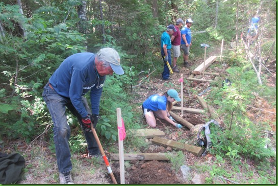
First work is on the cribs.  I call them platforms for the boardwalks.  Each stake marks the location for the crib frame to establish where to lay the walking planks across to make a continuous boardwalk from one end to the other.  Unfortunately Acadia is experiencing a real drought although it’s lucky for this trail work since little damage is made to the area by all the walking around.


The volunteers are split into teams and begin the work   David joins the young people’s team.  He describes the girl as experienced, had done this before, knew how to operate all the tools while the young man on the left didn’t have much experience or confidence.  Nice switch of gender roles I thought.


Here’s David with an in motion swing with a pick axe.

IMG_0018


At this point he isn’t actually working on the crib but on the landing point where the first boards are intended to be flush with the ground and extend to the first crib.  The use of a level was critical at all times.  The grade from one crib to the next could not be more than 3%.  The group leader would decide which crib needed to go up and which down to create a nearly flat walking surface that would be no danger when wet.   They don’t want anyone to slip on a slope.   Beyond the young woman, a second team is considering another section.


IMG_0019


IMG_0020


The team leader is checking out the first span from David’s entry log to the first crib.  He’s checking out the level and considering whether it needs to be raised or lowered or perhaps a step added.  From the smiles it looks like he must be fairly happy with the work.

IMG_0029


Here’s a look at the progress being made.  The far end shows the in ground piece David had done with the plank to the first crib.  They decided to raise the first crib a bit to line up better  to the second crib.  


IMG_0030


The information when you volunteer says that you will come at 8:00 and work until noon and then everyone will have lunch here afterwards.   But only David had brought his lunch and stayed.  He was disappointed not to get to share some comments, experiences and stories of the morning with the members of all the teams.

He says it was a great way to spend a morning and he highly recommends it.   No doubt he would have done it more had he known about it earlier in our stay.


While David is off with the volunteers building those important environment protecting boardwalks, I’m playing.  Doesn’t seem fair does it but I’m not much of a handy woman.  More of a helper go-fer.

I have some chores to take care of first so I don’t take the bus until after 10am.  My goal ultimately is to go to the Bass Harbor Lighthouse but I first want to stop and check out Eat-a-Pita & Cafe 2 in Southwest Harbor.  Not sure why such a cumbersome name but I showed some pictures of it on my last trip to the little town.  Today I’m actually going to have brunch there.

The cafe is located right on the Main Street.  It has tables inside and outside under awnings.  Outside tables areseparated from the town sidewalk by lovely flower/vegetable boxes.


IMG_1815


It’s just before 10:30 when I arrive and many people are at tables both inside and out.

IMG_1816


Still there are many open tables to choose from although  while I’m there, every table fills.  I pick the one at the far in the corner next to the flower boxes.

IMG_1819


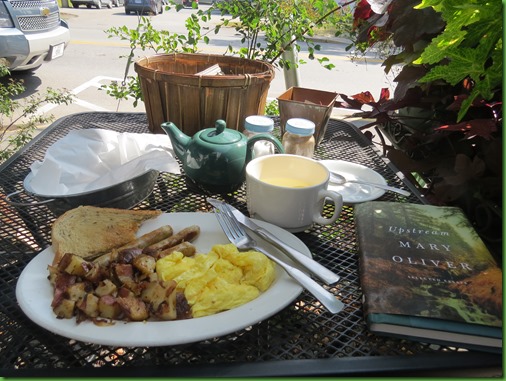
I order and while I wait I spend my time enjoying some Mary Oliver as the cars move slowly by.  I have hot water with lemon and love that they bring me a pot of water in addition to just a cup.  The breakfast is delicious.  Everything is cooked to perfection.  I rate the potatoes as outstanding.


IMG_1820


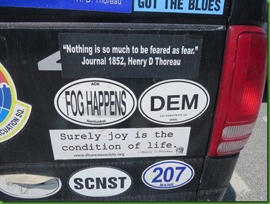
After breakfast I have some time to walk a round a bit before the bus comes that will take me to Bass Harbor Light.  In the post office parking lot I find this seriously decorated truck.   What a riot!!   The owner definitely has opinions and wants to express them.


IMG_1821


Here’s a couple of close ups.  Wish I”d moved my camera up just a bit on the picture on the left.  I intended to include the two stickers above including Erosion Happens and Earth Got the Blues.

IMG_1822


IMG_1823


The bus driver very kindly drops me off, not at the formal bus stop across from Bass Harbor Campground, but at the top of the road that goes down more than half a mile to Bass Harbor Light.  Saves me maybe 1/4 mile walk.   Island Express bus drivers are wonderful.  Just raise your hand anywhere they are coming toward you and they will stop and pick you up.  They will also drop you off anywhere they can safely stop.


IMG_1848

I’ve been here before so I know that there are two views of the lighthouse.  One is the famous one over the rocks, the other is the one that shows the attached keepers house from the other side.   I check out the keeper’s house first

Bass Harbor light was built in 1858 at a cost of $4983.35 with an additional $50 for the land.   I’m swooning over the price for this land.  Originally it had a 5th order Fresnel Lens.  Presently it has a 4th order Fresnel.  The lens was electrified in 1949 and automated in 1974.


I walk down the drive to the keeper’s house.  All of this is Coast Guard Property.  Not sure if they use the house as living quarters or not.  If so, I feel very sorry for the occupents with all the people wandering around their house all day every day during the season.

IMG_1828


Thes light is obviously attached to the keeper’s house.  The fog signals here were all bells, two of which are on display.  The sequence of bells is very interesting.  1876-hand bell, 1898-Steam Operated Bell, 1902-Pyramidal Bell tower,  1949-Electric Operated Bell and 1974- Bell Buoy which is still operational. 


The bell tower was just on the right edge of the picture above.

IMG_1837


IMG_1842


From there I have to go back up the hill, through the parking lot and pick up this path at its far end to see the classic view of Bass Harbor Light.


IMG_1849


Several flights of wood steps and then rock steps are required in order to get near the foot of the cliff for the view.

IMG_1852


At the bottom of the steps, the lighthouse is not visible and I saw a number of tourists  without the proper shoes for navigating this rocky way.


IMG_1856


There are some large obstacles to negotiate for even this sliver of a view.

IMG_1857


I get closer and closer but it’s still not the view I’m looking for.

IMG_1861


This is a little better but the view I really want is WAY over there and I”m not sure I’m up to even more navigation of these rocks.

IMG_1863


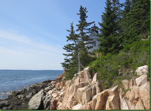
I think this one will have to do for my postcard attempt.  I do love lighthouses and am a bit unhappy that I can’t get the shot I really want.   But how lucky am I just to be here on this beautiful day ahead of the big mass of tourists I’ll find when I head back up.


IMG_1865


Not that there aren’t any people here but the later it gets, the more there are.  And who can blame them.  What a fantastic spot!

IMG_1868


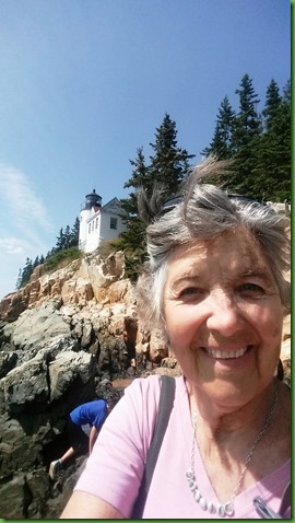
Just before I leave I make a selfie attempt and then take these two pictures with my phone which uncharacteristically did a pretty good job. 


20170817_132613


20170817_132621


My selfie is photobombed by a woman being very careful on the rocks.  Climbing is definitely the safest way on this uneven and slick surface.

20170817_132641


To get back, I’ll walk back over the rocks, up the steps, half mile up the road and then another bit down Route 102 toward this bus stop to catch the bus back to Seawall.   Imagine my surprise when I get to the parking lot and see that it is packed full and cars are lining the road.  Cars everywhere and in line for the next parking space in the lot is David who has come to rescue me.   My hero!!   What a surprise!  He’s right on time!!
Thanks David.
He’d already waited 10 minutes so he opted to just turn around and head back.


IMG_1825


It’s about 2:00 now and I’m glad he’s come to get me.  We have packing up to do and this saves a lot of time.  Tomorrow we head over to the mainland to the Schoodic Peninsula section of Acadia National Park.  


As you’ll see from up coming posts, there just isn’t any end to all there is to do here on the coast of Maine.