Sunday June 22, 2014
Union Bay Campground
Porcupine Mountain Wilderness State Park Michigan
We’re headed for the farthest reaches of the park.
It’s a 32 mile drive from the campground to the other end of the park. We re in the campground way up there in the upper right, Union Bay. We are going to go down South Boundary Road, the road right on the edge of the bottom section of the park’s green area. We will take it all the way over to that section on the lower left. That river you see there, running north and south, is where today’s hike is located.
The section of the park we are going to is known as Presque Isle after the Presque Isle River which tumbles over several waterfalls and many rapids as it races to meet Lake Superior. We are going to do the East/West River trail which you can see on the map below. The Presque Isle area also has a smaller very sweet rustic campground no hook ups, but no reservations either. Very nicely wooded so difficult for solar or satellite. One loop does not allow generators which I would have really appreciated as a tent camper. This is a really beautiful area. Had I known, I might have split our camping days between the two campgrounds although the 32 mile road down here is a bit rough and it would be slow going for Winnona.
As you can see on this map, we can access the trails from either South Boundary Road or from the picnic area which has good parking. We are at the picnic area and will walk up one side of the river to the road, cross the bridge to the other side of the river and hike back. It’s a trail of about 3 miles.
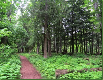
It’s a lovely wooded trail with some interesting brightly colored fungi.
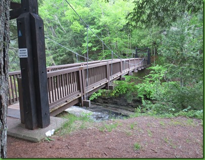
We come shortly to the decision point. Go up the east side and down the west side or vise versa. I really like walking up to my waterfalls from the front rather than behind so we go up the west side. But before we set off, we stand on the suspension bridge and look at the river coming in a hurry down to Lake Superior a short distance away. There is a mist and some fog here this morning making picture taking a bit challenging. The mist on Lake Superior is so thick we can’t even see it though we know it is right there at the end of the river.
Upstream Downstream
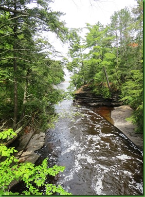
A sign tells us that the finely terraced rock over which the river flows is called Nonesuch shale and is composed of sand and clay particles that were deposited in a shallow lake that covered this area almost a billion years ago. Amazing that geologists know what was going on a BILLION years ago. Think about how many zeros that is.
Anyway, the round potholes in the riverbed, that amaze us when we see them, form where an eddy current continually swirls pebbles and sand grains in a circular path. Over time the scouring action of these materials wears away the softer shale forming the large smooth sided potholes that we see.
Through the trees and across the river, we see the shale river banks are beautiful.
Just to the left of the shale stack, we see an area that we are later able to access from the trail. We are actually able to walk out on these rocks. I love that we can explore both sides of the river bank so closely without doing any damage to the habitat. The west side has a boardwalk nearly the entire way.
As we move on up the boardwalk, I don’t find I need my bug gear yet but David does.
We think this is the fist waterfall but soon we learn it isn’t. It is a “minor cascade”. OH BOY!
UP we go. Another sign informs us that some of the trees along the banks of this river are over 400 years old. They would have been seedlings when the native Ojibwa Indians fished this river with nets crafted of nettle fiber. Boy if they could only talk. Wonder what they’d have to say about the arrival of the Europeans.
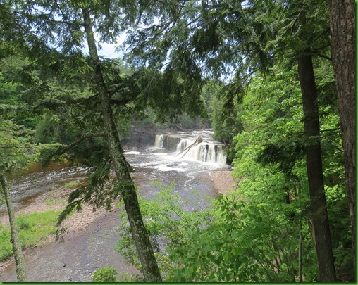
We come to Manabezho Falls which takes its name from the Ojibwa proper name for the spirit we call God. This is the largest of the river’s falls and boy is it putting out the mist and fog.
Manabezho may be the largest of the river’s falls but I like the second falls up the river, Manido Falls, the best if one can actually like one magnificent waterfall better than another.
The viewing deck at the top of the falls has a bench which seems the perfect place for our picnic lunch
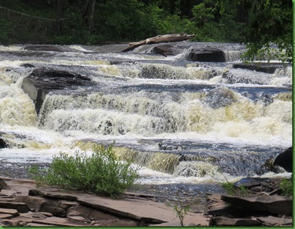
Just one more shot before we leave. Look closely at all the ways in all the directions this water flows. The Presque River is the largest river in the Porcupine Mountains draining 300 square miles of forest land in Upper Michigan and northern Wisconsin. No wonder there is SO much water especially after the winter they have had this year.
We take pause at a sign that tells us is “Steep Terrain ahead”. It turns out that what this actually means is no more boardwalk and rough footing as well as steep. Once we get back up on the ridge the path levels out winds through big trees and runs through fields of ferns.
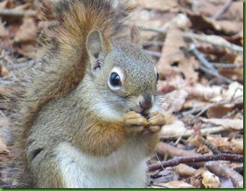
We get stopped by a busy red squirrel whose antics we watch for some time. Too many pictures of him of course. He was busy picking things out of the leaves and rotating them around in his hands while eating them. I so wanted to get his use of his fingers. Really amazing small motor skills.
The third falls here on the river is called Nawadaha which in Objibwa means “in the midst of the rapids” and that is what these falls look like. We learn that the name is especially appropriate in the spring of the year when the river swells with rain and melting snow. During this time of peak flow nearly 12,000 gallons of water tumble over the Nawadaha Falls every second. EVERY SECOND!!
The Presque Isle River’s water quality makes it choice habitat for many fish. Brook and Rainbow trout are found here year round. Adult coho and chinock salmon appear here only during their fall spawning season but never make it this far up stream.
The walls on the far opposite bank catch my eye. There is beauty everywhere.
More beauty in this fungus growing on a tree on the riverside trail.
Just above the falls we are so close to the water that we have to see how cold it is. David does the honors and pronounces it warm. WARM? I have to try that for myself and find that he’s right. The water is comparatively warm. But it won’t be for long once it gets into that great lake.
How about a water’s eye view from here?
On we go. BIG trees and GREAT falls. What a hike!
There are a few steps up to the road, we walk across the bridge to the other side of the river and start down the east side. David finds some yellow birch bark. I’ve never seen the inside of the bark. Orange birch bark would be more like it.
Happily, we get to do everything in reverse. And of course we take more pictures of the falls from the opposite direction since we are now walking with the river rather than against it. It’s a whole new hike. But this post is quite long enough as it is so I’ll just give you a small sampling of the beautiful water side trail, more big trees and gorgeous water.
Near the end of the east side trail we come to the rock outcropping that I showed you early. I said I thought we could walk out on it and we can, the trail goes right across it.
This really is a massive outcropping. That little blue thing on the left is me. In the bottom picture the little gray thing on the rock in the middle just below the tree line is David.
The picture directly above is taken just off a cut in which looks like a little lake. Some of the river may flow in there when the water is even higher but primarily it just seems to be lake Superior pushing its way up stream. The markers for the trail go right up across the shale and into the woods in the right hand picture.
You can see the blue marks on the shale showing the path across can’t you? But of course no one just walks straight across. Everyone explores all over these rocks. You can get so near that powerful water. It’s very seductive.
Look at the colors and designs in all this shale. Pretty clear it was part of the sea at one time.
We have pretty much finished our explorations when we see from here as we look downstream that the fog is increasing. Is it moving up the river from the lake?
Fog is pretty eerie. I don’t think I’d want to be out on these rocks when it gets really thick.
It’s coming around the corner. Time to be on our way.
Before we go across the suspension bridge and climb up to the parking lot and Ruby, we take a walk down to see the river mouth come into Lake Superior.
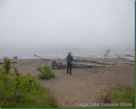
Except that the entire lake is socked in. The fog is rolling up the river. Soon nothing will be visible. Those folks who started out late in the day are going to be mighty disappointed.
The only things you can see clearly are the beautiful lake rocks.
We cross the suspension bridge and hike up the stairs.
It’s a long climb up but it was well worth it. If this isn’t the premier hike in the Porkies, I can’t wait to see what is.
Postscript:
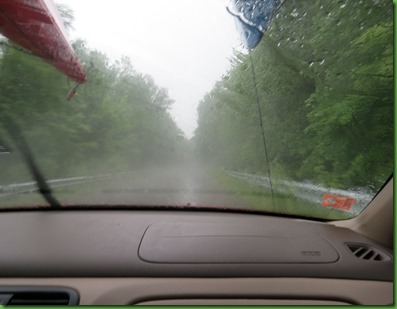
Boy are we the lucky ones. We JUST get to Ruby when the skies open up and it pours. We had passed several groups going out on our way in and I wonder how they fared in rain like this.
All 32 miles of the trip back it pours. Somebody is looking out for us.
















I agree with you about that area that is one of our favorite hikes in the Porkies. We love to with cross over the bridge and spend time on the island like area in the middle. We have taken our picnic lunch with us down to the Superior shore line and rested there watching the waves and occasional boat.
ReplyDeleteWhat a stupendous hike! Between the water, the falls, the green, the fungus...you must have been in awe every step of the way!
ReplyDeleteIt amazes me how many people don't even start to hike till lunchtime or later! Must be night owls or something!
That fungus looks like little tomatoes :-) Fog can be eerie, but lovely when the sun starts burning it off. You guys certainly we're lucky to beat out the rain.
ReplyDeleteWhat an amazing hike! The falls and rocks are beautiful. What great fungi!!! I love the "root path!" Guess the weather isn't improving much. Lucky you timed it perfectly:)
ReplyDeleteOf all the beautiful pictures you took I love the one that looks like it was taken at night (right next to you hugging a tree) They are all beautiful, just saying that was my favorite today.
ReplyDeleteCan't believe you saw all that in just 3 miles! The "gorgeous water" pic after David's orange bark (cool too!) is truly spectacular. Since retiring I have become such a morning person, and even Bill is up before 7:30 on weekends. So I'm thinking that hikes in the morning will be an easy option for us. Afternoons are for naps!
ReplyDeleteBeautiful pictures of the waterfalls!
ReplyDeleteAnother great hike, and this will be on our list. Sherry you are really our trail blazer. Wonder what it would be like in august there.
ReplyDeleteMy favorite pic is the one of the falls after the picture of you hugging a tree. A beautiful hike.
ReplyDeleteYep... Lucky, Lucky You!!! That was a specatcular hike:o)) Lucky, Lucky Us to get to share those great photos!!! I'm with Judith...love the same waterfall photo...AMAZING:o))
ReplyDeleteAll those waterfalls, I'm starting to worry you're going to get all washed up! ;c)
ReplyDeleteI want to live on top of a waterfall … or beside one. yes, I think that would be better … well? like the viewing deck. that'd work. AND I'd have me a nifty little cute squirrel to play with all day long.
ReplyDeletegorgeous! that last picture of the two waterfalls! ahhhhh me. it's heading toward 100º for the next few days... think I'll insert a pfffffft but then I'm not that kind of person .... or I would
What a wonderful hike that was. I especially loved how the swirling water makes such perfect potholes. I'm glad you got out when you did though.
ReplyDeletewow. . .pretty, pretty, pretty. ..what a wonderful day, and a wonderful hike. . .
ReplyDeleteI just knew that you would like that area. They have electrical hookups now??? Hmmmm.....I like that!!
ReplyDeleteJust an advisory re: Voyageurs, That area is experiencing some flooding. I have not seen any evidence that the mainland camping facilities are unduly affected, it would be wise to monitor the situation and have a plan B.
Randy we thought we saw electric as we drove through the campground but your comment made me double check and you are right Presque Isle is a rustic campground. All the better in many ways. No reservations to worry about. Thanks so much for bringing this to my attention so I could amend the post.. Love my commenters.
DeleteSorry you had to drive 32 miles in it, but I always enjoy a little rain after a long day of hiking. Bet you both slept good.
ReplyDeleteI'm with Laurie -- I thought that little fungus looked like tomatoes. Beautiful falls! And your timing was perfect in beating the rain!
ReplyDeleteWhat gorgeous photos of your spectacular hike. I could almost feel the moist cool air and smell the pines. I especially love the shale and expansive waterfalls. The fungi are awesome too!
ReplyDeleteWhat a wonderful hike, love waterfall hikes and especially ones with suspension bridges, even if it was a long 32 miles back at least you were dry.
ReplyDeleteNice hike. Think of those beautiful waterfalls next time you get rained on.
ReplyDeleteWhat a hike and what great timing. I am particularly intriqued by the potholes. So perfect. I've only been rained on a couple of times when I was hiking and the rain always started when we were furtherest from the car. Lucky you! Thank you for sharing.
ReplyDeleteWhat a spectacularly beautiful hike! That was a seriously thick fog bank rolling in -- glad you made it back before the skies opened up. Cool photos of the fungi -- I've never seen those little "cherry tomato" ones either. Interesting info about the Ojibwa crafting fishing nets of nettle fiber -- I've harvested nettle for cooking and teas, but didn't know the fiber was used for other purposes.
ReplyDeleteGreat pictures, we just love that area.
ReplyDeleteLove those brilliant mushrooms. The bunch of yellow/orange ones on trees looks like chicken in the woods which is a nice edible. Isn't geology fascinating? Well, you know I love it anyway. Shale would typically be deposited in a swamp, delta or estuary. Could be some fossils. Such a treat to walk through an ancient forest and feel the energy of those magnificent falls. And to beat the rain.
ReplyDeleteWhat a wonderful hike! Gorgeous trail to those lovely trees and gorgeous powerful falls. Fog is so mysterious as are trails through ferns. Like another world. The rain waited for you. How nice! That must have been a day that made you smile to be alive and feel lucky, lucky to get to see it all. That wet winter definitely added to the excitement of those falls :)
ReplyDelete