Sunday August 17 & Monday August 18, 2014
Moraine Park Campground
Rocky Mountain National park
SUNDAY
It never ceases to amaze me how long it takes for us to pack up and move to a new backyard. Last night was our last night in Glacier Basin Campground. I made reservations a long time ago and thought we’d spend a week in each campground. I could get 7 days in one site at Glacier Basin but only 5 days in a single site here in Moraine Park Campground. Today is moving day. We are only going 5 miles but it takes us the entire morning to get it accomplished.
Check out time is noon and check in is 1:00 so we figured we might as well not chance having to sit around and wait to get into our site. The site is another long one on the side of the road. If you want a pull through in either campground that means just off the road. The only problem is they’ve dug a drainage ditch through it that we have to maneuver around. But once that’s done, it’s 1:05pm and time for the duckie view. The duckies don’t have a view of the gorgeous yard in this campsite. No one is next to us on either side and our yard goes on as far as the eye can see. It’s fabulous. There are people right across the road from us but we’ve found in both campgrounds that the folks here are outdoors people and gone hiking all day and tired when they come back so it’s very quiet. The dining room slide is right on the road is my only complaint. That and the campground Loop A roads are dirt and the dust is a real mess. We are told they had hoped to have them paved by summer but now it won’t be until fall. So if you come you won’t have to deal with the dirt. But make your reservations WAY early.
The aspens have no affect on the solar which, by the way, is working fabulously. We have been boondocking all but 2 days this past month.
Check out the yard. This is the view out the door. Wild as far as the eye can see. And look who came to check out the site just after we arrived. I’m thinking he’s going to be a regular visitor hoping for left overs.
In the afternoon we go over to check out what they call the Discovery Museum which is just across the road from Moraine Park. It closes early, 4:30, so we didn’t have time to see it thoroughly. I’ll talk about it on the post when we go back and do it justice. It’s a great building inside and out.
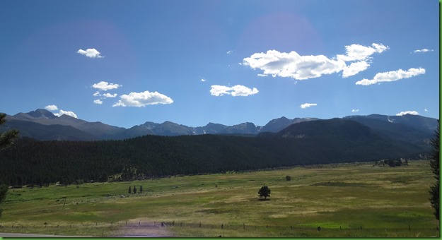
On the way over we take a closer look at Moraine Park, the huge valley for which the campground was named. The valley was once the melting basin of the Thompson Glacier. The huge mass of ice deposited loads of rock debris, lateral moraines, that are now the forested ridges that look like foothills to me.
At its furthest advance, about 18, 000 years ago, the Thompson Glacier dumped a load of rock fragments, a terminal moraine. As it retreated, its meltwater formed a lake here which later filled with sediments. The valley is much much larger than these pictures show.
MONDAY
Today we are on the road at sunrise to drive up The Trail Ridge Road to the Alpine Visitor’s Center. What a great idea it was to start out this early. The sunrise gives the skies and the mountains a fabulous glow.
The Trail Ridge Road has a guide book and 12 sites to stop along the way. Some have short hikes. we’re only going to go up to stop # 8 today and then save the second half of the drive for when we spend the day on the West side of the park to check it out for future stays at Rocky Mountain National Park.
The first stop is at Hidden Valley where we take a short hike through the valley at an elevation of 9400 feet.
The park has done a lot of restoration in this former commercial ski resort area which began in 1931 and operated until 1992. They have removed all the buildings, the lift and restored Hidden Valley Creek.
For 50 years, Hidden Valley Creek was seriously hidden as in an underground pipe. They removed the pipe and brought the water in the stream back to the surface. I just LOVE this. I’d bet none of us has any idea how many streams have been buried in our own home towns. I’m also betting there are quite a few. You can’t build anywhere you want without altering the landscape.
These wetlands here were covered by a parking lot for many years. I just love my National Parks!! Still adding to and protecting this area as little as 22 years ago.
Many of the Engleman Spruce and Subalpine fir trees in hidden valley may be up to 600 years old. They grow here because this forest is well watered and has not seen fire for hundreds of years. Snow blown into this valley piles deep and lasts well into the spring and even summer. No wonder they wanted it for a ski resort. This abundance of water has created conditions not found in many areas of the park. These are big trees as you can see with us standing under them.
Rocky Mountain National Park has been home to Native Americans for at least 12000 years. Hidden Valley was a travel corridor for them leading to the high country. They have found very little evidence to mark their passing. Stone projectile points, game drives for hunting and sacred places for worship are all that remain of these early visitors. Unfortunately the same light footprint cannot be said of those who have been here for the last 200 years.
Some of the mountains’ though luckily still speak the Native languages with names like Mount Wuh, Arapaho for Grizzly Bear, and Mount Neota, Arapaho for Heart of the Sheep. Although the sheep are still here, both the Grizzly and the Wolf, native to this place, have been hunted out and are refused readmission by the local communities.
At Rainbow curve we are 2 miles above sea level. That’s 10,560 feet. The views are spectacular both out and down. We can see the road curving up behind us. Here we are way up among the rocks near the tree line.
From here you can see the Alluvial Fan which is the light colored fan like area on the left. On July 15, 1982 the upstream Lawn Lake Dam failed. Flood debris damned the Fall River eventually forming a temporary lake and flooding most of horseshoe Park. This past September it flooded again.
I can get a neat picture of the meander in West Horseshoe Park.
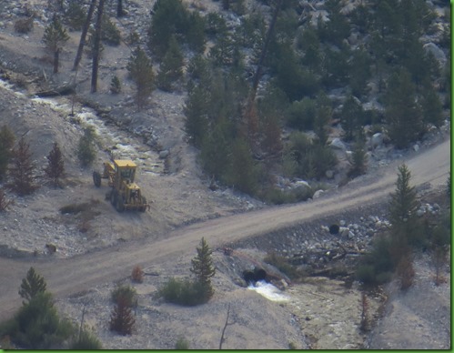
I can also zoom in to look at the road construction still going on in the Alluvial Fan area on the 1920’s Old Fall River Road which remains closed. We hiked up to take a look at all this and the Roaring River a few days ago. As I look at this I’m wondering if this road fix isn’t merely temporary. When will the Roaring River flood again?
We have arrived at the Alpine 11,500 feet. These must be serious bicyclers to bike from Estes Park or even from the Deer Ridge Junction at 8,940 to the top of this road at 12,110 feet. I wonder if Bill Mills would be up for this ride, .
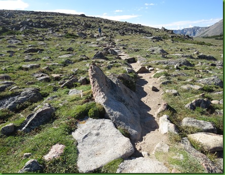
We stop at an unmarked pullover which has an information sign and find out that this is one end of the 3.8 mile Ute Trail. The sign tells us that several cultures have passed this way. Prehistoric people hunted elk, deer, and bighorn sheep in this area. Thousands of years later, Ute and Arapaho Indians walked this ridge in in moccasins while journeying between their summer and winter hunting grounds. Trail Ridge is actually named for the narrow footpaths they left. After I walk a bit of this trail I am amazed that they walked it in moccasins. In some ways I feel like that is what I do, commute between my summer and winter grounds. It’s a life I love and I feel sorrow for them that they have totally lost their nomadic lives.
Although we don’t have time to walk the entire trail today, which I vow to do on our next trip here, we do walk about a little more than half mile before returning to the car. This is one of my favorite parts of this day as you can see by so many photographs.
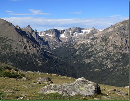
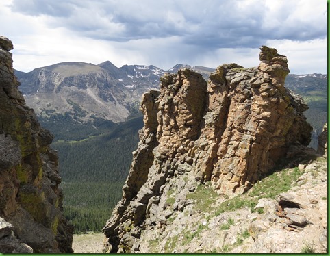
The views as you walk this trial are just wonderful.
The lichens on the rocks bring color to the landscape.
I think we both feel a sense of contemplation as we walk this trail.
It’s deceptively rugged, you have to watch your step. This is a very rocky landscape.
All around is the low growth subtle alpine beauty.
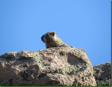
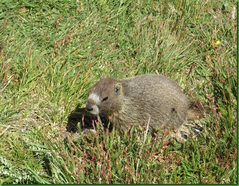
I hear the squeak of the Yellow Bellied Marmot before I see him. He’s another little cutie as he peeks over the rocks to see what’s going on. I actually spot three separate marmots at different points on our hike but have put all the pictures here.
As I walk quietly I try to imagine being in a long line of my people moving from one spot to another through this magnificent scenery. I try to imagine knowing this place well, perhaps seeing it every year of my life.
I could just keep walking and walking, on and on along this trail, but I live in this world now and must go back and continue my own journey.
It’s gotten colder and windier. We put up our hoods. I wonder when the Ute’s would have been walking this trail. I know from my dress up day that the buckskin clothing was very heavy and very warm.
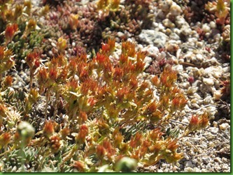
The alpine plants are of course specifically adapted to this climate. They are short and have thick skins. They are often growing under rock ledges, beside rocks or on rocks which heat up with the warmth of the sun. All along the trail we see them tucked in here and there. You have to look closely, walk slowly to appreciate the amazing beauty that is here.
All too soon for me we are again within sight of the road where others have stopped but few are climbing.
Not so at stop #5, where many people are willing to walk the paved trail but most of them do not bother to even read the sign telling them that this short trail crosses the tundra, Russian for “land of no trees”. Here above the treeline winds often exceed 100 mph and temperatures remain below freezing for at least 5 months each year. Thus they don’t read that because of these harsh conditions and short growing season, tundra plant communities require centuries to mature. All along the path there are signs begging them to stay off the tundra, that their footfalls will damage the environment. It could take several hundred years to repair.
The landscape here is similar to those in arctic Alaska, Canada and Siberia where extreme climates also limit plant growth. This is a region of rocks. At one information sign we are shown that these rocks form “patterned ground” that is only found in Artic and Alpine regions where temperatures remain below freezing at least 5 months a year. During the last ice age, freezing and thawing of this tundra topsoil forced these patterns to the surface. The degree of slope determines the rock patterns. Luckily these rock patterns are on Sundance Mountain in the distance so that they cannot be disturbed. I see both polygons and circles on the surface.
At the top of this trail I find another marmot and along with others am worried about this piece of plastic someone has carelessly thrown away or just not noticed when it was dropped. He does finally give up on it after a while. I hope the plastic he has ingested will do him no harm. Our footprints are everywhere and on everything.
One nice thing about others on these short trails along the drive, we can swap pictures. Kind of ironic to have a South Carolina sweatshirt on here on the Arctic tundra!
Further along the drive we stop again at an unmarked pull out and at this point I am seriously furious as I watch these people pay no attention to the signs all along this short trail leading to a fenced in area which they just ignore and climb on up. An entire family.. I just can’t stand it and so I yell in my loudest voice which is VERY loud. “ WHICH PART OF STAY ON THE TRAIL DO YOU NOT UNDERSTAND”. It does me no good at all, they of course have no response. How could they. But it makes me feel that I’ve done something rather than just ignoring their arrogant selfishness. I stand there quite a while with my camera aimed up at them and take pictures. If nothing else perhaps it will give them pause that I might turn them in and they will be more careful at other places. But I suspect, “fat chance”. It is at these times that I most dislike my fellow humans. So here they are, if you know any of these people I hope you will step up and give them a good tongue lashing.
The ending of the path is very clearly marked by these wooden railings. Can you see them walking up to get on top of those stones?
Do they look guilty? They may pause but they don’t stop. They climb all the way to the top.
I calm myself with the amazing beauty along the trail. The flowers that bloom and grow here are incredible.
Our next stop is the Rock Cut where in 1933, the first year The Trail Ridge Road was fully opened, about 290,000 people and 86,000 automobiles entered Rocky Mountain National Park. We are told that Park Managers and road workers took great care to minimize the damage to the landscape such as covering nearby rock outcrops and pillars during blasting to avoid scarring.
Drill, blast, then collect the rubble and carry it off. Workers repeated this for three summers to carve through these gneiss and schist layers and create Rock Cut. The road was constructed from 1929 to 1933. I wonder if it was a WPA project. It opened up the alpine tundra world to motorists. They say popular support for the road far outweighed any controversy over preserving the pristine high country. That’s what they said about the Skyline Drive too but the anger among the people displaced exists generations later. But selfishly, I would never have climbed this high, without this road.
The Tundra Communities Trail is here at Rock Cut and it too is paved and well traveled. There are signs along the trail with quotes from some of my favorite environmental writers. There are also many many signs warning people to stay on the trail.
They are clearly trying to allow old trails to grow over.
Rocky Mountain National Park preserves more than 100 square miles of alpine tundra, the most of any American national park.
At their upper limit, trees may grow only an inch in diameter every one hundred years. I think about that and imagine how old the little trees I have seen at just slightly lower elevations might be. The growing season lasts 6 to 8 weeks a year. On the tundra, snow can fall any day of the year, even today. And night time temperatures often dip below freezing. Each winter hurricane force winds of 100+ mph drive snow across the tundra. Thirty foot drifts form in places.
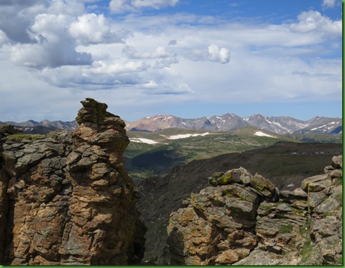
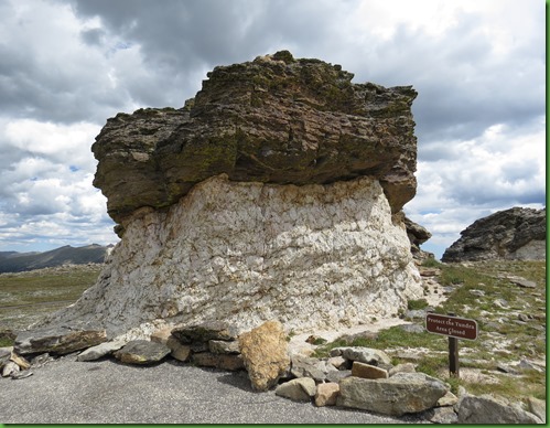
The rocks in these odd formations were made of fire and water. The dark colored schist was originally sand, silt, and clay at the bottom of a long departed sea. Molten magma from deep in the Earth invaded the schist and gradually cooled into the lighter colored granite. The mushroom shapes form when the granite stems erode quicker than the schist caps.
We are headed for the end of the walk, those rocks in the far distance on the left.
It’s getting colder and colder. The wind is picking up. Lots of people are heading back but we proceed. What is up there on the top of the rock to the left?
Great views for sure.
We climb up to the top and find, well I don’t know what it’s called but it was really something.
The wind is blowing so hard by that time my pictures are affected by having to hold on tight to keep from being blown away. But look at this. Wish we had come up just 20 minutes earlier so we could have stayed and looked in more detail at this amazing metal work showing National Parks Distances by Miles.
Gaelyn, that’s Grand Canyon straight out, 400 miles away.
On the side are the mountains, their heights and distances from here.
From up here, you can see the troops heading back down the trail, out of the wind to their cars. Look closely Nancy, Acadia is only 1950 miles from here.
We’re heading back too. Skies are looking ominous . No one is on the trail. I’m able to get great pictures with no one climbing all over anything.
On down the drive we go. We’ve left Rock Cut, nearly the highest point on the drive at 12,110 feet. In this direction everything looks great.
Up ahead a few cars are pulled over. We stop to see what’s up. The pictures speak for themselves. We stay here forever.
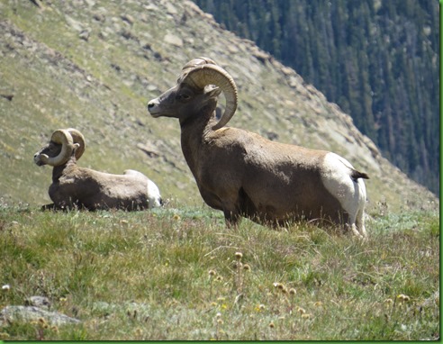
There are 3 bighorn sheep. The one closest one seems to be the head man.
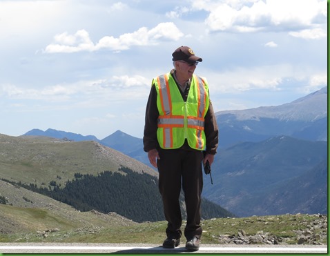
I talk with the volunteer assigned to this spot. Now there’s a job I might not mind having. He tells me that the sheep have been here napping for about 3 hours and he expects they will get up shortly. Like cows they have multiple part stomachs and when they’ve eaten enough, they lay down to digest and when that’s finished they get up and eat some more. Boy don’t we wish we could do that. Eat, nap, eat, nap…..
I’ve always wondered how in the world they sleep with those horns. If you’ve ever picked even one up you know they weigh about 15 pounds each. That would make for a very heavy load on your head all the time. But this sure looks uncomfortable doesn’t it?
Sure enough, they start to get back up. What funny tails.
Notice the ends of their horns where they have rubbed them down on the rocks. I’ve been told they do this so the horns don’t obstruct their vision.
As you can imagine I took a zillion pictures but this seemed like a good one to finish with. Looks pretty majestic in his element doesn’t he? Sometimes I have to pinch myself. I don’t believe I’m hear seeing these amazingly fantastic things.
But the crowds have gotten too big and it’s time for us to pull out. The volunteer is here to protect the sheep and keep the people in line luckily.
Now that there is pretty much no one on the road, we stop at #7 Lava Cliffs. The information here is quite interesting. On the sign we read when we get out of the car is says:
The dark rock of Lava Cliffs is welded tuff. The rock formed as a result of a violent explosion some 28 million years ago. Volcanic vents in the Never Summer Mountains twelve miles to the west became clogged with thick gooey lava. When they erupted, not all of the molten rock flowed as liquid. Some exploded out as a fast-moving avalanche of molten rock and gas. Where the flow stopped it fused itself into a solid mass.
The Guide to Trail Ridge Road which we purchased for $2.00 at the visitor center says: The dark formation is composed of volcanic rock. Between 29 and 24 million years ago, volcanoes erupted repeatedly in the area of today’s Never Summer Mountains, eight miles to the west. Deposits of volcanic debris blanketed the land. , one flow of hot, incandescent ash extended this far, cooling to form the rock we see today. Much later, glacial ice carved into the hillside and exposed the tuff in cross section.
These aren’t exactly the same story are they? In any case, like Mt. St. Helens, these volcanoes had a lot of ash and if you’ve been following along with us this summer, you might remember that the betonite which looked like elephant skin in Theodore Roosevelt National Park was made up of ash from these volcanoes in the Never Summer Mountains.
This is supposed to be a home for the Prairie Falcon but sadly we don’t see them here today.
At the bottom of the snow I see a small lake of melting ice. It’s blue color makes me think this might be one of the glaciers except the information signs don’t mention it.
We do make it to #8 in our guide the Alpine Visitor Center but just before it closes so we’ll have to start here tomorrow on our way to Grand Lake on the west side of the park. I’ll talk about the roof then. It’s been a long day.





















So what was the temperature there? It looks kind of cold, but what an amazing place. I'm sure glad you got the new camera with the big zoom. Your pictures are wonderful.
ReplyDeleteBuried streams? I never heard of such things. We have lots of streams here. I hope none are buried.
This is chalk full of information! What a neat place. I, too, find humans so careless and selfish at time to be entirely insufferable. That walking off the trail would have made me furious too. What ignorance. So self-centered. Anyway, I enjoyed all the pictures and the information in this blog! What amazing views and horns on the sheep. Strong necks they must have! Glad you got to the top to see that map. And, lovely sunrise :)
ReplyDeleteMy absolute favorite are the sunrise pictures as I suddenly realized that is something I don't have! Surprising that as much of an earlybird as I am, we never managed to get any sunrise pictures. Gonna have to ponder that...can't figure out why! Love the sheep pics. They've still been in the lower elevations during early spring visits, but we we read that they soon begin their trek to their summer home in the tundra. How cool to see pics of them after they've arrived. So hope I can get back to RMNP between the time Fall RIver Road reopens and the time it gets closed again!
ReplyDeleteWow, Wow, Wow - such incredible beauty!! Thanks again for sharing all of this lovely scenery and critters and writing!!
ReplyDeleteMaggie
People can be very thoughtless, and it is discouraging.
ReplyDeleteThe bighorn sheep really have character. Beautiful shots of them and the terrain!
Fantastic post. Absolutely loved reading all of it. Pictures were fantastic. Maybe this is another spot we need to visit. Thanks for sharing!
ReplyDeleteBeautiful spot. Too many people for my liking though. Great pics of the bighorn sheep!
ReplyDeletewww.travelwithkevinandruth.com
Oh wow, I sure hope the area will be open when we get there in October.
ReplyDeleteBeautiful- Great pics of the Bighorn.
ReplyDeleteGreat post today. Your photos are outstanding. Love the sheep and the marmots. Also a very interesting story about the buried stream at the ski resort. Where we used to ski at Mt. Hood Meadows in Oregon, there was a beautiful stream among the trees. You could hear it when you skied past it. I'm glad they didn't put it underground.
ReplyDelete30 years ago, I went with friends to Rocky Mountain National Park. In the Never Summer Range it was quite unusual for the tundra to be exposed in the summer, normally it was covered in snow. But that summer, we were able to walk on the trail (it wasn't paved at that time). Even then there were many signs warning about the fragility of the tundra and to keep off. I wonder how often the tundra is exposed in summer now?
I don't think Rocky Mtn Park has ever been on my "must see" list, but after seeing your photos I will have to change my mind., What stunning views!
ReplyDeleteI have never seen an RV pull thru site quite like the one you are in! It's just the side of the road, which would work fine but isn't at all convenient to the fire ring, table, etc. But I guess you really don't need to use those.
Grand Lake is one of my all time favorite places. First time I was there was in the 70s and then twice more ~ the latest was 2012 … each time, growth but a very nice vibe. The wooden sidewalks… and well, the view… the lake ..
ReplyDeleteYou have posted some killer posts but I do believe this post is my favorite. I love the Rockies … the feeling ~ you described it perfectly. Put me right there with you.
and the people who mistreat OUR beautiful lands need to be shamed. Good for you! I would have reported them. I wish the budgets for our Parks would increase … sigh… a Ranger patrolling these areas is definitely in order.
hate loathe and despise that kind of mindset … hate it
outstanding read and pictures… absolutely stellar stuff, Sherry
Oh! What a treasure to see those sheep!! WELL.. I just thought they always had to sleep with heads up, sort of like me in my chair :) THAT looks highly uncomfortable to me, how in the world could anything get any sleep like that? Geez... Isn't that a glorius place? I got to drive up there too, but never did any hiking then, was at my heaviest. must go back now and try, altho had trouble breathing at the altitude.. wonder if I would now? did you? What a great, great post!!!
ReplyDeleteBeautiful post! I would like to have a chair and sit on the side of the road and watch the sheep and mountains all day! Really like this area and hope to go there next time we go to Denver.
ReplyDeleteThose big horn sheep photos are wonderful! We did not see any of them during our stay.
ReplyDeleteWe did the Ute trail last year and loved it! After about a mile on the trail you may see pockets of water in the rocky parts...really neat little ponds. We also saw a large group of female and young elk. Just a wonderful hike!
The brazenness and unthoughtfulness of the general public never ceases to amaze me. We must all take care of our national parks and refuges.
ReplyDeleteWhat a wonderful new environment to explore!!! Nature truly is amazing... the beauty is in the smallest detail:o)) Those Big Horn Sheep certainly weren't small... what a cool sight !! Yep... it appears Acadia is right around the corner from you;o)) Bill said, "He needs just a little more practice;o))" Keep having fun and try not to let the "me world" people ruin your day!!!
ReplyDeletethat is indeed a splendid drive. . .the first time we went up, the snow was over my head at the Alpine Visitor Center. . .didn't last long though. . .2012. . .hottest summer on record in the park (I think!)
ReplyDeleteI too am disgusted by those who don't think the rules apply to them. . .I feel the exact same angst every single time I see a cigarette butt thrown down. . .UGH! How selfish. . .and yesterday, we saw folks feeding the burros here in SD. . .even though the signs plainly state not to. . .it's so bad for the animals, on so many levels.
I am REAL JEALOUS that you got to see the RAMS. . .wow. . .we did see a herd of the sheep. . .but only Ewes and lambs. . .your pics are spectacular. . .thank you!
Where to start. The trails and landscape are as amazing as the 'tourons' are idiots. And this is how frustrated us Rangers get with people who don't pay attention. The sheep are awesome and so glad the volunteer was there to keep the visitors in line. You'd make a great volunteer Ranger. And so you are only 400 miles away, as the raven flies, and not coming to Grand Canyon? :( It's OK. I love your journey.
ReplyDeleteFabulous photos of the bighorn sheep! You're right, those horns weigh a LOT. I wouldn't want to have to wear those things on my head.
ReplyDeleteI would imagine those sheep have very strong neck muscles to easily carry around (not to mention use!) those big horns. I'm a sucker for sheep, glad you got to share them with us!
ReplyDelete