Tuesday Morning August 5, 2014
Robidoux RV Park
Gering, Nebraska
Monday afternoon we drove 80 miles south through Nebraska to the Robidoux RV Park about a mile from Scott’s Bluff National Monument. Those are definitely my kind of driving days. After an easy morning at Fort Robinson, we left about 2:00 and arrived early enough for a leisurely evening at our new address. The early evening thundershowers follow us here.
Robidoux RV Park is a city of Gering facility and it is an excellent park. We have a FHU site with views of Scott’s Bluff out our window. We are less than three miles from the Scott’s Bluff National Monument.
The Monument was created to protect the area around the bluff and the section of the Oregon Trail that goes around and through it. Between 1841 and 1869 more than 250,000 men, women, and children passed within sight of these bluffs in a massive trek west. They of course were the cause of most of the Indian Wars as in many cases they were not just passing through.
The pioneers took many routes to the west but most travelled the central route up the Platte River. This became the famous Oregon Trail. It was also the route of the Pony Express in its 10 day rides from St. Louis Missouri to California in 1860 and 1861. I was very surprised to find that the Pony Express only existed for barely 2 years. It is the stuff of legend and I always thought it went on for years. The other group which went through these bluffs were the Mormons whose trail was on the other side of the river from the Oregon and Pony Express trails. The map in the visitor center show that the Oregon Trail split off into two trails after it passed Scott’s Bluff and Independence Rock. The Oregon Trail went North to Oregon City. The California trail went south to Sutter’s Fort. I guess they were the Gold Gang. The maps in the visitor center were too large and detailed to use here so I borrowed one off the internet which calls the Mormon Trial the Mormon Trek.
The Mormon Trail began in Nauvoo Illinois and followed the North Side of the Platte River to Salt Lake City. The Oregon Trail began in St. Louis Missouri and followed the south side of the Platte to Oregon City. The Pony express followed the California Trial from Independence to California.
The first transcontinental telegraph line crossed Scott’s Bluff through Mitchell Pass. It was completed in October of 1861 and brought the end of the Pony Express To the Plains Indians the “singing wires” meant troops and death. They frequently burned down the poles.
The railroad replaced both the prairie schooner wagons and the stage coach and by 1869 the Oregon Trail passed into history.
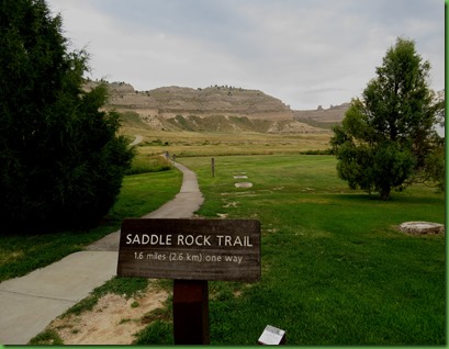
We had come over yesterday late afternoon to the Visitor Center to find out about the hiking and biking possibilities. We watched their excellent short film on the 4 groups that used the trails here. We found out that they have a drive to the top and 1.6 mile paved trail that ascends 500 feet to the top. They will provide a shuttle if you only want to do one way such as drive up and hike down. There is also a short trail actually along a piece of the original Oregon Trail and a short bike trail that goes along the bottom of the bluffs.
This morning we are hiking up to the top of the bluff. We get a later start than I like but thank goodness it is cloudy and overcast so the blazing sun doesn’t make it an uncomfortable climb. It does make it hard on the pictures though. The views are very restricted by the haze
The trail being paved is not the hiking experience I usually like and I am wishing it was just a natural dirt trail. We find that many locals use the paved trail as an exercise trail. There were even several people running up and down. Now that amazed me because this is a pretty steep hike.
The paving is necessary because of the sandstone. The bluff is eroding away as we see when we get to the top. So paving the trail keeps the erosion from so many feet under control.
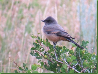
Along the way in the more flat prairie section we saw the Prairie Blazing Star wildflower and what I think was the Says Phoebe
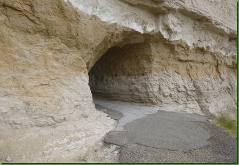
This is where are going. If you see the dark spot on the base of the rock we’re headed to, that is a tunnel through the rock. The first part of the hike is on this side, then you walk through the tunnel and come out on the other side to continue the hike up.
David is just starting the upward climb. Notice the dome formation on the left. The Visitors center is still visible behind him.
Now notice the dome and the visitor center is no where to be seen. He’s coming around the side of the mountain and he’ll switch back into notch between the two which you see next.
The trail leads into the notch and the switches back to come up the side of the next rock and on to the tunnel
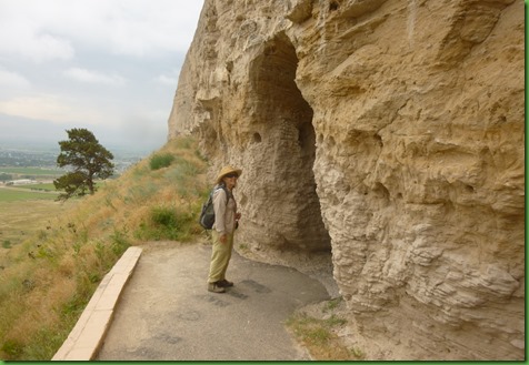
Dueling cameras. David takes me standing at the tunnel end taking him just coming into the tunnel.
I’ve zoomed up to see a little of the landscape behind him. The length of the tunnel is better represented in his picture above.
And here’s where we are going. The town of Scottsbluff is built near up to the base of the bluffs. We can hear the traffic noise now and those obnoxious machines with the back up beeps. We could hear none of this on the other side of the bluff.
We’re now on the other side still climbing up.
Isn’t life amazing the way it makes its way despite the circumstances.
At this point, my second camera battery dies. Apparently I did not charge either one of them last night. Oh well, at least David has a camera. The pictures from here on are from his camera.
Remember the people I told you were actually running up this 500’ nearly straight up 1.6 miles?
When we reach the top, this is what greets us. Apparently a dancer is having some pictures taken probably for her portfolio. She looks ethereal there on the rocks against the sky.
Not sure why she’d want the city of Scottsbluff rather than the beautiful open spaces visible from the south overlook as her background.
We walk all around the top of Scott’s Bluff named for a man whom legend says was abandoned on the Oregon Trail by his friends (hmmmm, friends) and crawled to the bluff and died at its base. Fact or tall tale? I’m not sure.
Because of the overcast skies the views are just not what they would be on a clear day. I’ll be you could see forever <grin>.
After checking out the North face views we walk across the parking lot of the road coming up for those who don’t want to or can’t hike up.
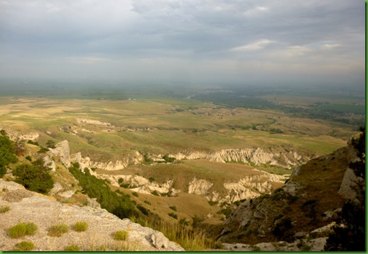
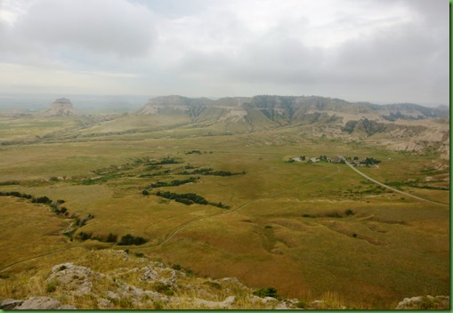
The views of the Wildcat Hills are a bit better on the south side. If you look closely you can see the trail we came up on going back to the visitors center from the lower left of the picture. The bigger “trail” on the right is actually the road to the top of the bluff.
Boy how I wish it were a clear day. This would be even more spectacular. Like too many places that are stops between here and there, this one deserves at least another day.
While at the top on the south side from information signs we learn that Scott’s bluff is an outlier formation of the Wild Cat Hills. Twenty million years ago the surface of the plains was as high as Scott’s Bluff. About 5 million years ago, the Platte River and its tributaries began to erode the high plains. Bit by bit, water carried away the soil and rock, creating canyons that grew wider and wider. Today only the Wildcat Hills, Scotts Bluff, and other erosion resistant remnants of the high plains remain.
We also learn that hard pipe like concretions (remember them from Theodore Roosevelt National Park?) along the Saddle Rock Trail help to hold Scotts Bluff together. As we start back down the trail we recognize them. We noticed these on the way up didn’t realize they were concretions. Many of them have the ends broken off probably from falling rock.
There is a very distinct while line between some of the layers of rock. This is a white ash layer which consists of tiny, wind born glass shards erupted from western volcanos at the time of the uplift of the Rocky Mountains.
The path along the edge is narrow but stable because of the paving. Must have been some serious work to get asphalt here.
That’s our trail leading down. The skies are clearing slightly. You can see my favorite formation known as dome rock there in the distance left of center.
One of the few concretions this large which did not have its smooth rounded end broken off.
Back through the tunnel
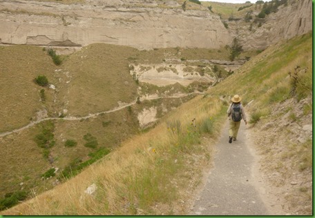
And on down the other side.
The heat is starting as we get back to the visitor center. We’ve seen the film but we now look over the rest of the displays and this is where we learn all of the information about the 4 trails, the Pony Express and the Telegraph that I explained at the beginning of this post.
It’s time to head for home to fiddle away the heat of the day. We hope to come back and drive up to the top just to see the drive and go through the THREE tunnels on the road. We also hope to hike the 1 mile of the original Oregon Trail. But that’s for another post.













I liked Scott's Bluff! It was an interesting place that I don't think I was really aware of.
ReplyDeleteFantastic place! We really enjoyed following the Oregon Trail.
ReplyDeleteWhew! You wore me out with that climb up and back down. Beautiful scenery but really kind of stark. I always feel sorry for the pioneer ladies who had no idea what they were getting themselves into.
ReplyDeleteI had no idea there was so much to do and see in the area. It is amazing what you find when you really look and you seem to do a great job of finding things that other people just seem to pass by .
ReplyDeleteGreat job you did with words and pictures. That is a beautiful park I have never been to. That paved path is amazing also and I can see myself enjoying the walk. Thanks for showing it to us. I also thought the Pony Express was a long term business, from the movies anyway.
ReplyDeleteDo you suppose that the young men were running because they did not want to miss the dancer?
ReplyDeleteI would imagine tht the city on the other side of the tunnel would be a letdown. Thanks for the armchair tour.
Interesting place -just imagine all the people that passed that way going west.
ReplyDeleteDuring our first trip around the sun back in 1999, we had the opportunity to visit The National Oregon Trail Interpretive Center outside Baker City, Oregon. It was very impressive and moving. I know the one thought that I came away with was, "How terrible the lives of the people who made the trek along the trail must have been to be willing to face so many hardships and challenges!!"
ReplyDeleteEven with the hazy weather, your hike is great and the views from the bluffs are wonderful:o))
We also traveled the Oregon Trail and was amazed what the people went through. We spent over a month in Nebraska last summer and can't wait to return to all the places and things we missed. The Pony Express is further east and the St. Joseph, MO exhibit is worth a stop.
ReplyDeleteWhen people plan their travels, there are usually well known and exciting places on their list. Scotts Bluff Nebraska is probably not one of them :) You've found another gem and another place we'll not bypass the next time through.
ReplyDeleteI'm surprised about the Pony Express. I always thought it was around for years and years!
Morning, Sherry had to come over to see where your ducks and Pooh are … that is Pooh, right? looks like Pooh … and here you are! the Oregon Trail … oh my …
ReplyDeleteThat black-eyed Susan growing right along minding its own little business amongst all those big ol rocks… just love it… nature is something else… look at that little girl… love it
The dancer ~ what a sight~ I wanna do that… but I couldn't get up there to do that even if I did have such an outfit … dagnabbit … I want to do that ~ leave off the dang cookies PIE ~ sigh another beautiful hike and day in the life of … ;)
I know exactly how you feel about a paved trail! Experienced that in Zion at Angel's Landing...but I do understand why they had to do it due to the volume of people and erosion.
ReplyDeleteVery pretty landscape you hiked through!
I would be one of those people that would have to take the road to the top. I'm glad that's an option.
ReplyDeleteI love the wild grasses - a slight breeze and the whole area looks alive. I'm thinking that Scott got the last laugh.....he is known by name many years after his death, and his story "smacks" his companions every time it's read. That's some really long-term karma :-). The single flower and the single dancer - both appreciating the starkness of the location, and making it more lovely by their presence. Thanks for sharing another great hike.
ReplyDeleteoh wow. . .what a beautiful view your duckies have. . .and the archway view was just spectacular.
ReplyDeleteI just keep adding to our list of places to see. . .not sure we'll ever get them done.
I've bookmarked this blog post for our adventures along the Oregon Trail. . .wow. . .really different than all the woods you just left in Minneso-tah. . .right?
I did not expect the dancer! Interesting sighting ;) I do wish the sky hadn't been so hazy, but nonetheless, pretty trail. I like the concretions color. Great virtual tour. That must have taken quite some effort to build that trail, especially the tunnel. Dad looks like he belongs there in that outfit of his...love the through the tunnel photo :) I think running up that trail would be really hard on your knees! Great for the thighs and gluts I suppose.
ReplyDeleteNice to get a virtual trip of places we've yet to visit. Thanks for taking us along. I like that trail ... plenty of entertainment (views) along the way.
ReplyDeleteI really enjoyed Scott's Bluff. I was there mainly for information and photos to take back to my classroom for when we "traveled" the Oregon Trail as a class project. I loved that some of the actual track is still there. Of course, the wagon was picture worthy, too. It was nice that they were having a living history situation around the wagon.
ReplyDeleteOooh, love that trail! What a view! Love seeing geology at its finest.
ReplyDeleteWhat a neat place to visit. We followed part of the Pony Express Trail through Nebraska and enjoyed visiting a museum somewhere along the way. That's where we learned about the brief time period it existed and also how young the riders were. We are so envious you are in RMNP. It's our favorite place among our travel memories and one we keep returning to on our way to/from other places. Can't wait to read what hikes you've chosen to do while there.
ReplyDeleteThe view on your hike was gorgeous, even with the haze! The Oregon Trail is on our list...
ReplyDeleteWhat an interesting hike, today! Felt like I was hiking with you right from the comfort of my sofa! I haven't spent much time in the prairie but it didn't look as interesting as you made it in your writing. When I saw your title, I thought, "Oh, I have to tell Sherry about Choteau. Then, I realized it is Vale, OR" I'm a day late and a dollar short as usual. On your next trip you might be interested in the story of the murals depicting the Oregon Trail. http://tinyurl.com/lo7yxz3 Rich and I spent a day following a map we got from one of the shop owners. Very interesting.
ReplyDeleteI was also surprised that the Pony Express was so short lived. On my trip in 2010 I stopped in the town of St. Joseph, Missouri where it originated.
Imagine how much work went in to pave the trail, but to protect the environment was worth it. Of course, if it had been done by the CCC, it would have been paved with hand fitted rocks... :c)
ReplyDeleteNot to be a buzzkill, but the dancer was probably placed where she was due to lighting concerns, right? And most likely the "view" behind her will not show up in the photos at all. Being so logical can suck the fun out things sometimes, but at least I'm an adventurer and an optimist! Scott's Bluff is actually on our list...for when we might be within striking distance. After decades of living in a "plains" state not many prairie state destinations hold much attraction for us. Perhaps after a few years of wandering mountains we'll long for the prairies...
ReplyDeleteI like the landscape on the VC side of the tunnel best, and those great rock layers. Yet another place to add to my growing list from your journey west.
ReplyDeleteBeautiful! We will be there for sure.
ReplyDeleteThe weather here in the UP is already fall like, cool days and cold nights.