Wednesday July 15 and Thursday July 16, 2015 Previous Post:
Big Meadows Campground Rainy Day and Dark Hollow
Shenandoah National Park
WEDNESDAY
David leaves early this morning for his appointment at the Cancer Center in Charlottesville, 45 miles from here. He has said perhaps he’ll spend the night there. He’ll let me know later. We agree on a time for me to be at the lodge so he can reach me. Having no cell or internet without going up to the lodge is definitely inconvenient.
Those of you who follow along have been on several Big Meadow walks with me and seen how spectacular it is. The park has Meadow Walks with the Rangers several days a week and there is one this morning at 10am. The weather looks iffy but I want to see what else there is to learn about this ecosystem so I walk down the really lovely trail from the campground to the Visitor’s Center and join the group.
We begin just behind the Visitor Center overlooking the meadow and learn some history about it. Archeologists believe early humans hunted the area during a period when the climate was colder and Big Meadows may have had a more alpinelike environment. Native Americans used the meadow and may have used fire to create it in order to attract game. Spear points and tools have been found. In the late 18th Century homesteaders moved into the area taking advantage of the rare, high altitude meadow. They farmed and grazed their livestock here. He tells us that the meadow was once nearly 1500 acres in size. Now it is about 135 kept in meadow by the park service mowing 1/3 of it every year. Otherwise locust trees would move in and shortly turn it back to forest other than the very wet spots.
He takes us down the Rapidan Fire Road that goes through the meadow and is the main way people walk into it. Those of us who want to get up close and person then take animal trails right into the meadow. Today we take a trail up on a slight rise to the west of the road. I’ve never been up here before so already I’m glad I came on the hike.
He points out that even in this cloud cover we can see the mountain of West Virginia from up here.
He also tells us that just beyond the meadow in the areas that have been allowed to turn back to forest, you can still find the foundations and root cellars of the homes of the mountain people who lived here. Hold that thought for later.
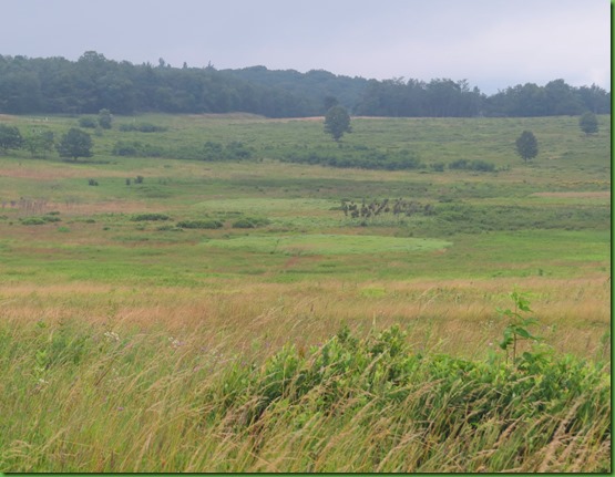
He also shows us that the meadow is a bowl. There are low spots that are always wet. You can see them by the differing colors and types of plants growing there.
Then we walk down off the little knoll and begin walking through the meadow. As usual I am captivated by its beauty.
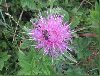
One brilliant thistle in a sea of hayseed fern.
But the star of the meadow this morning is the newly blooming Turk’s Cap Lilly.
Few things look happier than daisies in a meadow.
Another beauty I have not seen before is this exquisite butterfly bush. Just look at those colors.
We come as far as the ranger wants to go and when they turn to head back I wave and say I’m staying a while. I’ve been watching another group on the far side of the meadow around some rock out croppings I haven’t been to before. No wonder no one tried to farm this area but rather used it mostly for grazing. I walk through the meadow on a very faint path over to the rocks.
The group has moved beyond the rocks into the forest just beyond the edge of the meadow. Remember that thought about the homes of the people who lived in Big Meadow before the park? .
I find the group looking at this sunken pile of rocks and discussing the Weakley Family who lived in this area for generations, including during the time the CCC Camp was here in the meadow, before they were forced off their land. This was the home of Ben and Emma Weakley.
Turns out this is a special ranger tour for teachers working on curriculum for teaching a sense of place. I am so sorry I have wasn’t able to catch up with them sooner since this is the last stop on a two hour private tour that is not given to the public. This ranger has been at Shenandoah for a long time. She is a permanent ranger not seasonal. She has just finished over 10 years of research on those who have used and inhabited Big Meadow over time. I can’t wait to read the book she has started writing. She tells me not to hold my breath.
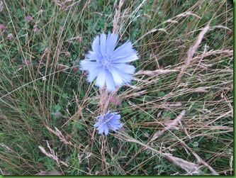
The tour is over and the ranger heads the group back through the meadow for lunch. I spy some chicory as we walk. Another flower I have not seen in the meadow before.
Along the way she stops at the spot where the CCC camp was and points out the markers for the buildings which were removed. There are information signs around in the grassy meadow now. I’m not quite as upset about the park removing these buildings as I am about the removal of all of the houses of those who used to live here. Keeping such a large compound here would really change the meadow. But perhaps one of the other 6 camps in this park. It would be nice to be able to go to one of the many many parks where the CCC did so much work and see the original buildings they they built for themselves.
It’s nearly noon now and though I’d like to stay here and look around the CCC Camp area, I don’t want to miss what other information she might give on the walk back. Plus it’s time for some lunch. I’ll come back another day. Maybe I can find another “special tour” to crash.
I take the same lovely walk back to the campground. When I get to the campground walk in sites, I find a very interesting tent set up. I’ve never seen this connected set of igloo tents. Looks like it would be a bit tricky to set up.
THURSDAY
David decided to stay over night and will be back this afternoon. We arranged for him to pick me up at Botten Gap at 3:00 so that I can walk another section of the AT. I set out headed South from Big Meadows this time to hike the trail 5 1/2 miles to Booten Gap
From the campsite I walk up the hill, past the showers, to the Picnic Area parking lot and the trail that leads up to the lodge. This is the same route I take to walk to the lodge for the so-so internet connection I use to post these blogs. It’s an all up hill pretty steep climb. Or you can drive of course. Big Meadows lodge internet is in name only as far as I can tell. It is seldom working and constantly has to be rebooted. If you come here, don’t expect to rely on it. Bring your own hotspot and cross your fingers for a strong enough Verizon signal.
Today I take the trail to the lodge only a few feet and then turn right on the spur that will lead me to the same spot from which I started my northern walk a few days ago.
It’s a pretty rocky downhill.
At the AT marker I turn left and I’m on my way
The AT skirts the campground and I pretty much have to walk all the way around the Big Meadows Complex to head South. At one point I have walked by the lodge and am down below the motel room type accommodations of the Big Meadows Lodge. They have cabins, lodge rooms and this separate motel like building of which I can only see the supper floor and roof..
I see others on the trail coming toward me. They see me. They don’t mind me but we have a bit of trouble passing each other.
They obviously aren’t afraid and as I stand there, they continue to work their way toward me munching as they go until they are less than 6’ away. The male goes up the hill and makes a wide circle. The female wanders back and forth as though she can’t make up her mind what to do. I step off the trail and behind a tree so she will get up the courage to walk on past and finally she does.
This section of the trail is lovely with views to the west at points and the usual interesting things at my feet and along the edges.
I come out of the woods surprised to see the large Tanner’s Ridge Cemetery on my right. I’d forgotten that the trail goes right by it. It’s particularly special today since it is the burial place of the Weakleys including Emma and Ben whose home site I saw this morning.
The cemetery is very well maintained as is the Tanner’s Ridge Road beside it.
Ben’s dates are much more worn than Emma’s. Ben was born in 1847 and died in 1926 so he never knew about the park. Emma was born in 1850 and died in 1933 so she also was not forced to leave her home as the work on the Skyline Drive had just begun. Although I learned this morning that she did live long enough to see the CCC camp built virtually in her front yard.
There are also caves in this cemetery. I particularly like the bench headstone.
The only visitors other than myself when I first arrive are these.
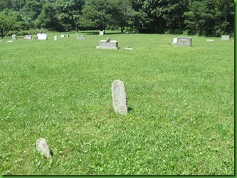
As in the Cave cemetery I have been to several times, there are simple unmarked field stones marking graves here as well.
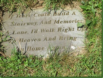
And some that are hand inscribed and suffering from wear.
I cross Tanner’s Ridge Road to continue on my hike
Looking at this photograph you may wonder what in the world did I see. Well I put this in because it is a picture of the tree where I saw a black bear scurrying down it and heading off into the woods away from me. It’s the larger one there in the middle. He was too fast for my camera but I was very excited to see him or her and glad s/he wasn’t headed toward the trail.
This AT hiker passed me going North. He’s behind the “Harper’s Ferry by July 4th if you want to make Katahdin” advice. But when I asked how far he was going, he said “Maine”.
Turks Cap Lily is in bloom here and being visited by a Swallowtail.
The AT crosses through the Millam Gap Trail parking area and as I leave it, I see these two hikers also headed north.
Turns out they are section hiking the AT through the park in two pieces. They started at “the bottom”, at Rockfish Gap Mile Marker 105 and are headed for Big Meadows where I’ve just come from at Mile Marker 51.
As we bid good-bye and they head on their way I call back to tell them to be sure to have a Blackberry Milkshake when they get there.
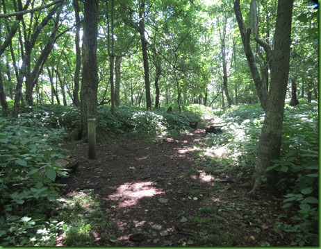
This section of the trail is fairly level which is very nice. I’ll bet the thru hikers love it.
I have partial views to the west and a close up of some sort of fuzzy interesting Skipper on the ferns.
I spy the berries of the False Solomon’s Seal on the end of its stalk and of course get a tree hug along the way.
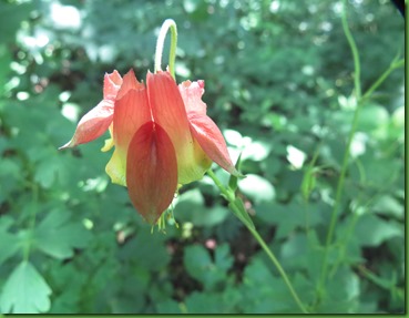
Nearing the end of the hike, I am surprised to find the wild columbine still in bloom in mid July although I know they have a much longer blooming period at this elevation than down in the foot hills.
I also find a short spur to a full view to the west of the Massanutten and Allegany Mountains.
That’s about when I realize how early I am. I’ve told David to come at 3:30 but the trail has turned out to more level and easier than I thought and I’m now less than 1/2 mile away and nearly an hour and a half early. I sure wish there were cell service. I would just walk on to the next Millam Gap and have him pick me up there. Although I might be able to get a signal at the overlook, David won’t be able to get one at the Campground or on the Drive.
In no time I reach the Conway River Fire Road which has a small parking area before the chain across it. There is one red car there but of course it isn’t Ruby. I’m 76 minutes early so I sit down in the shade of a tree on the fire road looking up at the parking lot to wait.
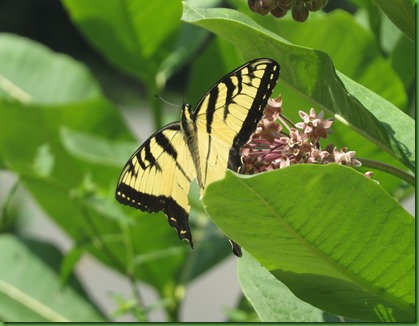
After a while I’m pretty tired of sitting so I walk up the fire road to the Drive so David won’t miss this unmarked parking area. The CCC has generously provided a stone wall for me as I watch the Swallowtails enjoy the milkweed blossoms.
My shuttle is right on time and back we go up the lovely Skyline Drive. If you have to be stuck for the summer, this is a fine place to be. You can bet I’ll do better at my time estimate next time.

















What a lucky day to be able to hike with two different ranger led walks. You sure know how to find them :)
ReplyDeleteSad to think of all the families forced off their lands, must have been heartbreaking for them to leave such a beautiful place.
ReplyDeleteI have to give the NPS credit for taking such wonderful care of the park, using good management to make the trails accessible for all to enjoy. After doing volunteer work at COE parks, I know how much work is required to keep the place open and in good repair, and the NPS does it on such a miniscule budget.
You go girl! I love that dogs are allowed on the trails. We will surely look for a job in that area one summer!
ReplyDeleteOkay Sherry, your numbers just don't compute. If Emma lived 24 years longer than Ben, some of the dates must be wrong. Being a former math teacher, numbers just jump out at me, I guess. ;)
ReplyDeleteI always get a thrill when I find Turk's Cap.
As always you are so right. No idea what I was thinking about, probably how long it takes to post anything up here IF you can even get it to do it. Emma lived 7 years after Ben and no doubt knew she would have to leave her home soon. I do think she was still living there when she died at age 83. Pretty sure I got that number right. :-) I wish you could proofread these things for me BEFORE I post them. Thanks for your help.
DeleteBeautiful flowers, great post also.
ReplyDeleteA great couple of hikes, I am guessing no problem in hitting the 10K mark.
ReplyDeleteIncredible places to hike through!
ReplyDeleteDogs are supposed to be leashed throughout the entire SNP. It is difficult to keep a dog on a leash for every mile, every day. Most AT thru-hikers are a little vague about their plans and timeline when talking to strangers. I'm so glad I hiked when I did, 1997, as there were a lot fewer hikers on the trail and less paranoia, especially for women. Looking back, I was probably too trusting and fortunately never ran into trouble.
ReplyDeleteI thought a Turk's Cap was a Tiger Lily. Beautiful with the butterfly. Wonder if that hiker will make it to Maine given where he is on the trail. Nice that you found the two ranger walks-nice place to wait and nice that your 'taxi' was on time :)
ReplyDeletePretty sure they are the same lily with different local names. Up on the mountain and in most wildflower books it's called the Turk's Cap. But Mrs. Morris, Blacky Cow's mom, gave me the ones in the pantry garden and she called them the tiger lily so I did too. :-) Happy memories.
DeleteLove that you crashed the teachers private tour:) We saw one of those three tent communities. A very cool idea for families. How neat was that to be up close and personal with the two deer:) So cute! Love that wild columbine!
ReplyDeleteA wonderful hike. The flowers always makes it a wonderful day for me. Hope that every thing went well add t the doctors visit.
ReplyDeleteI love having the time somewhere to learn it's history - the rangers must have been very engaging for you to remember so much of what they shared - and I'm glad you shared it here :-) The deer and the flowers and fungi are so lovely, and of course I love the doggy-hiker. Two things really jump out at me though. The fact that the meadow is being protected by humans against being taken over by trees, and even more so is that somewhere children are being taught a curriculum on a sense of place. While the first is just interesting, the latter is amazing and wonderful to me :-)))))
ReplyDeleteYour wildflower photos are gorgeous and the colors are so vibrant! It's great that you've been able to hike trails more than once -- to go on tours with rangers to learn more in-depth information, and to also hike at your own pace and with your own thoughts. I wish we had the time everywhere we go to do both.
ReplyDeleteI so agree with Laurel... while I know this is not the way you planned to spend your summer, it certainly has given you a wonderful opportunity to really get to KNOW something about the area you are visiting. We are also learning so much through your eyes and it really is a wonderful place!!!
ReplyDeleteWow!!! So many brilliant colors spot the meadows. Ours are in bloom too and I really need to get out there. How fortunate to get (almost) two Ranger tours. I can't imagine any Ranger turning you away. Such lovely companions to share the trail. The perfect way to see a bear, going away from you. The lily and swallowtail shots are exquisite! In fact all these photos are superb. Love a forest that offers a view.
ReplyDeleteBeautiful captures of those vibrant wildflowers! All your photos are fabulous! And the deer family is so cute and is probably asking you what you are doing there interrupting their lunch :)
ReplyDeleteI think you are really getting to know more of the Shenandoah Mountains.