Tuesday August 14, 2018 Most Recent Posts:
Great Smoky Mountains National Park Thanks for Sticking With Me-Mouse Creek Falls and Midnight Hole
Tennessee Hiking a Trail Under Construction – Rainbow Falls

Out early again to drive through the park. I go along the river and up and through the Newfound Gap, it’s the only road that cuts from one side of the park to the other. As you can see it’s a curvy route. But the views of the rolling mountains are stunning!


The Bradley Fork Trail which goes to Chasteen Creek Trail begins from the Smokemont Campground just off of Newfound Gap Road and a few miles north of the Oconaluftee Visitor Center and Cherokee North Carolina. I drive all the way to the farthest parking lot of the campground to find it.
The trail is another old road bed for a lumber company. This time for the base camp of Champion Fiber Company whose company town of Smokemont, with homes, a mill, a commissary, a hotel, a school and a hotel, located was where the campground is today. What a shame that not a trace of it is left.
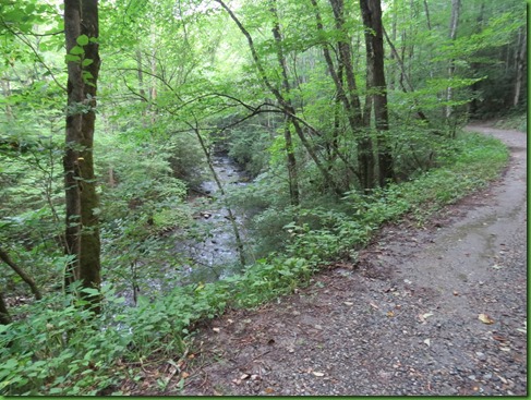

The climbing is gentle and this would be a nice trail for young hikers.

At a little over a mile, the Bradley Fork Trail goes left and I take the right fork onto the Chasteen Creek Trail.

Shortly a spur trail on the right pulls me in and I find several campsites along what I suppose is a tributary. I later learn this is back country campsite #50. I also learn that Bradley Fork and Chasteen Creek Trails are ablaze with wildflowers in the spring. I’d really like to come back and see that. But to get up early enough to avoid the crowds would mean much colder morning temperatures.
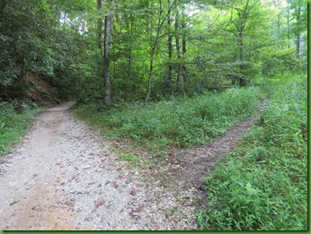


After about another half a mile there is yet again a split in the trail and and I see hitching ropes and platform. My information tells me to go this way so I do.

I’ve never seen a mounting platform this far back a trail. I assume the stables, which rent horses to those who may or may not be able to get back on their horses without it, were permitted to put it here. Well trained horses obviously. No hitching post, just ropes.

Just beyond this area a small trail goes to the right and this leads to the cascades. Straight ahead leads to a drop off into the creek.


Chastine Creek Cascades from the trail. It’s roughly 30 feet tall. I head down to the left to take a closer look.

I take an over view picture and climb down closer.

I have not seen one person on the trail this morning and I spend more than an hour here without seeing anyone.
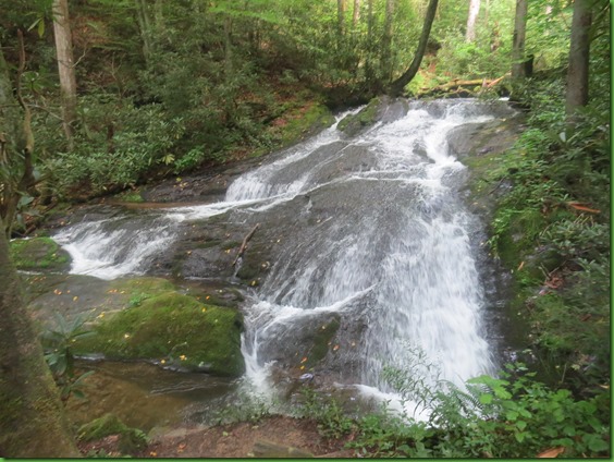
The view down stream from the cascade. Sitting by the cascade is peaceful and soothing. What a calming spot, out of the world and what is seeming like chaos.
Here’s a video of Chasteen Creek Falls.

Still no one has come and I decide to see if I can hike any further along this trail and perhaps see the creek as it flows to the falls. The first obstacle doesn’t look too bad.

On the other side of obstacle #1 is obstacle #2. Clearly this is not a maintained trail though it looks well used.

I see that I could manage this obstacle too but the trail appears to vere away from the falls and I have a couple of other things I want to do today on this side of the park. So

I do get a picture of the creek above the falls and wish there was a way to walk along it at the point. I can just see it coming to the point where it falls down but no further back.

My last picture is a side shot as I head back to the place where I was sitting.

What a beautiful path and no one but me has been on it so far.

I spot what I think is a yellow fringed orchid. I’ve never seen one before and it really does look more orange to me. It’s quite striking.


I’m more than half way back when I come upon the first people I’ve seen today and they are on horseback.

Just past this spot is a sign for the stables that points to the left. I walk up a ways to see where the horses have come from.

I get distracted by this one log footbridge leading off the horse trail. It doesn’t seem to go anywhere. But again, I can’t stay and just poke around, At this point it’s past 10:30.

When I rejoin the main trail to the parking area, I am behind a couple that I haven’t seen before. They’ve clearly been backpacking so they must have been behind me as I came down the trail.

We chat on the way back and I learn that they have just graduated from college and are on their way to Baja California for the winter in their new to them 1989 Chevy Van for which they paid $5000. It has a sink and stove which both work.
They are stopping all along the way to back pack in beautiful places. What a grand adventure for these young 20 somethings with their brand new backpacks and hiking boots.


I chatted mostly with Becka while Tyler was working on something in the van. He apparently is mechanical and she’s extremely glad. We part company and I drive around the Smokemont Campgrounds checking out sites for a futre visit. I do see them on their way as I’m leaving. Hope they have safe and wonderful travels.

My second stop for the day is going to be Mingo Falls which is on the Cherokee Indian Reservation outside of Cherokee North Carolina. The Cherokee refer to the reservation as the Qualla Boundary.
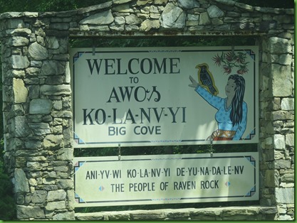
I stop as I leave the park to get this picture of the welcome sign to the Reservation. It’s quite impressive.

Seal of the Eastern Band of the Cherokee Nation. I assume everyone knows the story of Andrew Jackson’s forced march of the Cherokee referred to as the Trail of Tears. A black mark on our nation that I don’t believe we have ever apologized for. For both the march and this , I am ashamed. The Western Band of Cherokee are in Oklahoma and the Eastern Band are made up of decendents of those 800 Cherokee who managed to remain as 15000 were forced on the march.

This is the side I will see when I leave to return home. I’m trying to get a picture of the flame above the seal. The light is better for that on this side.


I’m headed for Mingo Falls which is located outside of the city on the reservation. Another sign welcomes me. All signs are in English and Cherokee, a language still written and spoken by the people and taught in their schools.


Somehow I find steps more tiring then just hiking up a steep trail but I understand that with all the visitors and the steepness of the slope, a trail would create terrible erosion.

When I arrive at the top, the trail is rocky and muddy around to the falls.

As at Deep Creek’s Juney Whank falls the Cherokee have built a viewing platform at a break in the falls the base of the main falls as the water flows under the platform and on down in other tumbling cascades.

At 120 feet tall, Mingo Falls is hands down the tallest and most spectacular of the falls I’ve seen on my stay in the Smokies.

My research tells me that Mingo means Big Bear and that falls are often locally called Big Bear Falls. It is described as a horse tail plunge down the long rocy slide. It’s glorious to behold.
Here are closer pictures in sections because of its height.


Mingo Creek drops dramatically into the Raven Fork Gorge over two waterfalls in succession. The Upper Falls is just above this main falls but apparently unknown to the non researching public and requires some difficult and potentially slipperly climbing though I did find a web site with detailed directions for how to get there.
The main falls lies just a little way above Mingo Creek’s mouth in the Raven Fork of the Oconaluftee River.

Here’s a video of this spectacular natural beauty. You can hear people in the background. This is rightfully a very popular place that I’ll come to first next time. Many thanks to the Cherokee Nation for making it free and open to the public to enjoy.

On my way back to the city of Cherokee I stop in front of the Cherokee Central School with its artistic paint.


I’m a bit surprised the street signs are not in Cherokee with English sub-titles.

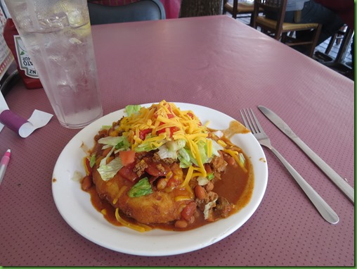
My next stop is at Paul’s Restaurant. Doesn’t sound native but they make a fry bread taco and I’ve been wanting one for a long time. The main streets of Cherokee are, of course, a tourist town. I wish I’d been able to determine where the locals go for lunch.

I took a seat on the porch and in no time was eating my artery clogging lunch.

Yes, it was as delicious and filling as it looks. I had every intention of taking half of it with me for dinner or lunch tomorrow. My mind did that is, my taste buds had other ideas. Won’t need to worry about eating any dinner.
On my way to Mingo Falls, I went past the Oconaluftee Visitor Center and the large grazing area where elk are often seen. Bill and Nancy saw them on their visit to the VC. Supposedly they are quite common. No elk for me
After leaving Cherokee and entering the park I went by the Visitor Center. No elk then either. I’ve been shut out. Maybe I should have driven down Elk Crossing Lane back at the school.

On my way back through the Newfound Gap I stop at an overlook and am reminded that the mountain in front ofme is Clingman’s Dome, at 6643 feet the highest in the Smoky Mountains, the highest in Tennessee and the 3rd highest in the Eastern United States. I also learned that the tallest 6 peaks in the Eastern US are all in North Carolina and Tennessee. I was very surprised to learn that New Hampshire’s famous Mt. Washington of wild weather fame is the 17th tallest in the East.

 A second overlook sign tells me about the Old Growth Forest that remains in the park. Because of massive logging at the turn of the 20th century, the mountains are ancient but much of the forest is young. Still there are some old growth trees and they aren’t always the largest trees. Where conditions are harsh, like on ridge tops, a 500 year old tree might be just 6 inches in diameter.
The old growth forests remaining in the park are shown on the map above in darker green. I’m surprised to see so much. Clearly there is a lot more than can be relatively easily hiked to. I’m happy to see this given that every trail I hike seems to be a former logging road or rail line. Then I read that less than 5% of American’s Forests escaped the logger’s saw or the farmer’s ax. The statistic just makes me want to cry.
I’m, thankful for those with the wisdom nearly 100 years ago to save what remains of these beautiful and smoky mountains.

