Saturday July 25 and Sunday July 26, 2015 Previous Post:
Loft Mountain Campground The Inside of a Mountain Cabin
Shenandoah National Park
Note: I’m in a race to try to catch up on this blog so I’m posting daily even if there are only 5 comments by then as on the previous post. If you care to see ones you missed, you can always use the previous post link or the blog archives just under the Followers and Subscription information in the right hand column.
SATURDAY July 25
David is looking for a short hike to do on a Saturday before the week-end troops get up and out. The closest one is the Discovery Trail, only 1.3 miles long. It starts from Skyline Drive across from the Loft Mountain Wayside, climbs up Big Flat Mountain to the AT and some lovely views there and then comes back down creating a loop. I’ve already hiked the AT portion of this and seen all the views without doing the climb so I pass. But he gives me these pictures from his hike.
The map shows the Discovery Trail in yellow, the Skyline Drive in Green and the campground sort of circled in red. You can see the AT going from the campground over to the Discovery Trail which then joins it until the AT moves on beyond.
It’s a beautiful day and I think I’ll post a blog, make some lunch and dinner and then sit outside and read. Best laid plans right? I do manage to do the cooking in spite of all the problems I had trying to post the blog and comment on others’ blogs.
But more on that later. Back to David’s hike.
David starts out on they Skyline Drive across from the Loft Mountain Wayside. He sees only one trail worker with a weed whacker on his way up to the AT.
Once on the AT he goes by the beautiful views I saw on my way to Ivy Creek. It’s a no cloud blue sky day.
On the trail back down there is a huge rock outcropping of Greenstone.
Once down at the bottom there is a beautiful stand of wildflowers with black eyed susans, queen anne’s lace and joe pye weed. This is a short hike and very rewarding for the effort. Particularly good for families with children I would think.
Because I’m thinking of it just now here’s some information you might like to know about the lovely Loft Mountain campground. Even on week-ends like this when it is full, somehow the campers are quiet and people don’t seem to use their generators like at Big Meadows where week-ends are noisy on both counts. This would be my campground of choice in Shenandoah if it were not for the nearly complete absence of phone and internet. (Aside: We won’t be camping in Mathew’s Arm because of the total absence of internet and phone there and for about 3 miles up and down the parkway). One of the reasons I am getting increasingly further behind on the blog is the internet challenge here at Loft Mountain.
When we called ahead of time to ask about internet we were told that “about 70% of the time people could get internet in the campground”. That sure hasn’t been our experience. A few days after we arrived and found no internet at all in the campground, we asked where the best place was for internet, and were told at the amphitheater and between the two signs in front of the check in station. We found neither of these to be true after trying both.
We were able to get a fairly good phone signal at the amphitheater if you want to walk around outside there with your phone. Although we’ve also had dropped calls there. But no internet.
So we drive around the area looking for a signal to post the blog and make phone calls. Once we got a fairly good 3G signal for a while in the overflow parking. Next we discovered some unused campsites on the exit road above the check in station. That’s where I’ve had the most luck but not today. Today I can’t get a signal to save my life. It’s very frustrating. I’m behind on the blog. I really do like to be in real time so that the advice and recommendations given by my commenters is of some use to me now, not next time I’m here.
Frustrating that I have a blog written and cannot get a signal to post it. So I’m getting behinder and behinder. Still it’s ridiculous to be so dependent on the internet that we choose campgrounds based on the degree of its availability. Ok enough of that. On to our Wilderness Hike.
SUNDAY July 26
We normally do not hike on week-ends to avoid the warrior congestion but I need to get out today so I try to pick a trail that most of the week-enders won’t be interested in. On it there are no long distance views or water falls both of which are big attractors of crowds. It’s called the Big Run Trail which definitely implies big water but I think that’s a misprint along with its mileage.
It does go into the Wilderness Area of the park where all permanent trace of human interference is eliminated. The trails are lightly maintained. There are no shelters, cabins or other manmade things.
In 1964 Congress passed The Wilderness Act setting aside millions of acres of public lands to be “untrammeled” by man and to remain “without permanent improvement or human habitation”. Forty percent of Shenandoah National Park, 80,000, acres is designated Wilderness. Big Run lies in the largest segment of Wilderness in Shenandoah. This is why we’ve come to hike this trail.
Big Loop is listed as a 5.8 mile circuit that, like many trails, uses the AT at the conclusion to take you from the end of the trail back to your car at the beginning. There is a 1658 foot elevation gain/loss and two stream crossings. One of which I assume is the “big” run.
On the map the trail is marked in yellow. You can see that the last section is marked with the AT symbol and that we will cross the Skyline Drive, walk up the AT and then walk back across the drive to the parking area
There are nice views at the trail head overlook but that’s it for the rest of the day until we are on the AT at the end..
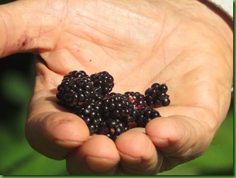
We haven’t put one foot on the trail before David finds berries at the trailhead. He’s like a bloodhound for them.
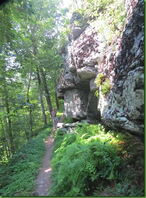
Lots of nice outcroppings on the trail and clearly a lot of stone work in creating it.
We seem to be the only people going into the wilderness on this Sunday but we meet several groups coming out. They have been back country camping. It turns out that the Big Run Trail is the lead in to connections for several other trails going deeper into the “Wilderness”.
We come to a large crop of blueberries which, unfortunately for David are not ripe yet.
The hike is down down down to the Big Run in which area there are other trail heads. The folks coming out have to hike out climbing up up. The area has that dark wilderness feel and big trees both tall and around.
At the “bottom” of our hike, we come to Big Run. Can’t imagine how it got its name unless it was during a period of flooding.
It’s a nice place to sit for a while though.
On our way up we find some low ceilings and a lovely blooming Rattlesnake Plantain
Many big trees and verdant green. It’s really a lovely trail.
There are intersting rocks. Many actually but this one with the prominent quartz is perhaps my favorite.
Lots of mushrooms but this was today’s favorite.
After a few miles of UP, we find ourselves at the end of the Big Run Trail. Well that was a very nice hike.
And then we discover that the exit path is another 3.5 miles long. Hmmmm they didn’t mention that the Big Run was the 5.8 part but to get back to your car it was quite a bit further.
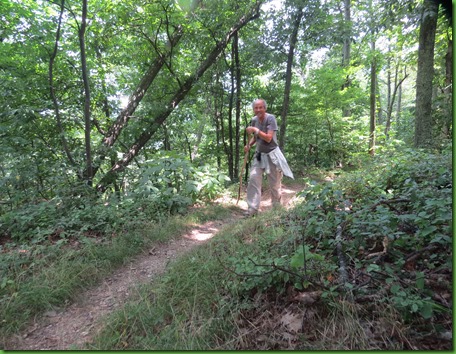
Ok then. We start out on the feeder trail to the AT. David is rowing up hill with his now preferred wooden hiking stick.
I pause for some shots of interestingly painted Indian Pipe
We finally reach the AT and find we still have a bit to go to reach Ruby at Big Run Overlook.
Not sure how happy David is to receive this news. This is beginning to feel like the never ending trial trail.
More up hill. David’s beginning to look tired.
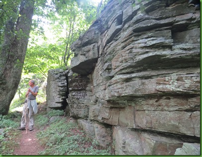
This section of the trail is brightened by the really wonderful rock outcroppings.
We come to an overlook but unfortunately it isn’t the parking area where Ruby is. BUT, there are lovely views to the west.
Back on the trail headed up.
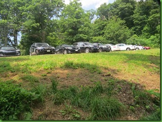
The last up section brings us to the parking lot where Ruby is no longer the only car there as she was this morning. Now they are double parked and parked on the grass too. Sure glad we are coming back and not going out.
That’s Ruby way up on the far end on the right in the pictures. Even in the second picture I wasn’t able to get all the cars parked on the road.
It was a wonderful hike through a beautiful wilderness where we had the trail almost entirely to ourselves on a week-end day. I think our expectation that the total mileage would be 5.8 made the last few miles pretty funny as we wondered if there was actually going to be an end to this hike. Those expectations, they get you every time.









That was another beautiful hike with some amazing views, but I would have not been happy with the additional miles. Just how many miles did it end up being?
ReplyDeleteAhhhh, the never ending trail! One of my pet peeves about hiking is the lack of, or inaccuracy of trail maps and trail signs! It's a good thing the beauty around you was decent distraction from the unexpected length!
ReplyDeleteWe are always amazed at trail markers that aren't quite accurate. Perhaps they were marked before a trail was cut through a different part of the forest? Oh well. Beautiful hike for you both!
ReplyDeleteI've been asked why I keep my blog so up-to-date...my answer is that if I get behind, I would never remember what happened so many days back. lol I don't know how you do it, but just keep on doing it, fun to read. --Dave
ReplyDeleteYou have to appreciate all the work that has gone into those trails by many unsung heroes. Just hauling those cement marker posts up with the directions on them must have been a major job. Nice that they are labeled with distances of the trails so you know what lies ahead. :c)
ReplyDeleteDavid got some great shots of that sunny view, and I love the green rock! The quartz vein is beautiful, another treasure to find when paying attention. An additional 4 miles is no short jaunt! Surprising you didn't run into more people with all those cars there. Love the little painted pipes :-)
ReplyDeleteAfter a few stops with spotty or no internet I have a new found admiration for those of you who have maintained a blog in campgrounds all these years! Loading pics sometimes takes a whole evening :-( Thanks for hanging in there, I so love your posts.
You put me to shame. I have not blogged since March. Now, I do not know where to begin. Well, anyway, Love your hike. Wish John and I could do them, but John just cannot make it now. Keep the hikes and photos coming when you can.
ReplyDeleteThis post made me smile!! Every hike we did in Maine was ALWAYS longer than what the map or the book or the ranger said??? We all just assumed it would be 30% longer than the stated length:o)) But heck...just a little more time to enjoy all that beautiful nature!!
ReplyDeleteIt is such beautiful countryside!
ReplyDeleteSo nice to see that you are both enjoying your time in the mountains. David managed to get some nice photos of the view. It is a pretty clear day:) I found myself worrying about David as your hike together kept continuing. Glad he was able to make it back to the car:)
ReplyDeleteI do believe John has enjoyed his blogging break while we are basically just hanging out, visiting friends, and attending appointments. Sometimes our world is consumed with blog reading and writing. Not having internet is a blessing sometimes and cause one to be shorten posts and just hit a few highlights. Not a bad idea at times:)
Many trail mileages given on maps and in guides are not exact, but you should see how far off the profile maps are!
ReplyDeleteThat marker sure wasn't very accurate, that was a long walk, but worth if for the beautiful views.
ReplyDeleteLovely trail despite being longer than expected. Glad Dad faired ok...loved the 'rowing' up the hill :) Ah internet...a blessing and a curse. We do enjoy the blog!! :)
ReplyDeleteYou are not alone in being behind in writing :( Im always behind. Sometimes I like not having an internet as that would be my great excuse of lagging in my blogging.
ReplyDeleteI'm going to try to remember to use the app on my phone to track miles on my upcoming hikes and see how accurate the signs are.
ReplyDeleteI know that "behinder" feeling both with reading and posting but it's only partly based on poor internet signal. Nice to find a place with few other hikers but almost seems a shame visitors don't enter wilderness. A gorgeous forest walk, even if a bit long. Love having berries to snack on along the way. Not something seen along my recent southern Utah hikes.
ReplyDelete