Thursday August 29, 2013
Lubec, Maine
Today, no fog so the coastal hike is on but we still don’t get an early start.
We are going out to do that hike we didn’t do yesterday because of the fog. Not sure what in the world we did while the morning mostly disappeared. It’s 11:00 when we’re driving down the road to the West Quoddy Lighthouse to walk the Coastal Trail. It’s low tide. How do I know? Did I look it up? Nope, I’m getting so good that I can look right out at those acres of mud flats and know – yup that’s low tide.
But then Whoa….hold on…. Back up…. Stop.
We look over and there is a truck out in the middle of the mud. Do you see it? WAY out there in the middle.
I guess this is like the Minnesotans who drive their cars and trucks out onto and over the ice. But at least they have weeks or months before they have to worry. At five feet per hour I hope he’s paying attention.
We pull into to the light house parking and head down to the trail head which is off to the side behind the machine building.
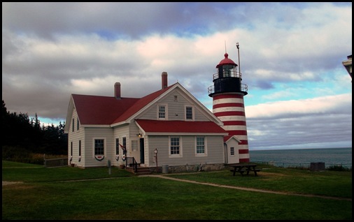
On the way down, I really can’t walk by a beautiful lighthouse and not take its picture no matter how many I already have. It’s looking very fine today as always.
The coastal trail runs along the coastline to a spot called Carrying Place Cove. There you can take an inland trail back or retrace your footsteps. Either way, round trip it is four miles we are told and provides spectacular ocean views and a close look at West Quoddy’s cliffs. We’ve gotten a late start this morning. If we’d waited this late yesterday we could have hiked it then but we would have missed Tea Two so everything worked out just right.
Being the easternmost of something really seems to count in this area.
The trail is part of Quoddy Head State Park located on the peninsula of West Quoddy Head, the easternmost point in the United States. I sure have been hearing a lot of bragging about easternmost point.
West Quoddy head is wrapped in fog an average of 59 days per year. A lot of them have been within the last two weeks it seems.
The Park’s rock cliffs are remnants of marine volcanoes that erupted 420 million years ago and now form the bedrock of much of coastal Maine and New Brunswick. The horizontal volcanic layers were tilted almost to vertical along the Fundean fault – a fracture in the Earth’s crust that parallels the coast just off the park’s shores. Glacial scouring and the battering surf have carved the cliffs which rise 90 to 150 feet from the sea.
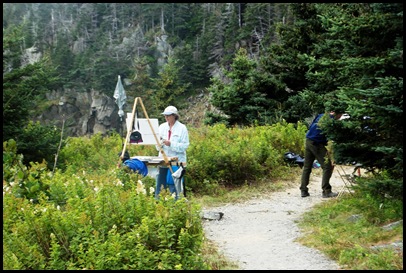
There is a group of pastel painters all along the path and in some cases taking up the entire path so that we have to step off on the cliff side to get around them. I’m surprised at this since it is a state park and a public trail.
I take the opportunity while one artist is away to take a look at what she’s painting. It seems the class has been asked to paint dead trees. I saw others on the path with similar works in progress. I would love to have such a talent. I suspect I would paint nothing but seascapes. What a beautiful spot to be painting in.
I can already feel this is going to be a favorite trail.
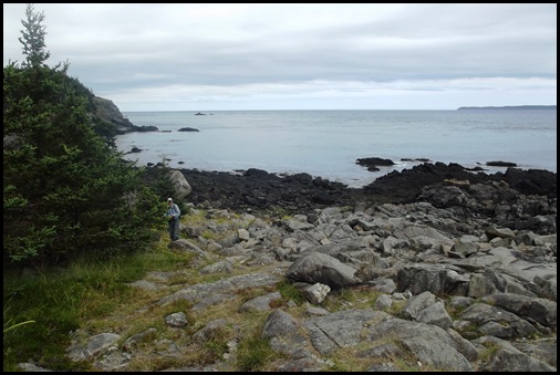
The trail winds up and up. It is in good repair with nice steps and beautiful views.
We reach the area known as high ledge where the views as promised are even more stunning.
A light breeze is blowing. The air is crisp and clear. This is a place where you can really breathe deeply.
Spectacular - Looks like a perfect lunch spot.
As usual we stay at our lunch spot and enjoy for quite a while. The sound of the waves is so relaxing, I could easily take a nap.
I look down and see what looks to me like a giant feather lying perfectly flat half way down the cliff. Do you see it here?
Does this help? Am I seeing things again??
One last look at all this beauty and and it’s back on the trail to discover what’s next.
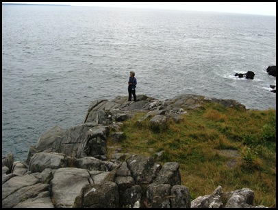
These are definitely tall cliffs. It’s a long way down.
The trail has a really varied habitat.
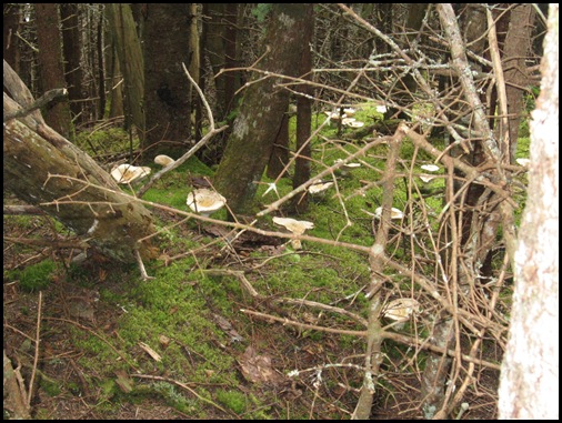
When we come into a wooded section we find it is filled with mushrooms. They are all over the forest floor. I wish I knew more about them. They are giant plate sized and bowl shaped. They look delicious but I know better than to take a chance.
If these smaller ones further along aren’t oyster mushrooms, they should be.
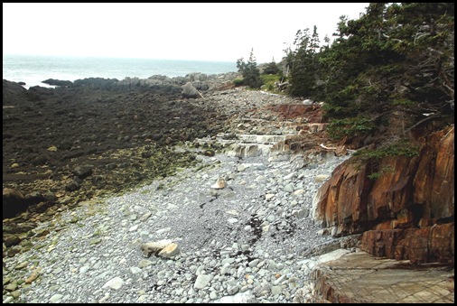
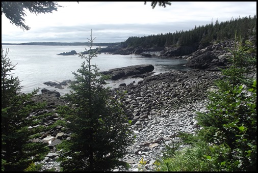
When the tide goes out some very interesting things are uncovered.
At this cove just before Green Point, the rocks are a rust color like something from the southwest. There are white stair steps that remind us of Mammoth Hot Springs in Yellowstone and one rock looks like a giant dinosaur bone. Such a varied and beautiful landscape here.
From down in the cove, we climb up to Green Point
This is what we see
A closer look reveals
It seems most folks turn around at Green Point.
As we go on, the trail changes and becomes very different from what we have had so far. Even more variety.
I really enjoy this variety and am glad we didn’t follow others’ lead and turn around. The views are wonderful.
We come to a small cove. From the top I look down. I can hear the water falling but I can’t see it.
I walk on along the path, around to the other side and see that the rocks are wet. Their colors are beautiful.
And there it is. I know it’s not a waterfall but the sound of the water
and seeing it just makes me smile. I love falling water. It has a fresh clean smell. It’s magical however large or small.
One thing on my list for ‘next time’ we are here is to visit Grand Manan Island in Canada.
This is the first time I have been able to see it from a coastal trail. From here it is about 9 miles off the coast across the Grand Manan Channel which is what we are looking at. I zoom in to see the 250 to 300 foot cliffs. Grand Manan is the largest of the Fundy Islands at 21 miles long and 11 miles wide. I want to take the ferry over and our bikes to ride around the island.
How about this bit of trail. The root path.
Looks like the second half of the hike will be much quicker.
We reach the end of the Coastal Trail and as we turn, we can see that this will be an easy two miles back and will take much less time.
Others we met at the beginning of the Coastal Trail have told us to be sure to see the bog walk. But it is getting late. We will have to by pass the bog walk for another time. My list of things to do on a return trip grows every day.
In about a quarter of the time it took us to do the first two miles, we are back at the lighthouse. The return trail is mostly flat and wide with no obstacles and is the perfect way to end a gorgeous hike along the cliffs of Quoddy Head. It has taken us 5.5 hours to do a 4 mile hike. 4.5 miles to do the first 2 miles and an hour to do the last two. We’re not at all surprised. But there is just no way we could have done it faster and enjoyed it as much as we did.
Quoddy Head State Park has a lot more to offer than just its fabulous lighthouse. This is most certainly a trail I will hike multiple times.














What can I say, wish we were there:)
ReplyDeleteAnyone know what the man is doing out there in the mud flats at low tide? Clams, mussels or scallops maybe? Love the stone bird pecking stone stone art. The one under that looks like a seated man looking out to sea. Beautiful views, wonderful hike, great woodland trails as well.
ReplyDeleteWhen we were at Sunset RV Park, the locals would go out at low tide and collect clams. They brought them to the campground to sell to the campers. The collectors were still covered in mud...those were some fresh clams;o))
DeleteLove the little stone cairn sculptures someone made ;) I'm not sure a summer is enough to do all the trails there!
ReplyDeleteI am smiling...thanks for taking us back to one of our ALL TIME FAVORITE hikes:o)) Your photos are fantastic...some of the best you have taken. I think you must have learn some wonderful techniques at your photo class in Acadia!!!
ReplyDeleteA beautiful coastline indeed! Pretty good painting too!
ReplyDeleteLove this destination and will hope to get there some day. Loved the lighthouse photo along with all the rest...
ReplyDeleteI hope the truck got back to shore before the tide came in.
ReplyDeleteA friend of ours is a painter and he insists that anyone can learn to paint, you just need lessons. I figure one of these days, I might just take some lessons. I think the talent would come into play, but at least I could maybe paint something.
We were talking about you two yesterday and wondering if you ever took a day off to just rest. You've been very busy ever since you left Florida! Love the beautiful coastline.
What an awesome rock feather. But those cliffs look a little steep for climbing down to the sea. The big mushrooms almost look like Lobsters, but don't think the little ones are Oysters. This area is over the top amazing for hiking.
ReplyDeleteMaine needs a longer summer so you'll have enough time to hike all the trails and see all the beauty of the coastline.
ReplyDeleteGood to see you're getting the hang of tide schedules. We became very attuned to them when we lived on the shore for 11 years. They became so ingrained in our minds that we'd be driving somewhere inland, pass a lake and think it was high tide. :c)
Gorgeous hike. You must wear out your hiking boots pretty regularly. ;)
ReplyDeleteIt would take a lifetime to see all the nooks and crannies wouldn't it. . .fabulous travels with you today. . .thanks!
ReplyDeleteLove all of those different walking surfaces, great pictures!! And the lighthouse is a beauty!!!
ReplyDeleteEach view is more beautiful than the previous one. So lovely! Thank you!
ReplyDelete