Saturday May 18, 2013
Site 40, Prairie Creek COE Campground
Lowndesboro, Alabama
* this is a repost of the blog that has been causing all the trouble. So if you’ve seen two of these you aren’t seeing double. But you can comment twice if you want to, that would be cool. :-))
I was in high school when this all happened.
I remember it well. I remember being shocked by what I saw on TV in black and white. People walking over a bridge being clubbed and beaten. And then another march. And another.
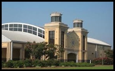
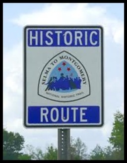
Today we visited what is known as the Lowndes County Interpretive Center. We had a hard time finding it even though it was right there in plain sight on Route 80. I knew it was a National Park Service Visitor Center and was expecting a sign for the Selma to Montgomery National Historic Trail Visitor’s Center. Or at least something that looked like the famous National Park sign.
We drove right by the big impressive building before turning around when we knew we’d gone too far.
We went back to what we thought was a county tourist bureau to ask where the National Park Service Visitor Center is. Our surprise, this is it.

I should have asked the friendly and extremely knowledgeable Ranger Anthony Bates who greeted us when we first entered the center why this center is not called what I was expecting but is instead the Lowndes County Interpretive Center. Am I the only one that finds that unusual for a National Park Site? But I was too busy being amazed.
The exhibits inside are not the only really impressive thing. The building design itself is noteworthy as well.
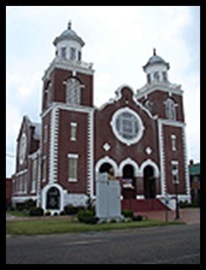
From Ranger Bates, I learn that the building was designed to incorporate 3 important places on this historic march. You can compare the first two to the building picture at the top. The front of the building is designed to resemble the architecture though not the brick color of the Brown Chapel AME Church which was the starting point in Selma for the marches. The metal clear story archway at the top of the building is to commemorate the Edmund Pettis Bridge where the marchers were attacked during the first March and where they stopped and prayed during the second. The third place is the state house in Montgomery a replica of whose dome is on the grounds and visible through the window toward which the marchers are proceeding.

This is a very powerful exhibit and the curators have done an amazing job of telling it like it was. We’ve come a long way since this day and I’m proud of my National Park Service for giving this Route the recognition it deserves.

When I was in school I remember thinking how wonderful the Lincoln and the Emancipation Proclamation were.
Then I read about the continued discrimination after the Civil War ended and on into the 20th century. On into my own life time.
The Civil Rights Act of 1964 outlawed major forms of discrimination against racial, ethnic, national and religious minorities, and women. It ended unequal application of voter registration requirements and racial segregation in schools, at the workplace and in public accommodations.
But what good is a law that isn’t well enforced? The Jim Crow South lived on. This exhibit highlights the struggle for voting rights that should not have existed given both the 1860’s and 1960’s laws. But it did exit.
The exhibit begins with conditions prior to and at the time of the Civil Rights Act.

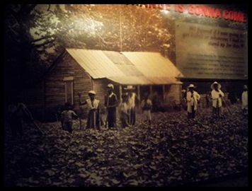
Many former slaves and their descendents in the Selma and Lowndes county area lived in accommodations like these. The county was actually over 50% Negro at that time the marches began. They were largely sharecroppers trapped in a never ending cycle of plantation-like slavery. They were often paid in “company” script and were always in debt to the store. They couldn’t move if they wanted to and they couldn’t do anything about their conditions because they were not allowed to vote. Well they were allowed IF they could get registered which required that they pay a poll tax with money they didn’t have, answer a 4 page questionnaire that I’m not sure I could answer. For instance, Do you know how many congressional districts are in the United State? And have a “sponsor” preferably white.
The 1965 Marches were a direct result of efforts begun in 1963 to register people to vote.

These efforts were organized by the Dallas county Voters League, a Negro organization created to help register people to vote in the Selma Alabama area which is located in Dallas County. White resistance to this work was enormous and took many forms including violence.
The first march took place on March 7, 1963 when 600 marchers protested the violent death of Jimmy Lee Jackson as well as the people’s exclusion from the electoral process.
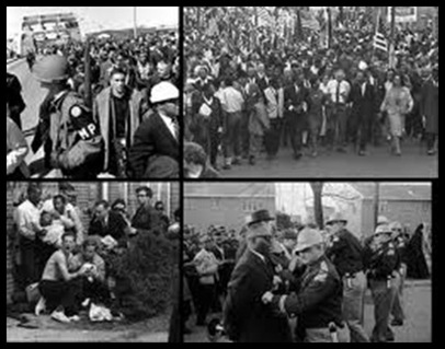
At the Edmund Pettis Bridge in Selma, the march was met by state and local police with tear gas and clubs. So many people were beaten and injured that it is still referred to as “Bloody Sunday”. Footage of this violence, of unarmed people being beaten, kicked and bloodied was on the nightly news and heightened public sympathy for the marchers and the entire Right to Vote movement. Life magazine’s cover photo highlighted the march and gave it additional national coverage.

A second march the following Tuesday, March 9, also began at Brown Chapel
It stopped just on the far side of the bridge where the beatings had taken place. Twenty five hundred Marchers, some of them Clergy from all over the country, led by Dr. Martin Luther King, knelt in prayer as club wielding policemen looked on.
The third March began on Sunday March 21. By this time the media coverage had expanded and federal troops had been sent in when Governor George Wallace would not assure President Johnson that the marchers would be protected. Johnson federalized the Alabama National Guard who in the past had been part of some of the beatings. The FBI and Federal Marshalls along with the reluctant guard lined the route. About 3200 marchers set out for Montgomery walking an average of 12 miles a day and sleeping in fields. The marchers walked the 54 miles from the Everett Pettis bridge of Bloody Sunday to the Alabama State House along Route 80, the same route we drove between the campground and here. It took them 4 nights and 5 days.
Along the way they stayed in tents on farms where owners took great risk to permit them to gather.
All along route 80 are signs marking the locations of these stops. The organization of such a march to secure camping places, food, water and medical care was truly an amazing feat of dedication to a cause. I wonder how many of us have ever been as dedicated to doing the right thing as these people were.
At campsite #1, The congregants of Selma’s Green Street Baptist church cooked massive amounts of pork and beans and spaghetti and pork and beans. They delivered the food in new garbage cans. The temperatures fell below freezing in the four large tents which housed the marchers.

Among the most moving of the exhibits is a group of 5 life size marchers.
The first two are real representations of Lewis Marshall who was 15 years old when carried the flag during the march and Jim Letterer who came from Michigan and marched the entire 54 miles on crutches. The detail on the clothing and facial expressions of these people was remarkable. Standing there in their midst was very humbling. I have never risked my life for a principle. My admiration knows no bounds.
![Replacementpictures12LewisMarshall_T[1]](https://blogger.googleusercontent.com/img/b/R29vZ2xl/AVvXsEg_ueF5LHSlqxOJ_yNyr1esMNkJev6P1FGbOCjzXNEgGCVNTdqesK_xVsElzpI9R9BdrQoxO0q5FBZIcUPg27lpdIBY6ZPyNIZsoRHkGYFrN0KYK021A2QDUtynfOy_gJtjoJa46Lx7KnEr/?imgmax=800 "Replacementpictures12LewisMarshall_T[1]")
This link is to a very interesting story of the grown Lewis Marshall returning to visit his model at the center.
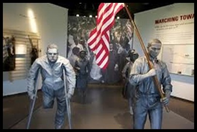


By the time they reach the capitol on Thursday March 25 they are 25,000 strong on the steps of the Montgomery capitol building, where Martin Luther King delivers his “How long? Not Long!” speech.

And it was not long
Less than 5 months later President Lyndon Johnson signed the Voting Rights Act of 1965. This is surely one of the fastest acts Congress has ever passed.
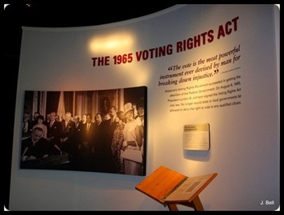 Thanks to Judy Bell of Travels with Emma for allowing me to use her photo of this exhibit when mine turned out to be totally terrible.
She is always paving the way for me.
Now you would think that would take care of things. But it didn’t.
After the bill’s passage a mass movement to get people registered resulted in many of the tenant farmers and sharecroppers being thrown off their land and out of their houses when they registered to vote. They had no where to go. Some of them moved in with relatives or left the state. But others lived for as much as two and a half years in tents on the property which now houses this Visitor Center. Several organizations helped to buy the land for the Tent City, brought cots, tents, heaters, food and water. Over time the organizers helped these people find new jobs and permanent housing in their new lives.
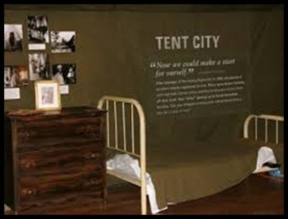
I am in awe of the people involved in these marches and their steadfastness and devotion to this important civil right.
Thanks again to my National Park Service for creating such a memorable place for me to visit and experience this history up close. It was great to be reminded of the days when improving this country and life for all its people was upper most in many of our minds, including congress
Sure wish I could make more of our tax dollars go to the National Parks. I LOVE THEM!!


![Replacementpictures12LewisMarshall_T[1]](https://blogger.googleusercontent.com/img/b/R29vZ2xl/AVvXsEi9_ksr2VPThtB9INe5KHQtrwgS7343-ZVQSc6PM9CGVVtaXx9exowMQKFcmDoJ9t4v1LC1dzeAgKWiD-qILgGB6EKLS463NxdpLrqIepDB48gbfNJ4RGSKk9SQIpDaiJSTmh6WwLtYAmKa/s1600-h/Replacementpictures12LewisMarshall_T%25255B1%25255D%25255B3%25255D.jpg "Replacementpictures12LewisMarshall_T[1]")


