Monday July 15, 2013
Site #79, Blackwoods Campground
Acadia National Park
We enjoyed our ranger hike so much we decide to do another one.
This morning we are waiting for Ranger Susan at the Parkman Mountain Parking Area. There are even more people gathered to take this 2.5 hour walk along the carriage roads to two of the stone bridges.
Susan tells us the carriage road system is 51 miles of one lane gravel roads, contains 17 granite bridges and two gatehouses. One of those was pictured in this post about our bike ride on the carriage trails.
She explains how the bridges were built with all hand tools and has the tools there for us to see. This was painstaking work begun in 1913 and not completed for 27 years.
Originally designed for horse carriages, the carriage roads are now used by hikers, bikers, joggers, horse riders and cross country skiers.
These roads were the inspiration and design of John D. Rockefeller Jr. who hired noted architects and local engineers to do the formal design and to construct the bridges and gate houses.
Until 1960 Mr. Rockefeller maintained the roads although he had already given them to the National Park service along with a third of the land now within the park. The roads fell into disrepair due to lack of funds for maintenance but in the 1990’s and early 2000’s an $8 million rehabilitation program, paid for with federal and matching private funds, made possible the rehabilitation of most of the roads and bridges. Such a shame that we don’t seem to realize it will cost more to bring it back than it would to maintain it. I know I would like a lot more of my income tax monies to go to the National Park Service than currently do. Wouldn’t it be nice if we could tick off boxes on our income tax forms saying what we’d like to support. Wonder if congress would ever be able to give themselves raises or how many wars could be fought on the funds people chose to send for that purpose.
But I digress……….where carriage roads meet Rockefeller had sign posts to indicate directions. These were used mostly by folks who knew the area well.
But then the park was visited by more and more people who were not as familiar and who would look at the sign below and ask “Which way to Jordon Pond??”
So the park service put numbers on the posts at each intersection that correspond to the carriage trail map. This post is number 12. A map is a MUST if you travel the carriage roads so you can see which way you really should go to get from post 12 to 13.
As we walk along the road she tells us many little details about the construction and about the history of the roads and the park.
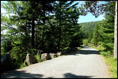
Among the interesting things are that the granite boulders lining the roads are referred to as Rockefeller’s Teeth and that Rockefeller himself walked every inch of every road as it was being designed to make sure it went by the views he wanted to see as he went by in a carriage. The park service has tried over the years to maintain those views but with the sequester and the constant lack of funds to our National Parks this is very difficult.
We come to the first bridge. Hemlock Bridge.
Rockefeller did not name the bridges but the park service staff in an effort to be able to communicate has named them.
None of the bridges is exactly the same. Notice this one has a roman arch and large circular end pieces.
On we go to Waterfall Bridge.
This is very easy walking although we all comment that the “gradual rises” described are sometimes pretty steep and long. We wonder about the horses carrying a cart full of people or materials.
It also has the large spiral end pieces but its arch is rounded and was built on an amazing angle which I really am not able to show in these pictures. Rockefeller was as concerned about the views of those going under the bridges as those going over the roads. There is a trail that approaches the bridge from below and he had the bridge angled so that the waterfall on the other side is framed by the bridge as you approach it on the trail. AMAZING! What attention to detail.
All of the bridges have their dates of construction on them somewhere. Hemlock Bridge was 1924, Waterfall Bridge is 1924.
For this bridge we walk down the path to see underneath.
The waterfall is lovely though slight as the weather here has been hot and the rain scarce lately.
We head back up where Susan concludes the hike by giving us multiple possibilities for returning to the parking lot.
Among them are the two trails under the bridges we have just seen.
Most people choose not to hike but to return to their cars on the carriage roads. Those that do hike go back down to walk the Hadlock Brook Trail going away from the waterfall.
David and I enjoy solitude while we hike so we walk back to the first bridge and head down the Maple Springs Trail. David’s got a head start as I stop to take a picture of the trail signs. I really love them although I know they must have to be replaced more frequently than something made out of metal. They seem to be so suited to this place being made of wood.
This enables us to see the Roman Arch from underneath and to notice the totally unnecessary ornamentation Rockefeller has included on both sides of the arch.
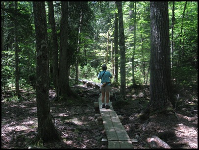
It turns out to be a lovely trail running away from the spring in the direction we are going.
Like pretty nearly all Acadia Trails there are rocks to negotiate.
What’s going on here??
This piece of orange tape seems really seriously out of place here deep in the woods. The trail becomes more sketchy.
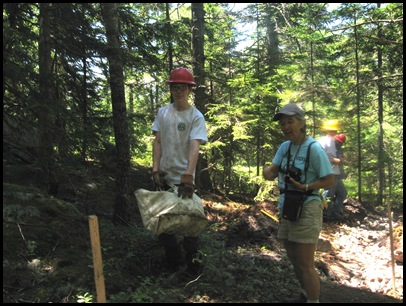
We hear them before we see them. Uh oh…..is the trail closed for maintenance? There isn’t a sign we tell them. Nope, not closed, come on through. Come on through where??
We manage around this trail maintenance crew only to come upon another one just a little further along. They are shoring up the paths by hand. Cracking and cutting bigger rocks and moving them by this carrying bag to where they want them to go. Hard work for sure. But a nice environment and great weather to do it in.
There is one more bridge to see today.
We make it to the carriage road which we will take back to the car. But first we want to go see another bridge Susan told us about. So we turn left instead of right.
This one is much smaller, has no spiral ends and was built in 1926.
So today we have seen a 1925 bridge, the roman arch, a 1924, the waterfall and now this 1926 bridge whose name she didn’t tell me and I didn’t think to ask.
Just another of the many advantages of being short. I get chosen to show how tall this bridge is.
It’s getting pretty warm by this time. The high is predicted to be 90 today.
So we are more than ready to get back to our tree shaded campsite where it will be cool and breezy. It is also pretty seriously after lunch time so we hike it up hill to the car and home.
We make a detour on the way to drive through Seawall campground where we have reservations for another 2 weeks of boondocking. Not sure we’ll be able to do that with our current charging woes but we want to see what it looks like.
It’s a smaller campground than Blackwood, that’s nice. It’s on the other side of the park and close to many things we have not seen. Also nice. The sites seem much closer together than Blackwood. Not so nice but that was just a first impression from a drive through. I am able to get 1X with 2 or 3 bars on my phone which is way better than the zip/zero I get anywhere within 5 miles or so of Blackwood. So perhaps from Seawall I wouldn’t have to drive so far to read and comment on blogs and post my own.
But that’s just my phone. Who knows what our hot spot would do and I really can’t comment using my droid. It’s just too hard.
After our very late lunch, I spend some time in the hammock. It’s lovely in the shade and there is a nice breeze so the heat isn’t a factor. If you aren’t in the sun, it’s very nice.
And this is my view. I do love being camped in Acadia National Park.
As I relax and read my mind wanders. I wonder if I can arrange to see all 17 of the carriage road bridges while I’m here. Stay tuned.


What great hikes you are doing in Acadia. If you get a good ranger, you can learn so much from those guided hikes..
ReplyDeleteRFD-TV has a weekly show featuring groups on horseback seeing the sights across America. One of the places I remember well was the carriage road in Acadia, and it's nice to see some of it from the perspective of a walker. I think John D. Rockefeller, Jr. was an amazing man - for all his money he did a lot of great things to benefit posterity.
ReplyDeleteI have learned so much more about Acadia from you and your posts. I am embarrassed to admit we have never done a ranger walk. I need to be more open to this opportunity. I used to be more impatient and always wanted to see monuments, museums, and parks at my own pace, but I think retirement is changing that and now I can see the value of doing tours, etc. Thanks again for opening up my mind to new possibilities.
ReplyDeleteWow what a hike! The bridges are beautiful!
ReplyDeleteLoved our little tour today. The ranger was very informative. The bridges are beautiful. We stayed at Seawall when we were there. To be honest I can't really remember whether we were happy with it or not. I do remember the generators running most of the day, we didn't like that, that I do remember!
ReplyDeleteRuth
www.travelwithkevinandruth.com
Love your idea about how we choose to spend our tax dollars. I'd say there used to be more of the 1% who would put their money into projects like this. Those bridges are a remarkable example of fine craftsmanship. I do hope you get to see all 17 of them so we can see them too.
ReplyDelete51 miles is too much. You'd miss lunch.
ReplyDeleteGreat tour again ... when we were in Bar Harbor for just a couple of days (years ago), we made just one foray into Acadia NP for a taste to whet our interest in returning there someday.
ReplyDeleteAmazing craftsmanship on those bridges. You sure don't see that today. Did you see any trolls under the bridges? ;c)
ReplyDeleteFantastic post. Loved the bridges and the detail. I hope you get to see all of them too!
ReplyDeleteBeautiful bridges with so many details - I feel we don't build with such care and intricacy anymore - the trails looked nice too - especially with the waterfalls. I've done trail maintenance in a group - not easy work, but it's always in a great location and makes you feel productive for sure.
ReplyDeleteSuch beautiful bridges, and lovely architecture. Glad the Rockefeller made them both structurally sound, and pleasant to look at.
ReplyDeleteThanks for explaining about the carriage road and bridges. I knew about them, but didn't know about Mr. Rockefeller donating the land. How wonderful that he gave away this land so that everyone can enjoy it.
ReplyDeleteI sure hope you get to see all 17 bridges while you are there. I hope your battery/charging woes will allow you to stay as long as you like. I think I could easily spend a summer up there.
Great tour of the bridges. I really recommend that you go to the Stanley Brook bridge. It's a buetifull piece of architecture.
ReplyDelete