Wednesday September 10, 2014
South Rim Campground
Black Canyon of the Gunnison National Park
Montrose, Colorado
Today we put three trails together into a loop starting and ending at the campground. These are my favorite kind of hikes, the ones I can do right outside my door.
Those who know me understand that I’m an odd duck in many ways but none more odd than that I’m a full time RVer who hates to drive or ride in a motor vehicle. So I love being able to camp in the National Park and Monument campgrounds rather than outside so I don’t have to drive in every day.
But often even in the parks, the hikes I want to do require a drive to the trailhead. But today – hooray - we can leave from our campsite and begin on the Rim Rock Trail. We’ll take that through Tomichi Point the only spot on the drive we haven’t been to. Rim Rock then goes on to Gunnison Point, to the Visitor Center and hooks up with the Oak Flat Trail. Oak Flat is a separate loop which will allow us to connect to the Uplands Trail to circle right back to the Campground. Each trail is 2 miles long for a total of 6 miles for our last hike in Black Canyon National Park. Very cool!!
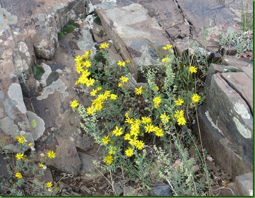
Off we go to loop C where the Rim Rock Trail begins. Sage and wild flowers are along the trial.
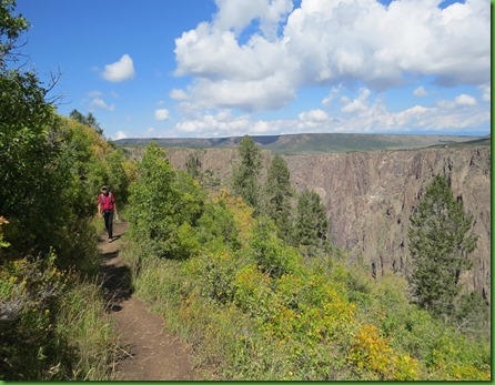
It’s definitely a rim view hike.
About a mile along the trail, half way, we come to Tomichi Point, the first stop on the South Rim Drive and the one we haven’t seen yet. Great views. The morning light emphasizes the many layers of the eastern end of the canyon. The Gunnison River is framed in a notch created by rock outcroppings.
After 2 miles we reach Gunnison Point and look up to see the Visitor Center. The Oak Flat trail goes off behind it so up we go.
This year is the Birthday of the Wilderness Act. It turns 50 and what an important piece of legislation it was although there are still, after 50 years, factions trying to undermine its ability to protect. On a bulletin board outside the center, a question is posed and many responses are posted.
Inside of course I find lots of books I’d love to read, especially this one. I love the idea, A Permanent Vacation in as many National Parks as I can manage.
We find the Oak Flat Loop a trail constructed by the Student Conservation Corps. I just love this organization. Before the Peace Corps, before AmeriCorps, long before there was an environmental movement, since 1957, more than 70,000 young people have joined the ranks of SCA and have provided more than 28 million hours of hands-on service yielding immediate and lasting effects on our environment,
SCA’s mission is to build the next generation of conservation leaders and inspire lifelong stewardship of the environment and communities by engaging young people in hands-on service to the land. This trail is a wonderful thing they have done for Black Canyon of the Gunnison National Park and it is no small achievement. Take a look
Like several other trails, this one has a spur off for access to the river. But also like those other ones, the spur leads into a Wilderness Area (thank you Wilderness Act) and requires a permit to travel on these very lightly maintained and steep trails. Not for the casual hiker and I’m glad. Even if I can’t go, I love that it is there, wild and free.
\
We head DOWN.
Just beyond the Wilderness and River access trail we come to the first view of the river.
Then we’re in the woods and in the scrub and…….
This is the first time we’ve been down below the rim. It’s cool down here and so is the temperature.
The trail takes us down and then back up.
Some of its sections are barely flattened ledges with steep sides going up and down.
As we get back toward the rim, the trail widens.
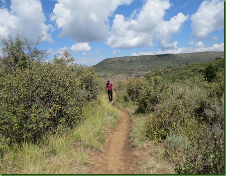
When we reach the rim again we find the Uplands Trail which leads us through just that and back to the campground. It’s our last 2 rocky miles.
The campground is actually at 8320 feet, one of the highest points on the drive so it’s more hiking up to get there.
We’ve had a great afternoon and are going to finish out our last day at Black Canyon of the Gunnison by taking the steep East Portal Road (16% grade with hairpin turns) down to get a close up look at the river. But that’s a post for tomorrow. See you then!


Wow, a self made and scenic hike!
ReplyDeleteI have volunteered at two refuges that had designated wilderness areas. As you know, the wilderness at Okefenokee is wonderful.
ReplyDeleteWhat strikes me is how different this canyon is from others. Beautiful shots!
ReplyDeleteWow - more wonderful colors and wide open spaces! and, those canyons... I hope you can get that book if you haven't already!
ReplyDeleteWhat a beautiful day you had for this hike!!! I love the idea of a Permanent Vacation in the National Parks:o))
ReplyDeleteFavorite photo today is of David at the Uplands Trailhead. He just seems to be having such a great time!!!
More gorgeous country. You could write your own book. Well, actually you do. Has always been a pleasure to work with SCA folks. Our future in conservation.
ReplyDeleteThanks for introducing me to the Student Conservation Corps! I missed that on the hike and I love the idea and goodness of it. I confess it was me who made the editorial scribble on the "What does Wilderness mean to you?". I could not resist the notion that Wilderness is not and escape from the real world but rather an escape to the real world. Guess it actually works both ways which is kind of neat.
ReplyDeleteSome of those pictures look so steep they make me dizzy!!! Beautiful, beautiful pictures!!
ReplyDeleteGreat photos today. I won't make it to this Canyon this year, but hope to make it to the canyons in northern Texas later this month. I've read about that road because I considered applying for jobs at Black Canyon of the Gunnison.
ReplyDeleteNice editorial! Any hike that has views like this one has my attention. Thanks for taking me along.
ReplyDeleteWhen we were there, the Oak Flats trail was closed due to bear activity. I was disappointed as it was one we'd hoped to do. And can't wait for the report on the East Portal Road. I looked at it longingly, but out time was so limited on our one day at Black Canyon, we had to chose activities carefully and the road to the river got ruled out.
ReplyDeleteAnother great hike! You two are so much like us, just wanting to see as much of a place as possible. Hiking is a great way of doing that!
ReplyDeleteLooking forward to your drive, I am sure the view were awesome.
www.travelwithkevinandruth.com
The second pic looks like an oil painting - beautiful colors. The one of David at the edge makes my heart stop. I'm so not good with "edges" :-( Seeing the steep walls through the tall, straight trees really captures the feel of them.
ReplyDeleteGreat news in California yesterday - President Obama signed the bill that puts 346k acres in SoCal into the San Gabriel Mountains National Monument. It is a popular hiking and fishing area that is now protected for future generations to enjoy :-))))))
I like the wilderness board! The Act was definitely an important piece of legislation! Great hike to below the rim. So many flowers and a pretty sky too. And a closer sight of the river...nice!!
ReplyDeleteHmm, have to pick up that book too! Love the Wilderness board. I don't think enough people get to experience the true wilderness. They're missing a lot!
ReplyDeleteThere is hope for the future for our wild lands! Those notes on the board were great, what a cool idea to make people think and appreciate the wilderness in all it's untouched beauty. :c)
ReplyDeleteBeautiful hike, and I loved the Wilderness board. Such a great idea (and I agree with your little edit, David). We might be able to use something like that in our Jr. Ranger's program.
ReplyDeleteLooks like perfect hiking weather!
ReplyDelete