Friday September 12, 2014
Piñon Flats Campground
Great Sand Dunes National Park and Preserve
Mosca, Colorado
We know fall is definitely here when we find it is 49 degrees in the morning. But our expensive gas line gives our Cozy World heater the glow we need to warm the place up in short order.
After it warms up a bit as well, we set out on another “walk from the campground” set of trails. I LOVE when we don’t have to drive to trailheads.
The Dune Trail actually takes you from our campground loop B through loop A and then down to the dunes and along Medano Creek before going back up to the visitor center where we can pick up the Wellington Ditch Trail to come back to the campground at Loop C. The loop is on this map but you have to look closely below the ‘You are Here’ arrow to the bottom campground loop and the purple dotted trail going off toward the dunes, to the parking area and up to the visitor center.
This is one of the most beautiful desert flowers I have seen. It was growing just off the trail as it left the campground and had a fence around it for protection. Just look at that color.
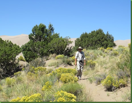
The trail goes through the scrub area on its way to the dune field. There are wildflowers galore. I can only imagine how hot it is here in the summer.
I thought these two were particularly interesting, the first for its flower head and the second for its pea like seed pods.
The National Park and Preserve include the Sangre de Cristo Mountains on the right.
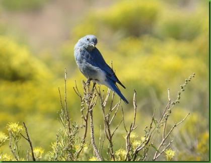
As we near the dune field, we stop to watch a bluebird flitting around in the rabbit bush.
The park and preserve are made up of several entities. The dunes are actually in the wilderness area.
The dunes look close but we still have a long way to go before we come to what remains of the seasonal Medano Creek at the foot of the dunes.
This must have been a big year for the creek since it is still at least somewhat visible. The length and time that Medano Creek flows greatly depends on the amount of winter snowmelt. In heavy snow years, the creek may flow through July or even throughout the summer. Typically, the creek starts to flow in late March or April, with peak flow in late May. We have been told that when the creek is flowing well, the area may look more like a beach in Florida, complete with people in swimsuits, than a Rocky Mountain stream.
No swimming today that’s for sure.
We walk on down toward the day use area where we find changing rooms just like at the beach. Men’s on one end and women’s on the other.
On the information board we find this. I am always so happy to hear that grizzly bears or mountain lions or wolves live anywhere. I don’t have to see them for just this knowledge to bring a smile to my face.
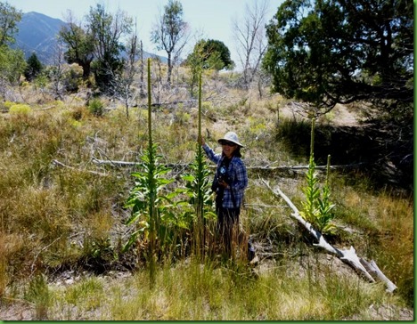
From here the trail climbs up to the visitor center and past some VERY tall yucca plants.
Another plant I love this is Horsebrush. The shiny wool shields the plant from direct sun and traps moisture from the surrounding air.
The VC has a great film of course and they also have a number of really excellent exhibits including this topo map which shows the dune field between the Sangre de Cristo mountains on the right and the San Juan Mountains on the left. There is an educational show on the screen behind which describes how these dunes came to be.
In a nutshell, like many other places we have visited in the west, this place too is the result of volcanic action and plate uplift.
First, the La Garita Caldera erupts. We are told it is the largest known volcanic explosion in Earth history. Boy that is a BIG statement.
Through extended and dramatic volcanic activity lava and ash create the rounded San Juan Mountains.
Through the breaking apart and movement (rifting) of large surface plates on Earth's surface, the Sangre de Cristo Mountains are uplifted in the rotation of a large plate. With these two mountain ranges in place, the San Luis Valley was born, covering an area roughly the size of the state of Connecticut.
In 2002, geologists discovered lakebed deposits on hills in the southern part of the valley, confirming theories of a huge lake that once covered much of the San Luis Valley floor. The Lake later receded from climate change, and from its water cutting through volcanic deposits in the southern end of the valley. With the southern end of the valley breached, the lake may have drained through the Rio Grande River, forming the Rio Grande Gorge near Taos, New Mexico.
Smaller lakes still covered the valley floor, including two broad lakes in the northeastern side of the valley. Further climate change significantly reduced these lakes, leaving behind a large sheet of sand geologists call the sand sheet.

Sand that was left behind after these lakes receded blew with the predominant southwest winds toward a low curve in the Sangre de Cristo Mountains. The wind funnels toward three mountain passes there and the sand accumulates in this natural pocket. The winds blow from the valley floor toward the mountains, but during storms the winds blow back toward the valley. These opposing wind directions cause the dunes to grow vertically
Two mountain streams, Medano on our side of the dunes and Sand Creek, on the far side of the dunes, also capture sand from the mountain side of the dunefield and carry it around the dunes and back to the valley floor. The creeks then disappear into the sand sheet, and the sand blows back into the dunefield. The creek was definitely disappearing into the sand sheet today.
This combination of opposing winds, a huge supply of sand from the valley floor, and the sand recycling action of the creeks, are all part of the reason that these are the tallest dunes in North America. There are other dunes in Colorado, and in most western states in the US, but none as tall (750 feet) and none as dramatic. Here giant dunes rise in front of the alpine Sangre de Cristo Mountains, while streams flow across the sand seasonally, making for an unusual and unexpected sight.
And there you have it. All of this is part of the 150,000 acres of the Great Sand Dunes National Park and Preserve
.
Outside the visitor center is the half mile Sand Sheet Loop trail. We decide to stroll around it before heading back up to the campground.
Encircling the dunefield like a grassy sea, the sand sheet is one of the major components of the Great Sand Dunes sand deposit. It is the primary source of sand for the dunefield today. This trail takes you around the field and identifies the plants and history of the people’s who have visited here.
On the map, we have come in from the Trail to the Dunes, gone to the visitor center and are now back at You Are Here. When we finish the Sand Sheet Loop we will take the Trial to the Monteville Trailhead which also leads to the Wellington Ditch Trail back to the campground. A full circle.
This post will never end if I do details of the Sand Sheet trail so just know that we suggest you do it before you do any other trails for the information and plant identification. Go to the VC, see the exhibits, do the Sand Sheet Trail and then make your plans to see the park. That’s our advice. But I do want to show you just this one plant, the apache plume. Is that neat or what?
Time to head back. We cross the road and head UP.
In 1927 the Wellington Family hand dug a ditch for irrigation from Mosca Creek to Buck Creek. This is a serious uphill challenge. The ditch can still be seen from the trail we are taking back to the campground.
The trail takes us up up from the dunes and the VC. Great views!
I zoom in on the dunes and the patterns are just spectacular. They are so beautiful they take my breath away and I have little success at controlling my urge to take their picture.
The trail is quite varied, dry and rocky in some places. Treed and grassy in others.
We come to a section of the trail where we actually walk through the remains of the Wellington Ditch.
We find some pinyon pine cones with nuts inside. We try them. They are delicious. We spend some time looking for more. No wonder they are so expensive. Trying to get them out of the cone is a real task.
The only wildlife we’ve seen all day has been the blue bird on our way to the dunes until we are very near the campground.
We’ve actually arrived back in loop C when we see this piggy with his cheeks absolutely stuffed with pinyon nuts. I guess he’s a yellow bellied marmot but he sure has a long tail. Does anyone know if he is or is not? Look at the length of that tail.
Back at the campground we walk by this little number. Not a full timing rig for sure. But interesting.
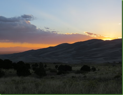
The sun is setting earlier and we almost miss it while finishing up our dinner.
We close our evening out with a talk by the singing ranger who opens with a pretty darn good rendition of Rocky Mountain High. His talk is “The Dunes Yesterday…and Today”. He has historic pictures for the adults, fossils and a mammoth tooth to show the kids, they love it.
Tomorrow we are going to do it again even though after Sleeping Bear we said that was enough walking up giant sand dunes. Yup, we’re heading out early to walk up the Big Dune and take a look over the 30 square miles of dune field. Wish us luck!


You outdid yourself on this beautiful post. Outstanding pictures.
ReplyDeleteThanks for explaining the dunes. They have beautiful patterns, and I'm sure after a storm, they change again. Nice sunset!
ReplyDeletethat lil dude with the chubby cheeks full of nuts was the cutest ever.. he was workin it!!!
ReplyDeleteSuch a landscape of contrasts. Plus the outstanding patterns in the dunes. Pine nut cones are so sticky I usually gather off the ground but this is not a year for many. Lots of those tent on trailer combinations in South Africa. I'll bet you were tired after the dune climb. Love the idea of a singing Ranger. Too bad I can't sing.
ReplyDeleteI believe that a beautiful sunset is the best way to finish a great day. I thought the Oregon coast dunes were huge! Geesh!
ReplyDeleteWe just made our first visit to the Dunes last month. What a special place! We highly recommend the hike up to Zapata Falls, about 5 miles (or so) south of the NP. After a long off-road drive and a short uphill hike you have to cross water several times and poke into a cave to see the falls. Very cool!
ReplyDeleteThe beautiful flowers look like bougainvillea but the leaves don't - what ever they are, they're so delicate! Seeing such delicacy like those, and the Apache Plume, in such a hostile place is amazing - how do they hang on in all that wind?! I swear that Blue Bird is posing for you :-) After all the heat, I imagine that cooler weather was feeling pretty nice. That little guy sure looked like he had to store up for winter very quickly! Nice catch on the sunset - what a magical place.
ReplyDeleteThe Dunes are amazing and the best part is not one 4 wheeler cutting across the beautiful dunes! Will definitely add it to my growing list of things I must see!
ReplyDeleteGuess we need to put this one on our bucket list for our next trip to Colorado! Thank you for your very informational post!
ReplyDeleteGreat shots of the sand dunes!
ReplyDeleteLovely, Lovely, Lovely !!! Who thought SAND could be so beautiful :o))
ReplyDeleteBeautiful pictures, especially of the sand dunes. They look more like paintings rather than photographs.
ReplyDeleteThis was so interesting, I put this place on my must see list. Thanks for all the details.
ReplyDeleteHope you made it up Big Dune. Guess we'll find out soon.
ReplyDeleteWe love our Cozy World heater. Have you had trouble with it cutting off at higher elevations even with windows cracked?
after what you paid to have that gas line put in, I'm glad it's serving it's purpose. . .yaa!
ReplyDeleteloved the sand dune with the mountain backdrop. . .thanks for sharing. . .not sure we'll ever make it to this one. . .but enjoyed seeing it through your lens. . .and another spectacular sunset!
The photos of the dunes are fantastic! I agree they look more like paintings than photographs.
ReplyDeleteThe sand dunes are mesmerizing! That first flower is really neat looking and one I don't believe I've seen before either. Nice shots!
ReplyDeleteI have to see this place for myself now... what a beautiful area. And the terrain and wildlife are so varied!
ReplyDeleteThis is one place we'll have to check out when we get west again! Loved your pictures!
ReplyDeleteYou are brave to do the dunes....Pam and I loved the views at Indiana Dunes, but would've been ok without the trudging uphill through the sand! Sounds pretty wimpish doesn't it?
ReplyDeleteGreat job telling the short version of how these dunes got to be where they are over so many eons. A stunning place for sure and one I would love to see again. Since time changes everything we are guaranteed a fresh new look each time.
ReplyDeleteHow nice that you got a beach fix in the Colorado mountains! :c)
ReplyDeleteWhat a fun place. Gorgeous dunes. Must be strange to see them so far from the coast. The sunset is just beautiful!
ReplyDeleteLove the patterns on the tune ... so flowy and elegant.
ReplyDeleteGreat pictures, especially of the dunes and the sunset. Thanks for the synopsis of how the dunes formed. As always is the case, this is a great description of the trail and is the next best thing to being there.
ReplyDeleteThose dunes are just gorgeous! And how wonderful to have so many fall wildflowers blooming. It's hard to imagine that the creek can be so full that it becomes a beach destination!
ReplyDelete