Monday September 22, 2014
Mammoth Cave National Park Campground
Mammoth Cave, Kentucky
Today we’re going to hike the upper portion of the trails on this map that I wasn’t able to do on my previous hike. If you’d like to see more of above ground Mammoth Cave you can find that hike here. I’ve outlined our route rather messily in green but I hope you can see that we started on the Green River Bluffs trail and then went over to the River Styx Spring trail and up to Sunset Point before coming back on the Heritage Trail.
This is a map of the entire Green River Bluffs Trail.
The Green River is the central force in the creation of Mammoth Cave. In this area, the river’s tributary streams flow for miles underground dissolving a maze of cave passages as they travel. Researchers identify the Green River as one of the most biologically diverse rivers in North America . More than 100 species of fish and 41 species of fresh water mussels are found in its water. The Green River is the longest in Kentucky flowing 370 miles from its headwaters. Its tributaries include the Rough, Nolin, Mud, Pond, Barren and Little Barren Rivers. Several lakes along these rivers are the result of man made dams so these are not free flowing wild rivers unfortunately.,
We start out high above it and hike down. I am really wishing we could stay longer and get the kayaks in the water now that we have really seen the cave.
About a million years ago, Dixon Cave was once part of Mammoth Cave but then a sinkhole collapse cut Dixon off from Mammoth, creating the Historic Entrance which lies just down the path. Such collapses are apparently very rare. And how they know this is happened a million years ago is beyond me.
Dixon Cave is a safe winter haven for the Endangered Indiana and Gray bats. A bat friendly gate keeps people out while letting bats come and go. The large dead end passage traps cold air. The cave’s undisturbed space and cold stable temperature at about 44 degrees F are just what they need to hibernate. Dixon Cave is one of a dwindling number of places suitable for them. These bats do not adapt well to habitat change and have become endangered as more and more caves become unsuitable due to human actions. People can harm hibernating bats simply by entering their winter caves and waking them, causing the bats to use up their fat reserves before spring arrives. This also makes them more susceptible to White Nose Syndrome. This gated cave must not be approached. We want to support the bats so even though it would be very easy to go down and look inside, we follow the rules.
Just look at the size of these trees. Big trees and big rocks on this trail.
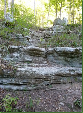
The rocks are everywhere. We look at them differently knowing they are the capstones for the cave below.
We turn onto the River Styx Trail. We go down to the Green River before coming back to the River Styx Spring.
We reach the river and find signs explaining about the Old Riverboat Landing.
The Green River linked the 19th Century Mammoth Cave community to the rest of the world. Kentucky pioneers found it less expensive and more reliable to transport large loads by the river rather than by horse and wagon over very rough roads if they could even be called that. Steamboat owners offered popular tourist packages. People often cruised from Evansville or Bowling Green to Mammoth Cave.
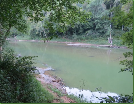
Here’s all that is left of the old riverboat landing. The river definitely looks green today and lazily, beautifully kayakable.. Rats!
Time for a little off trail hiking along a narrow path beside the river. Even bigger trees. We do love big trees.
Doesn’t look like we can get there from here so we back track to the trail and follow the boardwalk to the River Styx Spring.
From there it’s time to climb back up. We pass the flood gauge which is marked to height of 57.70 feet.
When we reach the very steep and squiggly path up to Sunset Point we are far above the river again.
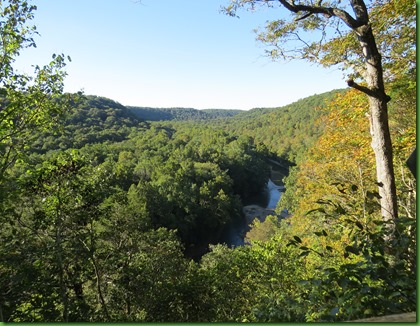
We seem to always be either going to campfire ranger programs or too tired to hike over here for sunset. Sure wish we had though. Even with the bright sunshine wash out, it looks like a really fine spot to view a sunset over the mountains.
David hasn’t seen the Old Guide’s Cemetery and Stephen Bishop’s Grave which I visited previously. If you’d like to see those pictures, the link is at the beginning of this post.
The descendants of Stephen Bishop and the other original slave guides, Mat and Nicholas Bransford, continued a tie to the cave working as farmers, teachers and timber men while supplementing their income as cave guides. Stephen Bishop’s grand nephew Ed Bishop was an accomplished cave guide. His discovery of several cave passages with German Cartographer Max Kamper leadi to the creation of the famous 1908 map with Carrie’s Pass shown in yesterday’s post. In 1939 the retirement of Mat Bransford’s great grandson Louis ended 101 years of unbroken family cave guide services. Family relatives still live in the local community.
Here is a picture of Dr. John Crogan, his Mammoth Cave Estate and Stephen Bishop. Below that is one of the gravestones of Crogan’s hospital patients who died in the cave and were buried here. Pretty gruesome although it’s true that when you have a consuming illness, you’ll try anything that might have even a chance of extending your life. There was no cure for TB at that time.
Tomorrow begins two long back to back driving to Virginia days. Can’t say I am looking forward to any of it, but we’ve sure had a wonderful time at Mammoth Cave and there are still more trails to hike and more tours to take. There is enough to keep you busy here for a week to ten days.


Thanks for all your detailed posts about Mammoth Cave. We obviously never spent enough time there to take advantage of everything there is to offer.
ReplyDeletelove big trees - the fungi is gorgeous in those pics!
ReplyDeleteBeautiful hike, and the river does look enticing for kayaking. I like being back above ground. :-)
ReplyDeleteYou certainly had a wonderful, rich experience at Mammoth Cave! Thanks for sharing your explorations and the interesting history of the caves with us.
Wonderful hike, once more and love ALL your photos....they are beautiful.
ReplyDeleteThe beauty of your travels is that the two of you generally take the time to immerse yourselves in the local natural world.
ReplyDeleteGreat hike with lots to see along the way:) Thanks for providing so much information on this wonderful area. We'll add this to our future stops if we return east:)
ReplyDeleteWhat a beautiful, peaceful trail! I should route myself through the Mammoth Cave area next time i'm driving through Kentucky.
ReplyDeleteYet another great day. I can't believe how much you have squeezed into your journey back to Virginia. I too hate those long driving days.
ReplyDeleteEvery time I visit a cave I cannot stop myself from thinking about earthquakes! (You can tell I am a California girl, sinkholes don't come to mind.) If we have a guide they always reassure us that it is extremely unlikely a collapse would occur during our visit. But really, how do they know that!!!!!?
ReplyDeleteLooks like a really wonderful place to visit, thanks for taking us there!
That was a very lovely way to end your visit to Mammoth Caves. You have made so many wonderful memories and we thank you for sharing them with us!!! We think of you both every time we see a really BIG tree ;o)))
ReplyDeleteI would love to hike that trail. Beautiful shots! Thanks for showing us around.
ReplyDeleteI've learned a great deal about Mammoth Cave and surrounding area from your blog. Beautiful pictures too. Thank you.
ReplyDeleteIt's so sad that the bat population has been infected with this insidious disease. We need those little guys to keep the skeeters in check. Hopefully, all the measures to decontaminate visitors helps bring a turn around.
ReplyDeleteJust wondering if you ever miss hugging well deserving trees? ;c)
Wishing you safe travels back to Virginia. I know you've been there for awhile now and hope things are looking promising.
ReplyDeleteThose look like really nice and well maintained trails. Who knew there was so much besides a cave there?
ReplyDeleteNice pictures of a pretty trail. I like the photos of you next to the trees! I am glad they are trying to protect the bats. Good for you for following those rules :) Too bad there wasn't time to kayak the river and see the sunset in that lovely spot. Think on the bright side though; you really got to see a lot while there and learn a lot about a great cave!!!
ReplyDeleteYou two really did seem to see every inch of this amazing place. Thanks for sharing it with us. We would like to spend some time there too, now that the weather is getting cold here in KY, it may have to wait until next trip through :)
ReplyDeleteThe lighting in the first trail pic is really special. It's fascinating to see those boulders and know they are capstones, that they "hold" such an incredible world beneath them. Looking at the river now, it's hard to imagine it near the top of the flood gauge - and hard to imagine it could "hold" all those large river boats. For some reason it just makes me so happy that Stephen's family continued his legacy at the caves, that his discoveries were enjoyed and expanded upon by his descendants, that as free people they chose to keep the cave and the surrounding area as their home. Good stuff :-)
ReplyDeleteI learned more from your detailed post than when we were there, I guess its because you guys take the time to look around. When we hiked there we took a 3 minute ferry crossing Green River and we did see sinkholes and very tall trees.
ReplyDeletePS. We were at Devils Den in the week of Oct 17. Im so far behind with my post as the two state parks we went to had no wifi connection. We are now in TX.
Just as nice above ground as below. Those hugging trees are spectacular.
ReplyDelete