Friday August 23, 2013
Sunset Point Campground
Lubec, Maine
It’s about a 4 mile drive from Sunset Point to the Roosevelt International Bridge.
Out the driveway, try not to stop at Monica’s Chocolates, turn right, follow the TO CANADA sign.
After we cross the bridge and say hello to the friendly Canadian Customs agents we park at the Island Information Center.
As I get out of the car, I see there are some really nice views, on this gorgeous day, of the bridge, Lubec and the Mulholland Lighthouse across the narrows from it.
Roosevelt Campobello International Park has ten hiking trails.
We, of course, have to try to hike them all.
On Wednesday we put together what turned out to be about a 6 mile hike by combining all the trails on the East and South East side of the island into a loop hike. That post is here if you didn’t see it.
Today we are going to combine the Fox Farm trail, the Upper Duck Pond trail, the Duck Island view, and the Cranberry Point trails into another loop. This one begins and ends at the Campobello Island Tourist Centre.
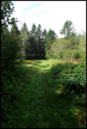
A nice green grassy trail leads us down from the side of the Information Centre and into the woods.
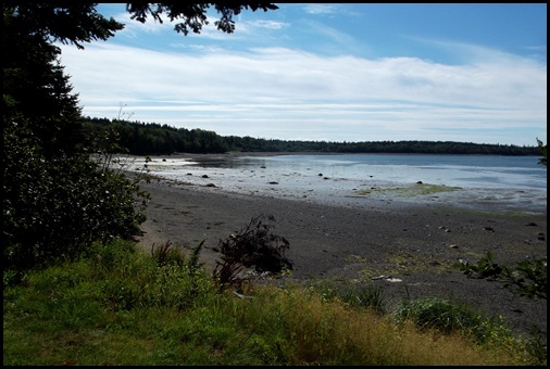
It’s about 4 hours before high tide. We can see the exposed mud flats through “window views” as we walk along.
We are again surprised by the number of mosquitoes along this beautiful wooded trail.
Luckily it is cool enough to wear long pants and long sleeves. With insect spray they are not bothering me too much but they are pretty thick and causing us not to dawdle as we sometimes do.
At several points along this section of the trail the green windows also provide excellent views of the bridge and Lubec in the background.
We come out of the woods at Fox Farm.
There isn’t a farm here at all anymore although David says he thinks he remembers someone saying that foxes used to be raised here for pelts. Now it is a nice picnic area accessible by this trail or by car on the gravel park drive.
We enjoy the views. I see both the Lubec Channel Light, aka Sparkplug, and the bridge. I realize I will probably have views of at least Spark Plug for most of the day today.
We walk the trail through the grassy meadow filled with wildflowers and back into the woods.
The wildflowers are magnificent in the meadow.
We are now on the second section of our loop and are headed for Upper Duck Pond.
I am wondering whether I will see an actual pond here. On Wednesday part of our hike went to Lower Duck Pond and it wasn’t a pond at all, rather a cove. But perhaps these are ponds when the tide is low. Hope we’ll find out today.
This section of the trail is a lovely moss covered woodland. Many sections are lined with small fir trees. The smell is heavenly. The mosquitoes seem to like it a little less here. Or something has changed.
We pass beside a bog where there are several viewing benches. I wonder what time of year someone could sit here and enjoy the scene? February??
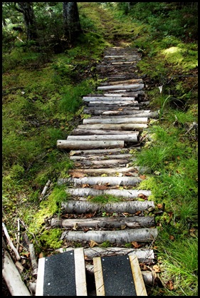
The trail guys we met on Wednesday have created a plank road for us to hike on. We lived just off of an 18th century Plank Road that went over the Blue Ridge Mountains. Of course it isn’t plank any more. but this one is.
In a short distance we come to the mouth of a little wetland.
What a glorious spot. A breeze is blowing. The mosquitoes have stayed back in the woods.
As we come out of the woods an eagle sails across the water. He has come from just over our heads and must have been in a tree on the edge. I’m not quick enough to get a picture of him until he’s nothing but a speck in the distance. He’s magnificent.
This is my “proof” of a sighting. HA!
In the picture of the wetland before “my eagle”, David is “combing the beach” not just for rocks, but for tools. If you’ve followed this blog for very long you know that in another life he must have been a Native American in charge of tool gathering for the tribe. “He Who Finds Tools” perhaps. This time it is a chisel and its sharpening stone. A few days ago it was a knife blade which could actually cut.
He finds the chisel, I find the beach peas dried hard in their pods and think seriously about taking some back to soak and use in soups. We haven’t brought a foraging bag or I might have taken some but we do eat the few right off the vine that are just past perfect.
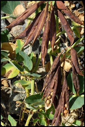
Great picking for a little snack on the trail.
These are like biting a brick
These are yummy!
Back to hiking, now on what David is calling the two track.
We cross a bridge
and here we are at Upper Duck Pond. Sure enough, no pond, a cove.
From here we have to take the gravel road around a bit to the Cranberry Cove trail head which will lead us back to Fox Farm.
Along the way we will take the Duck Island View spur to see which of these islands actually is “Duck” island and whether there are any Ducks on it. (Roxanne are you out there???) We don’t have much faith since fox farm has no foxes and the duck ponds upper and lower have no pond or ducks.
We think we may have found the path although there is no sign as we would expect. But it turns out to be a local spot for…………………what?
Anybody know what these hand made wheelbarrows might be for? Bringing in clams? Harvesting dulse? David’s looking out at the water from this spot trying to figure it out. They wheel these things out there? At low tide I guess or ????????? We give up.
We really are finding very interesting things on this little stretch of road.
Do you know what these two have in common? I didn’t but I do now.
Another foraging find. This one is my favorite snack.
We think we’ve found the spur trail to Duck Island View. No name but at least it has a trail sign with an arrow.
This must be the place, there’s a viewing bench. But which one is duck island? Oh it’s Duck Island View and these are the Duck IslandS. A binocular check confirms - no ducks.
BUT it’s a great place for lunch. David thinks maybe he’ll lift this rock up so he can sit on it. RIGHT! You and which other 10 men??
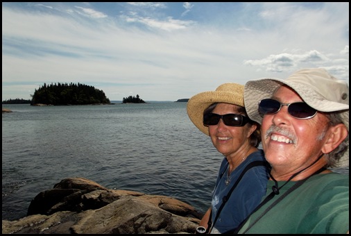
He gives up and just picks a spot that suits him, I get his picture, he takes our “lunch photo”.
Great view isn’t it?
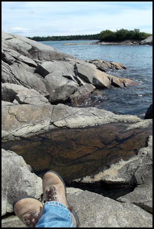
Notice the water level.
This guy flies up to check out my sandwich. Not a chance mister!
But he does look pretty cool in his orange jacket on the rock with orange lichens.
We hang around here for the better part of an hour enjoying the sounds of the water, the wonderful breezes, the terrific view and the NO mosquitoes.
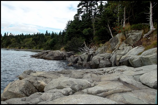
The tide is rising. Notice the level in the picture of my boots and the level in the last picture above. This happens in about 30 minutes. The tides here are really high. I explained why in the previous post about West Quoddy Light.
We finally find Cranberry Point and the trail back to Fox Farm.
I’ve been seeing Sparkplug all along the way but this is my best picture so far.
As we amble on, we find more International boundary markers. Thanks to Paul Dahl for explaining what those are in a comment on the previous Campobello post. Great explanation Paul! We hike up to take a look. David didn’t climb down to see the first one with me so he hasn’t seen one up close. Same plaque, different numbers.
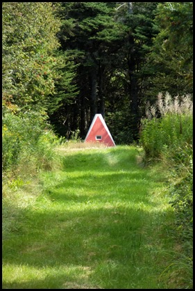
The orange triangular hut is WAY at the top. Notice this orange leg in the foreground.
And here there is a metal marker in the ground by the base of the poles.
No corresponding triangular cement structure. Now we have a giant orange metal triangle. The pole above is one of its legs. From up top it is WAY down there.
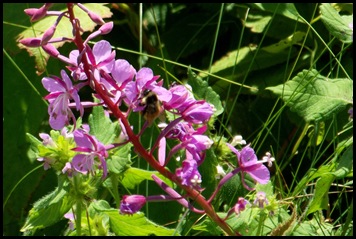
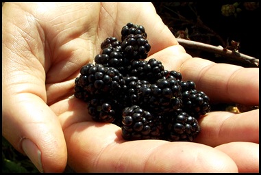
A little further on down the trail, we find more snacks to eat.
At Fox Farm we head into the home stretch toward what we thought was the information centre but they are calling the Custom House. That’s odd.
It’s also odd that this is an “international” park but all the trail distances are in KM without a secondary in miles. The secondary is in French….are their KM different??? Commas rather than periods maybe? Where are the American miles here?
Also disconcerting is that the KM distances on the trail map are different from those posted on the trail signs. Oh well………….even strung together the trails in one section aren’t more than 6 miles all together.
The mosquitoes are really getting to be terrible in this section where they were the worst this morning. I’ve tried to figure out what makes them so bad some times and not others. Fog clearly has nothing to do with it since today has been a gorgeous blue sky clear day. I think this time of year may be a bad time or perhaps all summer is like this. But in the woods with no breeze and they are ravenous. They are biting us through our shirts. Clearly we are their snacks today.
Later I find welts all over David’s shoulders and neck where we did not spray insect repellent. We put it only on our skin. Spray it all over your clothing and if, as we do, you use natural or organic repellent you must refresh it every 90 minutes or so if the mosquitoes are thick.
BEWARE SNAKE PICTURE AHEAD…Pretty gruesome snake picture.
I’m walking along through the woods in a bit of a hurry when a snake slithers quickly across in front of me. He seems to be going into the under brush backwards. Mosquitoes or not I have to stop and see what’s happening. BE warned there are snake pictures coming up.
He’s really hard to get a picture of because he’s well hidden. Since he seems to be eating he doesn’t hustle away so we get a lot of opportunities to try to get some pictures so we can later see what he’s doing. We can’t see much of anything at the time except him looking out at us.
It is so dark in the woods and even darker under there where the snake is hiding while finishing his meal that I have to use a flash and can’t really see so I didn’t know what was going on until I looked at these pictures when we got back. I guess this is all part of nature’s plan but poor froggy. How does this snake get his mouth open SO wide? This is more than a snack.
My guess is that the snake can’t move at all for some time while he digests this meal that distends his body.
Zoom by the next 3 pictures if you don’t want to see a snake eating a frog.
If you’ve gotten this far, look how fat he is now compared to the size of his head. Good grief!
After this experience, which is probably where we got the majority of the mosquito bites, we hurry on stopping only for a few photos before emerging out into the sunshiny field by the “customs house”.
This is the end of our hiking in the International Park. We intended to hike some in the Provincial Park but I’m not so sure now although we do intend to go up to the northern end of Campobello to see the 4th lighthouse and perhaps to drive through the Provincial Park and check out the campground there. But we’ve been dinner enough for mosquitoes for a while.
We haven’t decided about other hiking in surrounding areas like Maine Heritage Trust sites and National Wildlife refuges all of which are easy drives from Lubec. These mosquitoes are giving us serious second thoughts. If you’ve been here hiking at other times of the year, were they as bad as this??
These are just gorgeous hikes and well worth doing. My advice for late August would be try them on a windy day.
















Oh the mosquitos are killing me this summer. I guess there always has to be some bad side to everything.
ReplyDeleteOh, I couldn't look at the snake.
ReplyDeleteToo bad about the mosquitoes. They can ruin an otherwise lovely hike. We have been so lucky this summer, haven't seen any at all. I will be interested to see if anyone chimes in to tell you if they are around there all summer or not.
Did you see Peter and Beatrix?
ReplyDeleteoh, thanks for the snake warning... another great hike, m'dear... enjoyed it very much. David is so cute. seriously. and well you are too ... love the way you write.
ReplyDeleteOh....so sorry the mosquitos are ruining those wonderful hikes. We were there the last week of June and did have some problem when we were in the dark, damp areas in the woods. However, we used Deet and it did keep them away. Sometimes you have to make choices that aren't the best, but we were able to hike without a problem. Please be sure to do the West Quoddy Head coastal hike. It is the one hike I could do over and over and over.... Pick a windy day and just do the Coastal section down and back!!!
ReplyDeleteExcellent snake pictures. Bummer about the mosquitoes but at least there were snacks :).
ReplyDeleteGreat views! I think your native name would be "she who loves nature" or " she who dreams big dreams" ;) Dad's seems fitting. So many berries! I would love that :) Whoa..the snake - how many people actually get to see something like that?! Is kind of gross though. Another good day :)
ReplyDeleteWe can't wait to get to Maine. I feel like we've had several travelogues to guide our way!
ReplyDeleteyou will love the East Quoddy lighthouse walk at low tide. . .when we were there, there was a $5 fee pp to do the walk. . .still worth it. That is where we saw and got pics of eagles being chased by gulls, which I then inadvertently erased from my camera. . .I'm still sick about it! Enjoy. . .
ReplyDeleteI think your name should be "She-Who-Hikes-Long-Distances."
ReplyDeleteYour travels in Acadia inspired us. We are in Bar Harbor. Think we'll pass on the Canadian mosquito's though. I have heard they rival Florida's. Haven't seen any since we've been in Bar Harbor/Acadia. As always, enjoy seeing what you two are doing. 6 miles is quite a trek!
ReplyDeleteOh, my. I've read the first negative of this entire northern trip. I can be the only one in a crowd of 500 being bitten by mosquitoes. They love me. I will not be deterred though and will come armed with Deep Woods Off. In the battle with bugs, I say "Bring on the DEET!" :-)
ReplyDeleteThank you for the snake warning. I needed it!
I haven't seen mozies in years. A definite advantage to the dry SW. Very cool shots of the snake having dinner. It is amazing they can get their mouths open so far.
ReplyDeleteI have no authority at all on the subject, however I think the wheeled carts in the cove must be used for harvesting something. Wheeled out at low tide they could be used to gather in seaweed, mussels, scallops or clams, or maybe all. Need to ask someone with those high boots on.
ReplyDelete