Sunday July 28, 2013
Acadia National Park
Nancy plans it and we’re in!
Nancy planned a 15 mile carriage road ride and invited us all to join her and Bill. You bet! So Dan & Tricia, Syl, David & I set out at Bill’s 7:30 am appointed time to drive our bikes to the Parkman Mountain Parking lot on the park loop road.
When we arrive we are among the first there which gives us great parking spots. Syl is sporting some pretty coordinated biking attire so I have to get a shot of how great she looks. She kindly poses. She does look super doesn’t she? Vanna’s got nothing on her.
The carriage road trails have numbered sign posts so you figure out where you are going based on those rather than the place names on the signs. We set off from number 13 to ride to 19. Thanks to Nancy Mills for this ‘ready to ride’ picture of us at the beginning. From the left it’s Bill, David, Syl, Dan, Nancy and Me. The camera is on the seat of Nancy’s bike.
We are riding from post #13 up to #11 as our first leg.
It’s about 3.6 miles, starts at 300 feet and is mostly level. As we start out, Bill, Dan and Syl take the lead. Well Bill takes the lead and then the other two catch him. I’m in the middle. Nancy and David are behind me. Great spot for me to take pictures of the front group and then when we stop get the back group coming in.
The carriage roads are really lovely bike rides. They are well groomed with fine gravel although I’m not sure I’d want to ride on them with street bikes. My 700X35 tires do just fine but on many rides like some Rails to Trails, I’d like to have wider tires.
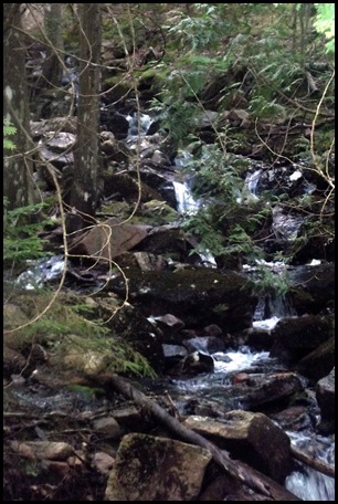
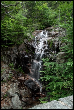
We stop at several spots along the way to see the lovely streams, small and large waterfalls running down the mountains and under the road. The drainage set up on the roads is just excellent. With the recent rains the water is abundant and looking mighty fine.
At one point, Dan, Syl and Nancy go down below the road to get a better look and apparently a better camera shot of this little waterfall.
Bill and David sit on Rockefeller’s teeth above the water.
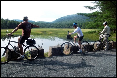
On we ride, Bill stops to take in another view
Twice as much UP on the next stretch.
From Post #11 we go 2.8 miles to #9. It is 100 feet up hill, 50 feet down. Hmmmm.
Along the way we pass Aunt Betty’s Pond. Dan has amazing eye sight and spots frogs in the heavily lily padded waters and shows us all where it is. Thanks Dan for the chance to get my one of my favorite pictures of the day.
You can see how many lily pads there are in front of this beaver lodge on Aunt Betty’s pond. No one seems to know who Aunt Betty was. I think I’ll have to ask around some more.
On we go. Looks like I’m at the end of the pack this time.
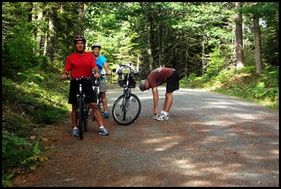
Time for a break. Dan stretches out his legs. Then everyone has to see how far down they can reach. No one can beat Dan with his hands flat on the ground. Bill can make it to his knees. I can make it to my knuckles.
From #9 to #8 it is 150’ up in 2 miles.
Don’t believe the books and brochures when they say the carriage roads are gentle grades. No pictures when you are puffing up hill.
We finally arrive at #8. Everybody is smiling. This next section to #10 is a two tenths of a mile LEVEL connector section.
As I’ve said before these carriage roads are the picture perfect bicycle paths. If you like to ride and are willing to do some up hills even if you have to walk part of the way, which we did, then these are for you.
Yes I’m pretty far behind at this point.
I feel like cheering!
The section from #10 to #14 runs due south beside Jordon Pond for 2.2 miles. It is pretty level and then goes down hill for half the way.
Here we stop for the first of 5 carriage bridges along the way. Some of these David and I have ridden by before on our last ride and they’ve been on the blog before but here they are again in case you missed that one.
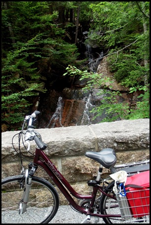
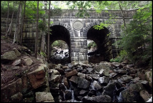
There is a small waterfall here on the right side of the road running down under the bridge and then on its way
The bridge is a double arch beauty.
It has stone steps, seen on the bottom left, going down below to the path which walks beside it.
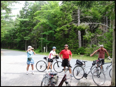
After I come back up from below, Syl takes a mid ride group picture and kindly sends me a copy when my camera’s self timer refuses to cooperate. Thanks Syl. We look pretty good and very happy for having ridden 7 miles already. It’s about 10:15.
We stop at post #14. Actually we stop at all the posts.
We wait for Nancy since she has the map. It is easy to go the wrong way if you aren’t positive which number you are riding toward next.
There are two bridges on the ride from #14 to #21 which climbs 150 feet and then comes back down 150 feet in one mile.
Bridges make nice stopping points. As you can see we do take a lot of breaks to make sure we are on the right roads and to see the beautiful scenery which Mr. Rockefeller specifically designed these carriage trails to go by and to highlight.
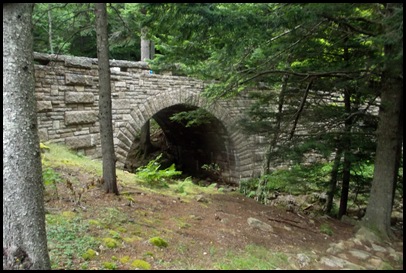
The first bridge is a small one.
That’s Dan peering down. This bridge was built in 1931
Our third bridge appears to have been built for drainage and to get the road over these huge rocks.
I particularly like the design of this 1932 bridge with its alternating stone colors, light below, dark above, and semi circular cut outs. Really beautiful work. A work of art as they all are.
We’re ready to head out. We look for Syl…..she’s found blueberries and is picking away. Never miss an opportunity.
We’re on the way to bridge number four.
At post #21, Nancy checks the map. She finds that from post #21 to #20 is 1.2 miles and goes up 50’, crosses a stream and comes back down. Sounds good especially since it has another bridge on the path.
I’m on my way down to get even better shots of the bridge.
, You can just see the waterfall off to the left
There is a great path up to it. The trail builders in this park are the best. Look at these stone steps.
Nancy comes down a different way to get her pictures
Bill and Syl watch her from up top
Again the art of the building of this bridge is amazing. Look at the workmanship.
This bridge is declared the lunch spot and I’m so busy eating I only take one pictures. It catches Syl, sitting next to me, in mid chew so I’m not going to publish that picture. Just imagine us sitting on the edge of the bridge eating sandwiches with the beautiful waterfall behind us.
We don’t need to look at the map at post #20. By this time we know it’s UP hill.
From Post #20 to #19 is 9 tenths of a mile. It too is 50 feet up hill and then 50 feet down. We all laugh when we get to the post. It must be UP hill to the right.
At post 19 we make a decision to alter the route and add the most difficult climb so that we can see the largest waterfall and another mile. #19 to #12 is 1.8 miles up about 250 feet to the waterfall.
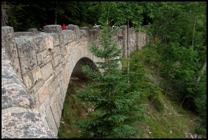
Most of us walk part of this steep climb but Bill, as the best bicyclist among us, powers it to the top. We see our final bridge, the 1925.
The camera bugs take the steps down under
We cross the bridge and go up the other side and under the bridge for a view of the falls from below.
This is a bridge and waterfall David and I have ridden past before but I go down to see it yet again. How can I not?? The bridge is beautiful and the waterfall is too.
About this point it starts raining.
It was predicted to rain. Well 20% chance. But in Maine….everything is up for grabs. Dan is the only smart one in the group. He’s brought a rain jacket. The rest of us hustle off. Luckily this is our last stretch We aren’t to post #12 yet but from there it is only 2 tenths of a mile to the parking lot and that’s all down hill.
BUT there is one more bridge. I think everyone but David and I skip it. Nancy says she’ll meet us back at the car.
It’s the 1924 bridge . I know I’ve seen it before, it has the Roman Arch but still rain or not, I want to see it again. In this picture you can just see the edge of the circular end posts. There are better pictures of this bridge in my first Carriage Road Post entitle Mr. Rockefeller’s Bridges. If you like carriage roads and bridges and haven’t read that one and would like to, you can find it with this link.
Too wet to go down under or try to get a picture of the water here. There is water falling from the sky all over me and my camera.
We pass Post #12, and #13 and arrive at the parking lot to find Nancy standing out in the rain.
Apparently the other 3 missed #13 and ride up hill again not down. I take Nancy an umbrella so she won’t have to stand in the rain to wait for Bill who has the car keys. And just then, here they come. Well…oops. Dan doesn’t mind, he has a raincoat. Actually none of them mind.
We’re back just after 1:00, have had a great ride and wonderful time. Thanks Nancy for all the work you did to put this together and for this “THE END’ shot.



















I wonder if Aunt Betty was Beatrix Farrand?
ReplyDelete"Rockefeller was once asked by Beatrix Farrand, the landscape gardener who advised him on design treatments for his carriage road system, why he constructed some of his bridges out of wood when most were imposing stone-faced structures. He replied that by using steel stringers, the wooden bridges could be constructed just as strong as the stone bridges, and by using them from time to time, a rustic quality would be introduced to the carriage road system. Rockefeller had originally intended to use rough cedar logs and poles for the railings, but Mrs. Farrand objected,
stating the cedar would lose its bark in several years and take on a shabby appearance. She favored instead the use of adze-hewn timbers, as these were pleasing in appearance and had been used in bridge construction for hundreds of years.2 Her suggestion was adopted, and the bridges all feature railings of squared"
Very interesting Nancy. Thank you for this information and welcome to my blog. I have not seen any wooden bridges in Acadia. Do you know where these are. I'd like to see them.
DeleteRockefeller certainly left an amazing legacy for us to enjoy. Not many people like that today (and there probably weren't that many in his day as well).
ReplyDeleteHis generosity is really amazing. But my next post is on George Dorr who spent his entire fortune on Acadia and was penniless at his death.
DeleteNice post about a fun day and a great ride!! Those bridges were spectacular!!!
ReplyDeleteAll thanks to you. We miss your "plans" already. Now I have to do it :-))
DeleteWhat a great day you had. I love that you are all so active. I'm goin to ask one of the gals at the meet in October if I can borrow a bike to see if I can pedal.
ReplyDeleteAs always, love reading your blog, and I'm so happy that you and David are enjoying every moment of life.
We really are so grateful to be able to be so active Nancy. I'll be cheering you on in your pedaling but remember, like anything else, it is easier to do if you have a bike that fits you and in this case has gears. We could never do the carriage roads without our gears. Thanks so much for reading and for your comments.
DeleteWhat a big frog! another great day, Sherry. The engineering is amazing. I always marvel at how they got the rocks there and ... I mean these roads are very wide. Guess the trucks weren't very wide then either. ha
ReplyDeleteSo glad Mr. Rockefeller loved nature. Winthrop did a lot of beautiful things here in Arkansas.
I agree that you and David enjoy every moment of life. gag... I'm such a slacker
sigh ... roads AREN'T very wide...
DeleteOh I knew what you meant Carolyn. The frog wasn't really that big, I just blew up the picture so everyone could see how cool he was and how clear the water is up here.
DeleteLoved the ride and all the bridges! Thanks for omitting my lunch mouth. ;) I miss Acadia already!
ReplyDeleteSyl
You are very welcome and I'm sure Acadia misses you. I know we do.
DeleteGreat group of "bikers!" Yeah, those uphills are a killer, but the downhills are so niiiice!
ReplyDeleteHA! I hoped I'd get someone with my "bikers" title. Not the usual kind of bikers are we. As long as they are short up hills I can handle it but you are right the downhills are way better. Too bad there isn't a ride with all down hill. LOL
DeleteGreat post. What a great time you guys are having!
ReplyDeleteThanks you guys. We are having a grand time and love having you along. Just wish you were here in person. You'd have been a great addition to our ride.
DeleteWhat a great ride you all had. It's such a beautiful area. I love all those bridges.
ReplyDeleteWow...Syl has lost some weight! Good for you! (I hope she sees this)
Syl is definitely looking great which is why I posted the picture. As you can see I love the bridges too. Hope to see all 17. But I'm getting confused as to which ones I haven't yet seen. David can probably figure it out. :-)
DeleteSounds like you had a wonderful day with friends.
ReplyDeleteAnd I thought the same thing as Karen when I saw the picture of Syl. She's looking lean!
Hi Page, good to hear from you again. I'm glad my spotlight of Syl got some notice. We seem to have a wonderful day every day. It's just amazing.
DeleteBeautiful falls and bridges with a great group of friends :) No end of sites to see and some rock scrambling too. Love the pictures - what a day!
ReplyDeleteYou are so right sweetheart, what a day! This is such a magnificient place it's hard to take a bad picture. You gotta get up here, you'll love it. Maybe next summer?
DeleteA lovely ride ... maybe by the time we get there I can manage the uphills without walking the trike up.
ReplyDeleteI don't know Erin. I think only Bill the Biker could do them all without walking. There are some hum dingers. :-)) But it would be great to be in such good shape. I'll look forward to your posts on your rides and will be cheering you uphill.
DeleteWhat a great scenic ride. We made the mistake of not taking our bikes on our northeast trip:(
ReplyDeleteYou are so right about the grades not being "gentle"...I never saw so many ups and downs as I did on those carriage roads! Thank heavens for gears, you really need them. Fantastic ride for you guys today!
ReplyDeleteHow fun! It looks like a lovely time was had by all. I am actually at MJH with my father -- long story, he's better now -- and took a short walk out on their walking trail this AM. It was sunny, but surprisingly pleasant -- goes by some wild flowers and 3 ponds all of which have fountains. I even saw a couple of turtles at the water's edge and thought of y'all. Should have taken a picture with my phone! There were swans on one pond, too. It's actually kind of a hidden treasure in C'ville and must be a favorite spot for employees in these surrounding buildings. It made me think that we should have some kind of walking map for UVA hospital visitors. We could direct them to the Pavillion gardens. They are our hidden gems. All of your pictures have made me want to visit Maine sometime. Hope so! Take care, Pam
ReplyDeleteGreat job preserving a great day for the future when my memory may not recall what a great time we had so well. Thank you!!
ReplyDeleteWhat a biker gang you are. I guess you could be called Bills Angels...
ReplyDeleteUp 100' in elevation and only down 50'? I think you were robbed! :cD
Syl certainly is a slave to fashion, right down to her shoe laces!
Wow. . .what a great ride, and a great post. . .tell Nancy I appreciate her planning also, as we can use this for a guide. . .if we ever get our bikes back from the shop. . .(sigh!). . .oh well, we've found plenty to check out. . .
ReplyDelete