Wednesday August 21, 2013
Sunset Point RV Park
Lubec, Maine
We’re not really out early but apparently a little too early.
We set off to hike a loop around Liberty Point at 8:30am. I’m sort of disappointed we aren’t out earlier but I’ve been having a lot of problems with the wifi and getting the blog posted. Although the campground’s wifi is cable, it seems to dislike allowing connections between 8:30 at night and 8:30 in the morning.
The trail head is at Raccoon Beach. It takes about 15 to 20 minutes to drive down the park’s gravel roads from the main road to Raccoon Beach. I guess this beach must have had raccoons on it. I don’t see any today or any evidence of them. I wonder if they are something special up here.
Rosa Rugosa is thick here on Campobello. The flowers are blooming and the hips are reddening. I pick a few for a snack. I really like them but they are a lot of work if you remove all the little seeds. Still not as much as cleaning a lobster.
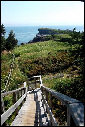
There is a long set of wooden steps going down to the beach which curves around a little cove. It is a cobblestone beach and as always I could get lost in the water and the stones but then I wouldn’t get to hike the trail.
Raccoon beach is another small cove. I wish I’d thought to take a panorama of it rather than two separate shots. Not sure whether the structure on the beach is a fort or a pretty thick raft with a flag pole. Any other ideas??
Fall is beginning up here and I am really enjoying the wildflowers.
I really could just stay here but the trail awaits. The beginning looks more like a stroll again than a hike. Grassy, overhanging bushes and trees.
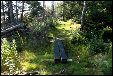
It isn’t very long before it changes into a wooded path, no more grass, and then into a bog with log boardwalks made from the abundant black spruce and topped with strips of rolled roofing material to keep you from slipping. I’ve never seen this done before on wetland boardwalks but it’s a great idea other parks should adopt. Although I imagine it is quite time consuming to cut these strips and nail them down.
It started out as a foggy dark morning but the fog is burning away at this point.
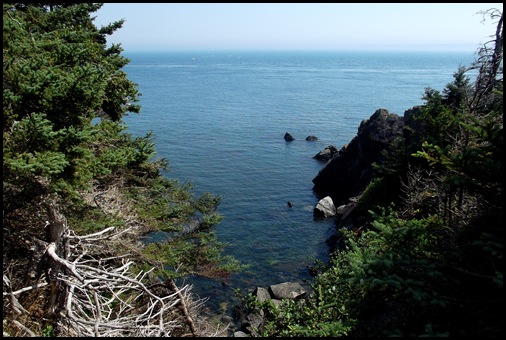
The boards lead to numerous wonderful views of the coast of the island.
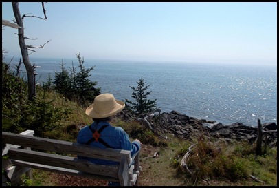
They also lead to the first of many benches to take advantage of the views. The benches are all propped up on cement stands with wooden frames and very well designed with arms and a slanted back. Very comfortable. But on the entire hike we never see anyone else sitting in them. We don’t see a lot of people but the ones we do see are tramping on at a rate. How do they see anything?
The trail winds around through the woods along the coastline. It is a beautiful trail with literally miles of boarded walk to make it easy to walk through the wet ground. and not damage the environment.
The only problem we are having is that the mosquitoes are ravenous. We are walking at a much brisker pace than we like in order to keep them off of us and even that does no good. They like David’s black hat and every time I look up there are 30 or 40 on it.
We have just finished talking about what a lot of work keeping this trail in such good shape is when up come the two men responsible for all the trail work in the International Park, one Canadian, one American. We compliment them on their work and they are pleased to hear that we appreciate it. They tell us that they make all these walk ways as well as the bridges and do the road repairs over 6 months each year. The other 6 months during the winter they are fishermen. Brrrrrrrrrrrrrrrr!
I jokingly ask the trail men when they come along if they are here to clean up the mosquitoes for us. They say no just to maintain the trails. But the mosquitoes don’t bother us at all while we talk with them and after they leave, we notice that the mosquitoes have left too.
Either they have some magic of some sort, mosquitoes leave when the fog lifts or we should just have started our hike about an hour later than we did because mosquitoes go home at about 10am. Even in the woods they are no longer a bother. At the shore views, the breeze kept them away even when they were thick.
On we go, more views,more benches to enjoy them from.
At Ragged Point, about the middle of the section of the trail from Raccoon Beach to Liberty Point, we come to a spur trail to the Sunsweep Sculpture. I’ve seen pictures of it but didn’t pay much attention as I am not a big fan of modern sculpture. But I am here and I want to see whatever is here.
Boy am I glad I did.
The trail to the sculpture is a path mowed through a riot of wildflowers on the way to a headland. David’s picture is too dark but the flowers are nearly over my head.
The Sunsweep is an international art project for three sites adjoining Canada and the United States. There is one here in Roosevelt International Park, New Brunswick, one in American Point Island, Lake-of-the-Woods, Minnesota and the third at Boundary Bluffs, Point Roberts, Washington.
The sculptures are aligned to the North Star, Solstices and Equinoxes. It portrays the path of the sun from East to West. It was designed and given by David Barr to the people of each community as a symbol of international friendship. I LOVE IT!
What a great place to be for a solstice or an equinox. I wonder if the other locations are as lovely and perfect for it as this one. For sure I have added those two to my list of places to see.
Here is the point beyond the sculpture and the coves on either side of it.
How was this done? It’s got me stumped.
You have to look very carefully in this picture to see the hands etched into flat surface on each side. But what is amazing to me is what you see when the sun is shining on the sculpture and what you see when it is not and it is darker outside. How did he do this? Any sculptors out there??
It’s almost noon when we leave the spur and go back to the main trail.
More boardwalks, more benches, more views as we look for a lunch spot.
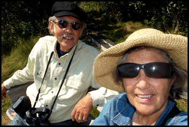
We find an excellent bench for lunch and then we try to take the lunch picture.
You can imagine how that goes. If only someone would come along and take it for us. I have omitted the most terrible FIVE.
Should we look this way? Nice background but half your face is missing.
Not bad but those glasses are riding mighty high and what’s the background??? Is that a board walk plank??
Ok enough, let’s just eat.
Back into the woods and on the trail. We must be approaching Liberty Point soon.
There is no bench at this view but we do see a familiar face.
Liberty Point! We’ve come half way.
We come out of the woods at this set of long stairs down to Liberty Point and the observation deck in the distance near the out cropping. As if there haven’t been great observation points all along this really wonderful trail.
From the observation deck, I see another one of “those” rock faces. Do you see this one? David doesn’t.
Flat head, eye brows over the slits for eyes, the nose just below them, a rather large upper lip and then the mouth is partly open. Could he be a turtle head?? If not what do you see??
There is a bench down another spur here at Liberty Point. Great views in both directions. Had we known there wouldn’t be many people here, we might have waited to have lunch. But since you can drive to this point if you like, we figured a lot of people would. Left over Acadia habits it seems.
I particularly like this view of 3 different types of rock all on this one section of coast. My favorite is the horizontal layers lifted up and turned over on their sides. Their lines are so clearly visible. They look rather like a sinking ship to me. I do like rocks both BIG and small.
On the next leg to Lower Duck Pond we come upon another mystery.
We’ve reached the half way point of the hike and are at the furthest most point. Now we turn back up this little peninsula and along the trail from Liberty Point to Lower Duck Pond.
As we come down the trail to a bench on an overlook, I don’t notice that triangular thing until I turn around to take a picture of David coming down the hill behind me.
What is it? It looks like it is made of cement and the front is painted orange. I’m thinking ski something but not on this terrain and right out into the water. NOPE.
I zoom in to get a closer look. There’s some sort of plaque on it but I still have no clue.
So I just put it out of my mind and sit down on the bench to take in the view which as you can see includes a triangular cement top.
Ok that’s it, I have to go down and find out. So I climb down in front of this thing on the edge of this cliff and here’s what I find.
It’s falling apart.
And it has this plaque on it. What does this mean oh Coast Guard folks?? Hmmm maybe there wasn’t a Coast Guard in 1910. Or at least it wasn’t called the Coast Guard until 1915 was it?
What treaty of 1910? That was before the First World War.
I zoom in on the plaque on the triangle up on the hill and it appears to have the same writing on it. A mystery to be solved. Stay tuned for reader comments. I hope!
The view from here is gorgeous too of course. These views are now facing west as we leave Liberty Point. Coming from Raccoon Beach to Liberty they were facing east.
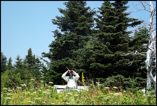
David spies an occupied speck.
We move further along the trail. We come to another bench.
What is this man looking at as he rests on this bench??
He says he’s looking at that little island out there.
That horizontal black speck.
I zoom in and here is what I see.
I recognize these guys even though I’ve only seen their faces up close. If I were a sea kayaker and could paddle out there and around their rock, I wonder if they would jump in the water with me or just ignore me all together and go on sun bathing?
Further down the trail another spot to stop. These benches are numerous and we can’t help ourselves, we sit at least a minute or two at every single one.
Things are beginning to change.
The path here looks like it did when we started out, grassy and wild flowers. I wonder if we are further along and closer back to Raccoon than I think.
We are definitely in a different habitat than the moist board walk requiring one we just came from. We’ve got rock steps here.
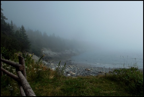
And the fog has returned. I guess I didn’t notice it as I started up the grassy path but when I look back at the picture now, there it is. Unless this fog is shorter lived than usual, there will be no more views.
The trail is getting steeper. The water is still on our left as we climb up the west side.
We arrive at Lower Duck pond and don’t see any pond at all.
Perhaps it is out there in the fog but this actually just looks like a point on the west coast. Or perhaps pond is a Canadian euphemism for cove. That’s what the map says is here, a cove.
Foggy coastline barely visible but it looks great doesn’t it??
Down on the beach in the fog I think I see someone pulling a sled with refuse. Is she cleaning up the beach?
I go down to see if I can help and she tells me no she isn’t actually cleaning the beach just picking up things to use in her art. She and a friend who live nearby make things out of beach findings. “You have to have a hobby in the winter around here” she says.
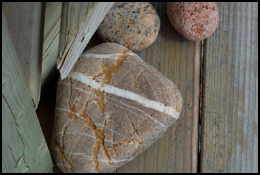
The lack of visibility makes us focus at our feet. As usual, the rocks are fascinating.
We could get really caught up in the rocks, but we have the last leg of this round the peninsula hike yet to go.
We’re in the home stretch.
The next two tenths of a mile are straight up the road that runs to Lower Duck Pond. Luckily it is lined with rosa rugosa and I can snack on rose hips all the way. They are delicious. But only a few are ripe enough yet. Another 2 weeks and I’m guessing they will be perfect but I won’t be here. So Carpe Diem.
We find the last trail head from Lower Duck pond back to Raccoon Beach. David starts in and immediately is bothered by the mosquitoes who seem to have returned with the fog. It’s only about 3:00 so I don’t see how “late afternoon” could be a factor yet. But who knows on Atlantic Daylight Savings Time it’s actually 4:00. No doubt the mosquitoes know this.
It’s a beautiful wooded trail through a lovely mostly birch forest. I am enjoying it but the mosquitoes quite unexpectedly are bothering David more than they are bothering me so at this point, he’s not having quite as good a time as I am.
He’s plenty glad to see these rocks marking the end of the path.
This is a beautiful hike made up of 3 circuits any of which you can do by itself if you drive that trail head and just do an out and back. You can start at Raccoon Beach as we did or at Liberty Point, or at Lower Duck Pond. The footing is sometimes tricky on the longest section from Raccoon Beach to Liberty Point so appropriate footwear is a must. But none of the sections is difficult or strenuous. And it seems you would do well to hike between the hours of 10 and 3 US time if you want to avoid most of the mosquitoes. Unless they are fog driven and then I haven’t a clue what to tell you. :-)

















Thanks for filling in the blanks!! We did the Liberty Point to the Sun Sculpture hike. Only drove to Racoon Run and Lower Duck Pond. Seems to me the mosquitoes were only a bother when it was foggy. They only place we ever saw more than one or two people was at the Roosevelt Cottages area.
ReplyDeleteMaybe those people you saw were hiking fast on account of the mosquitos! Neat hike besides them. Interesting structure sightings and a nice lunch spot. I actually liked all the self portraits :) Wild flowers in Fall. I like that. Two types of habitat. I like that too. I SAW THE TURTLE BEFORE READING YOUR EXPLANATION :) HA!
ReplyDeleteawwww. . .I guess with the fog, you couldn't see West Quoddy Lighthouse from Liberty Point. . .now, you'll hafta go back. . .
ReplyDeleteThanks for showing us the sundial, we only saw it from afar!
ReplyDeleteYou guys hiked a "fur" piece this day! (An early start is smart.) When we hiked this trail in June 2010, we didn't make it all the way to Liberty Point -- had to turn around at the Sunsweep sculpture. Hiking this coast was one of the most scenic trails we've trod. We were there in spring and what a riot of wildflowers we saw!!
ReplyDeleteI just love your posts, they are so lighthearted and fun as well as educational. I think I owe you lots of money for all the things you've taught me. ;c)
ReplyDeleteYou are right, the Coast Guard came into being in 1915 when the Lifesaving Service, the Revenue Cutter Service, the Lighthouse Service and a few others were merged into one military organization under the Dept. of the Treasury.
The orange triangle, I believe may be an old navigational aid. Range markers usually are two pieces, one in the rear is usually up high and one in the front and further towards the water is lower. As a ship enters the channel, it lines up the two range markers in line one above the other, then it knows it is in the center of the channel. If the range markers don't line up, the ship corrects its course until they do. It is still a system widely in use today.
Good thing all those skeeters were on David's hat and not his skin. That's one great hat! :c)
Love those benches ... not sure I'd be able to get up and continue the hike after sitting down. I was recently told that mosquitos are attracted to dark colors ... something to keep in mind when is skeeter country.
ReplyDeleteMaybe th pile of wood on the beach someone is working on a Huckleberry Finn craft to set out from the beach, escape their boring life and see where they end up. Hopefully they are not thinking of an Aggie bonfire!
ReplyDeleteI would never make it very far on these trails and spend much time in the benches just enjoying the view. And those flowers are so tall. I've been to Boundary Bluffs, many decades ago, and the view there is amazing also. You'd love it. But I don't remember the sunsweep. Definitely turtle. Fog or not, this is a gorgeous coastline. Although I could do without the mozies.
ReplyDeleteI have never heard of the Sunsweep sculptures. What a grand idea!
ReplyDelete