North Rim Grand Canyon
Site 20
Thought I’d mention since Syl
asked about the weather that it
has been perfect for boondocking.
Low 80’s during the day and 50’s at night.
No heat or AC needed.
Although,
that sun is mighty powerful during
the mid day so best to be in the
shade which the North Rim forests
provide plenty of.
Couldn’t be nicer here!!
Running this morning on the
Bridle Trail which connects the
Grand Canyon Lodge with the North Kaibab Trail
the most popular hike into the canyon from
the North Rim.
Bridle Trail which connects the
Grand Canyon Lodge with the North Kaibab Trail
the most popular hike into the canyon from
the North Rim.
The trail goes past the campground on its
way so I ran the campground loop and then
cut up to the Ampitheater
way so I ran the campground loop and then
cut up to the Ampitheater
and took a little feeder trail up to the Bridle.
You may have guessed that the
was
named because it allows horses (and dogs.)
And is the only trail in the park to do so.
Dogs do seem to have it rough as far
as rights to be on trails in the National Parks.
I think poor dog owners can be blamed
for such restrictions.
So I ran up to the lodge on this nice wide
trail
trail
which was not as UP and down as
yesterday’s Transept. Although running is
more difficult at this altitude for sure.
yesterday’s Transept. Although running is
more difficult at this altitude for sure.
Got to the lodge and the trail head to Bright Angel Point
turned around and ran back to the Trail Head for the
North Kaibab and then turned around and ran back
to the spur down to the campground
and was
FINISHED!! Hoo Rah! My favorite part of running
is being finished.
BUT, I did see the elusive ghost squirrel
on my run. That would be the Kaibab squirrel.
His story is very interesting.
He’s a tassel eared squirrel with a white tail
and lives only in Ponderosa Pine forests of
the North Rim of the Grand Canyon and
areas down to Jacob Lake.
You won’t see him anywhere else.
The tufts on his ears grow longer with age and
may extend 1-2” above his ears in winter and
not be visible in summer. He grows his own earmuffs
Now that’s a smart squirrel.
He's a sub-species of the Albert Squirrel
who lives at the South Rim.
He’s an example of evolution through geographic
isolation. The canyon became more and more of
a barrier and ultimately separated the two squirrels
on each rim. The genetic isolation of the squirrels on
the North Rim allowed evolution of distinct characteristics.
Although both have white tails.
So that was quite a treat. But of course
I didn’t have my camera and my cameraman
wasn’t with me.
Oh well those mental pictures and memories
are wonderful too!!
But for you, who didn’t see it,
I borrowed a picture from Wiki,
Came back to the generator on and
the smell which I hate. We really are going
to get one of those Gen-turi things. Do any
of you use them and what do you think??
BUT inside the smell was great with a
sausage and egg breakfast cooking
away on the stove.
After eating we took both the bikes and
the kayaks, which sadly have not gotten
much use on this western trip YET, off
of the car so we could get both the hood
and trunk open to check the fluids
and potentially top them off.
the kayaks, which sadly have not gotten
much use on this western trip YET, off
of the car so we could get both the hood
and trunk open to check the fluids
and potentially top them off.
With that done, we were off in Ruby for the
trip to Cape Royal which is east on the
Walhalla Plateau from area of the North Rim
which has all the visitor services.
It was great to drive down the road and
see no buildings at all. Just the forest
although some of it showed the signs of having
burned in the 2000 fire.
But it was coming back and it was
interesting to see what the first return
species are here in the West.
First stop was at Vista Encantada
which is at 8480 feet. Higher than
the Lodge at 8255.
With the lovely conifers on the rim here, the
views look very different. Today was also
a rare clear day. But WINDY!
Next stop was Greenland Lake.
I had to laugh when I saw it.
They have some mighty generous definitions
for lakes here. But I guess if this is all
the water you have……
Actually this “lake” is a sinkhole. Amazing that
such things exist in Utah at such high elevations
and in Florida at such low ones.
The North Rim is located on the Kaibab Plateau
an area of karst topography. It is topped
with Kaibab limestone which is a relatively thick
layer of water soluble rock. Because it allows
easy passage of water into underground drainage systems
there is an absence of above ground streams.
Water seeps through the limestone and eventually dissolves it.
The underground chambers that result may ultimately collapse
and bingo, you have a sink hole.
On down the drive to Roosevelt Point named for
Teddy who had so much to do with the early National Parks.
Teddy who had so much to do with the early National Parks.
The short trail here was described as
“secluded woodland loop with spectacular views”.
Although the fire was in 2000 obviously they
haven’t updated their trail descriptions.
The views were as billed but the
woodland is no more.

But it was still an interesting trail with
the forest on its way back.
Wildflowers blooming their hearts out
in the dirt
and the rocks
and of course the views
We passed on the Cape Final trail
”for now” since it was 4 miles and we wanted
to make sure we had time to get to the end at Point Royal.
So we pushed on thinking that on the way back we
could stop here and hike Cape Final.
But I’m wondering Final what???
So next stop was at Walhalla Overlook.
where we got our first look at the
Colorado River from the North Rim.
Not sure you can see it in this picture.
But we sure could when we walked to the overlook.
It isn’t the line squiggling in the canyon bottom.
That’s Unkar Creek which feeds into the Colorado.
But if you look just up and to the left of the
farthest point of the line you “might” be
able to see it horizontally there.
Here’s David’s zoom lens again. Color isn’t
quite right, it was much deeper red
but you can see the white caps on the rapids.
Amazing!
quite right, it was much deeper red
but you can see the white caps on the rapids.
Amazing!
Walhalla overlook was named for the Native American
Anasazi who lived in the Unkar Delta, that piece of
land you can see above jutting into the river.
There are Prehistoric remains there of winter homes
for these people who moved up to the North Rim
in this area in Summer. Sounds like a nice life to me.
Anasazi who lived in the Unkar Delta, that piece of
land you can see above jutting into the river.
There are Prehistoric remains there of winter homes
for these people who moved up to the North Rim
in this area in Summer. Sounds like a nice life to me.
Here’s the park service picture from a time when
Unkar Creek had water in it. You can see the delta
much better. Fifty five Anasazi sites were found
on the Delta and 10 were completely excavated.
The largest contained a complex of 25 rooms.
The delta contained numerous terraces so the people could farm.
“In fully trying to reenact Anasazi life, researchers found
it was an arduous 2 day walk from the North Rim to
the Delta down Unkar Creek”.
I’m wondering, maybe they didn’t take
the creek road.
These people occupied these sites for 350 years
from about 850AD to 1200.
it was an arduous 2 day walk from the North Rim to
the Delta down Unkar Creek”.
I’m wondering, maybe they didn’t take
the creek road.
These people occupied these sites for 350 years
from about 850AD to 1200.
We then went across the road to see their
rim location called Wallaha Glades. A pretty
funny subdivision sounding name I thought.
The Pueblo style building had 9 rooms
but even the living ones were VERY small.
I tried to imagine living in even the largest
one which is at the other end. Archeologists
think the rooms were entered from the top
Pueblo style.
but even the living ones were VERY small.
I tried to imagine living in even the largest
one which is at the other end. Archeologists
think the rooms were entered from the top
Pueblo style.
Here’s the largest room.
They aren’t sure what the large rock standing up
in the end wall was. It’s size and on edge placement
are unusual. Something ceremonial?
When they found the ruins of these shaped limestone
foundations built up from ground level, they were filled
with rock rubble from the walls as well as adobe and beams.
On this unusual rock the portion that has no lichen on it
was below ground before excavation of the site.
Near the North wall of this room is a small slab lined fire pit.
Eight hearths like this one were found at this site.
Used they think for cooking and heating rooms.
Eight hearths like this one were found at this site.
Used they think for cooking and heating rooms.
We sat on the benches near the site which are used
for nearly daily ranger talks
one we had just missed apparently.
Seemed like a fine place for lunch so
we did. Then back to the car and another quick
shot of the canyon. :-)
we did. Then back to the car and another quick
shot of the canyon. :-)
Then off we went to
First thing we saw just a little way down the
trail
trail
was this ancient Native American granary.
It had been mentioned at the Walhalla site.
I obeyed the sign and didn’t enter or disturb
but I did put my camera inside to see
Here’s the other side with a similar sign
which I obeyed in a similar way.
On down the trail
And then we got to the rock
with a very nice NPS sign that
said please don’t disturb anything and
by the way to carve your initials
or anything else is
against the law.
with a very nice NPS sign that
said please don’t disturb anything and
by the way to carve your initials
or anything else is
against the law.
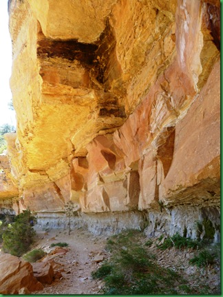
Around the bend was a canyon that had been
hidden
and the trail went right under the ledge
hanging gardens and ferns
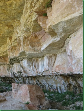
We arrived at the cliff spring where that
large boulder actually had fallen out of
a place above our heads that we could recognize.
On past the spring, the colors continued
to amaze us. For orientation in the shot
below, the path is at the lower right.
to amaze us. For orientation in the shot
below, the path is at the lower right.
We were so engaged with the cliff that we
kept forgetting to look out at the canyon it surrounds.
kept forgetting to look out at the canyon it surrounds.
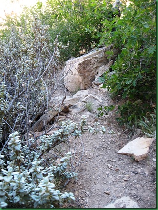
As we moved beyond the spring, the path
got smaller and smaller
got smaller and smaller
So we decided it was probably time to turn around
and go back.
On the way I noticed the Arch to be in the opposite
canyon wall and the interesting mustard colored splash
and go back.
On the way I noticed the Arch to be in the opposite
canyon wall and the interesting mustard colored splash
Some hanging gardens were barely over my head
And lots of spots were a bit too short
for some folks
for some folks
We were seriously sorry to see this hike end.
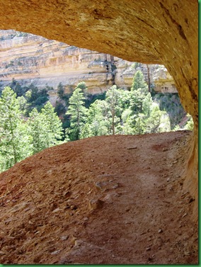
The last look back at the canyon through the ledge.
The last look back at the canyon through the ledge.
And on we went to our last stop at Cape Royal
altitude 7685 feet. One of the lowest spots on the North Rim.
altitude 7685 feet. One of the lowest spots on the North Rim.
The trail we were looking for was on the South East side of the
parking lot. Everyone else was parked over there but we wanted
shade so we parked on the other end
As we walked around to the trail, we saw this sign
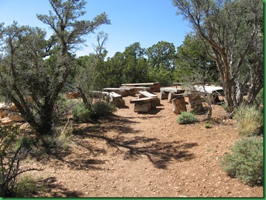
We passed by the picnic tables
and then
and then
And then I saw this. Looked like a cute
arch and a great wedding site to me.
arch and a great wedding site to me.
but then when I turned around, I saw
I thought preacher David was going to
do a ceremony but he was only taking a picture
of the gathering.
What about that back drop??
do a ceremony but he was only taking a picture
of the gathering.
What about that back drop??
No one else was around
other than this picnicer
other than this picnicer
I doubt anyone
who parked up close saw this at all.
So the Take Home Message is
Some times it’s good to park far away
and explore. :-)
The Cape Royal trail/walk
was the perfect one to end the day.
It was wide, paved and flat.
It had markers along the way,
like the one in the lower right,
pointing out, describing and giving common uses
for the native vegetation this area.
Like Big Sagebrush-one of my very favorites
Pinyon Pine
Cliff Rose
The views along the way were beautiful
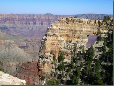
And then we came to Angel’s Window.
WOW!!
WOW!!
A little bit closer
Can you see the people on the top?
And even closer, framing a piece of
the Colorado River
My little Canon was actually up to this task.
Remember those people on the top.
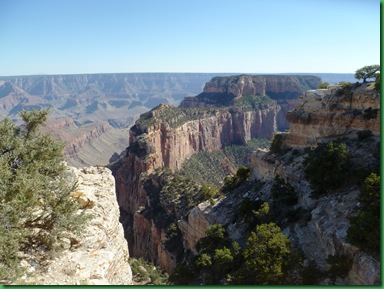
These are the gazillion views we had from there
These are the gazillion views we had from there
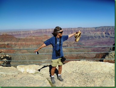
And here are the effects of the 50 mph winds
that were blowing while we were out there.
It’s the swept back hair look. I had to
literally hang on to my hat. I couldn’t keep
it on my head.
On we went to the end of the line,
Cape Royal Point
And here I was able to do my first
benchmarking. Never heard of it until
I read The Good Luck Duck Blog.
Those girls are hilarious.
Check out their story about Benchmarking
on the blog on June 20.
I totally agree that Benchmarks seem like a
real discovery.
I know I was plenty excited when I spotted it!
benchmarking. Never heard of it until
I read The Good Luck Duck Blog.
Those girls are hilarious.
Check out their story about Benchmarking
on the blog on June 20.
I totally agree that Benchmarks seem like a
real discovery.
I know I was plenty excited when I spotted it!
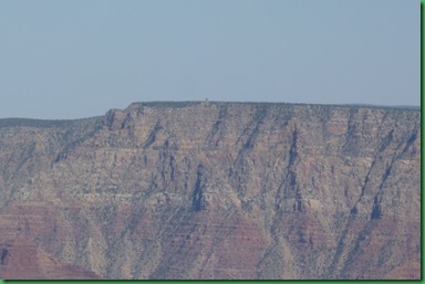
David was busy checking out the
South Rim and with his naked eye
claimed he could see the Watchtower
at Desert View.
I looked.
Bahhh I said.
Here’s the picture he took of what he saw.
Do you see a tower on the rim??
SO I got out my binoculars and
low and behold…..
He was right.
I’ll give you a clue.
See the middle of the picture with the
Mesa behind the South Rim?
Just to the right it looks like there is a clef
in the rock.
The tower is to the right of that.
Try this
Or for the visually challenged like
yours truly
yours truly
That’s 10 miles away.
What a GRAND Camera.
What a GRAND CANYON!!

















Another fabulous tour, thanks for taking us along.
ReplyDeleteYou look like you've got quite the tan there Sherry :)
ReplyDeleteI want to get married at the wedding site! Well, guess it's too late for that, but WOW! Can you imagine the wedding pictures??? Awesome.
AWESOME....just AWESOME is all we can say!!
ReplyDeleteDefinitely putting the North Rim on our TODOS list.
Glad the weather is your friend:o))
Keep having fun!!
Glad you're having good, clear weather. That big rock in the Pueblo ruins must have been an early big screen tv. ;)
ReplyDeleteSyl
Amazing pictures. I do believe it's the nicest, most picturesque part of the country.
ReplyDeleteGeography, geology, history, flora and fauna. I'm getting a great education reading your blog posts.
ReplyDeleteI'm learning more from you than I did in college!